
Louth Navigation
Most English canals were built to carry coal. The Louth Navigation was built so that a prosperous market town on a low coastal plain could finally talk to the sea. Eleven miles of canalised river, opened in 1770, connecting Louth to Tetney Haven at the mouth of the Humber. Eight locks to descend the gentle Lincolnshire slope. And six of those locks were built in a shape that almost nobody copied: each chamber side was a sequence of four elliptical bays bowed out against the surrounding soil, like the ribs of a half-sunken whale. Engineers since have looked at them and wondered who, exactly, drew the plans.
The Town That Wanted to Trade
By the eighteenth century Louth was a substantial market town, forward-looking and well-run, but stranded inland by a flat coastal plain that made every cart-journey to the sea a slow business. In October 1756 the town corporation hired John Grundy Jr., a respected canal engineer, to find them a route to the Humber. Grundy mapped a line down the River Lud to Tetney Haven. Subscriptions opened, town clerks knocked on noble doors at Lincoln Races, and in 1763 Parliament passed the act authorising the work. The act was eccentric: it gave the commissioners no normal way to raise capital. Money could only be borrowed against future tolls. Even so, Grundy was hired as Chief Engineer at three hundred pounds a year, James Hogard joined as resident engineer, and ground broke in 1765. By May 1767 the first five miles from Tetney Haven inland were open. Hogard finished the rest. The canal reached the Riverhead basin at Louth in May 1770 and was formally opened. The total cost was twenty-seven thousand five hundred pounds.
The Strange Locks
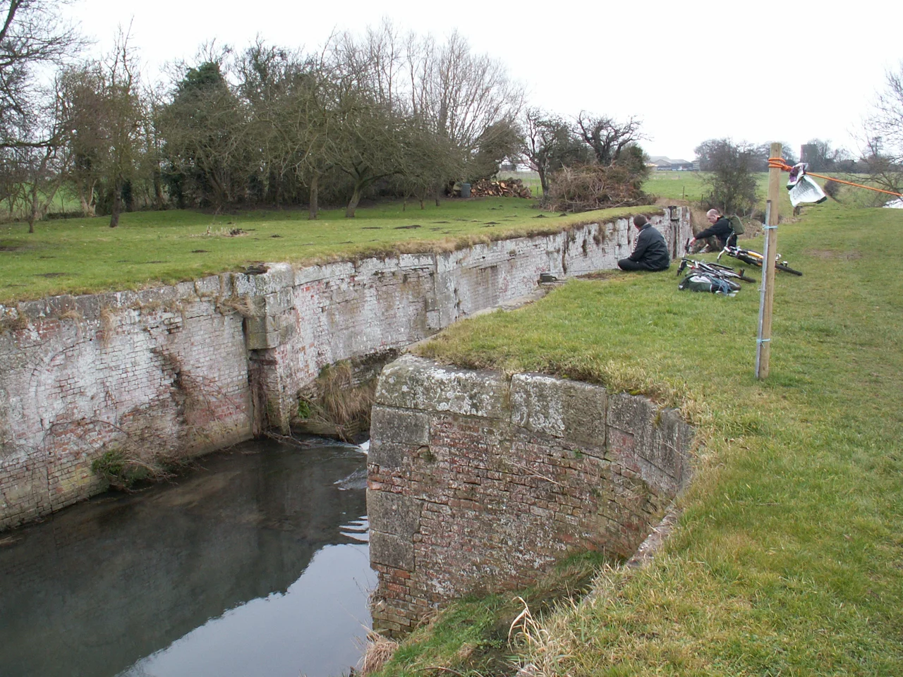
Eight locks lifted boats up the gentle grade from sea to town. Two were built with conventional straight walls. The other six were built differently - the chamber sides made of four elliptical bays, each bay bowed outward against the surrounding soil. Engineers think the design was meant to resist soil pressure, the curved walls distributing the load the way an arch distributes weight. The locks varied in length and width but all held a depth of five feet four inches over the sill, deep enough for the Humber keels and sloops that plied the navigation. Nobody knows for certain which engineer designed them - Grundy or Hogard. The locks are rare in Britain. Walk the towpath today and you can still find the remains of Ticklepenny Lock and Willows Lock, four concave bays of weathered brick between timber posts, slowly being reclaimed by nettle and willow.
The Chaplin Problem
Charles Chaplin was a commissioner of the navigation and held ten shares. In January 1770 he took the first seven-year lease on the canal's tolls. When the lease came up for renewal nobody else wanted it. The commissioners negotiated a new arrangement: in return for funding all repairs and paying interest to the subscribers, Chaplin would get a ninety-nine year lease. The act of Parliament did not authorise such a lease. Nobody challenged it for over fifty years. Chaplin collected the tolls and was, in his own phrase, not thorough in his side of the bargain. In 1782 and again in 1788 he had to be reminded to pay interest. By 1792 he had let the canal silt up so badly that horses had to tow the barges where once they had sailed, and water levels had been raised so high that the surrounding farmland was flooding. Chaplin was ordered to make repairs and died soon afterwards. His son took over. His grandson actually widened and deepened the canal in 1811 and spent another four hundred pounds on repairs in 1814. By the 1820s the family argued, plausibly, that the navigation had only just become profitable for them.
The Railway Buys In
In 1828 a new act of Parliament reduced the tolls and formalised Chaplin's irregular ninety-nine year lease, sixty years after the fact. In 1847 the East Lincolnshire Railway Company bought out the lease, and the Great Northern Railway in turn took control of the East Lincolnshire. The GNR held the navigation as a tactical move - to prevent the existing leaseholders from opposing the railway's plans - and kept the tolls as high as they could legally manage for twenty-nine years. When the lease ended in 1876 the General Manager of the GNR suggested the railway not renew. The commissioners struggled to find anyone willing to bid. Income was still satisfactory into the early 1900s, but the writing was on the wall. The early twentieth century brought rapid decline. The First World War finished what was left of the trade. In 1916 the total annual income from the canal was sixty-six pounds.
What the Canal Does Now
The Louth flood of 1920 wrecked the Riverhead area at the town end of the canal, and that was effectively the end. The commissioners asked to be relieved of their obligation to maintain the navigation. In 1924 the canal formally closed. The assets were sold for six thousand two hundred and forty pounds. But the canal had always been a land drainage channel as well as a navigation, and that second job kept it alive. Today the whole route is a designated main river, managed by the Environment Agency, with five pumping stations operated by the Lindsey Marsh Internal Drainage Board feeding water into it from the surrounding low-lying farmland. It feeds Covenham Reservoir, built in the 1960s to supply drinking water. The Tetney outfall sluice still controls the connection to the sea. The Grade II warehouses at Riverhead survive - Jackson's Warehouse, ten bays, two storeys and an attic, converted to a dwelling in 2003. The Woolpack Inn is still there. Baines Flour Mill, the old red-brick three-storey building that once supplied water to the basin, is still standing. The canal stretches dead straight to the horizon between wide grass embankments, in a country flat enough that the sky takes up most of the view. The keels and sloops are gone. The slow water remains.
From the Air
The Louth Navigation runs about eleven miles from the Riverhead basin at Louth (53.37°N, 0.01°W) north-east to Tetney Haven at the mouth of the Humber. The centre of the route is around 53.45°N, 0.04°E. Recommended viewing altitude is 1,500-2,500 feet AGL to follow the straight cut across the marsh. The nearest airports are Humberside (EGNJ) to the north-west and the disused RAF North Coates near the seaward end. Covenham Reservoir is a prominent landmark north of the canal mid-route. Watch for restricted airspace over the Donna Nook range south of Tetney. Best light is mid-morning easterly, when shadows pick out the embankments and lock remains.
Nearby Stories
- Westermost Rough Wind Farm 2.5 km away
- Silver Pit 5.4 km away
- Beverley Minster 7.4 km away
- Lincoln Cathedral 13 km away
- 2004 Ingoldmells Bus Crash 14 km away
- Humber Bridge 21 km away
- Holkham National Nature Reserve 33 km away
- SMS Blucher 333 km away