
Machrihanish
The runway at Machrihanish is 10,000 feet long. You do not need a runway that size to land a Cessna, or even a turboprop. You need it for B-52s and Backfires, for the heavy strategic bombers that the Cold War expected to scramble west across the Atlantic at short notice. The village of Machrihanish — population a few hundred, tucked behind a beach on the western edge of the Kintyre peninsula — was for forty years one of the places NATO planned to defend North America from.
The Forecast Knows This Place
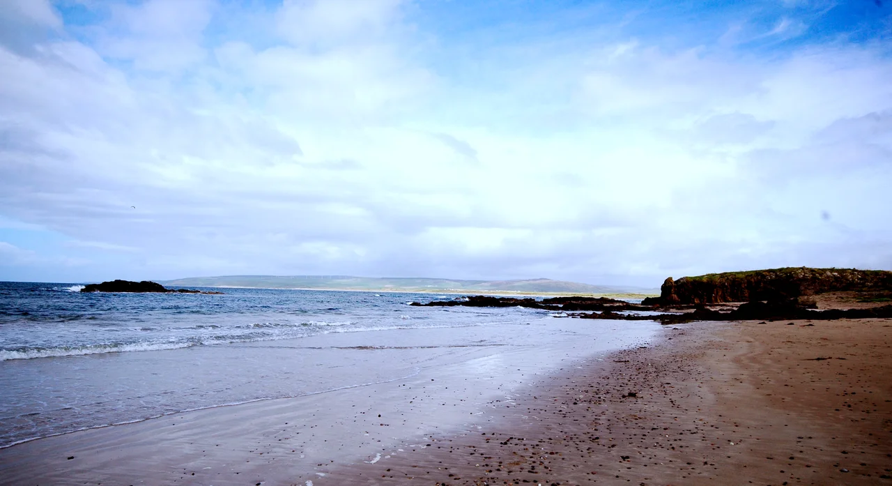
Anyone who has ever listened to the BBC Shipping Forecast — that slow, formal litany of sea areas read four times a day from Broadcasting House — has heard Machrihanish without knowing it. The Met Office takes its weather observations here, and the readings feed into the bulletins that small boats around Britain still hang their evening on. The village sits on Machrihanish Bay, three miles of sandy beach that runs north to Westport with views west to the islands of Gigha, Islay, and Jura, and on a good day all the way to Antrim. Surfers come for the Atlantic rollers; the village hall offers basic accommodation when the swell is up. The Kintyre Way, one of Scotland's Great Trails, starts or finishes here, depending on which direction you are walking.
Where Old Tom Morris Walked
In 1879, the club engaged the fifty-seven-year-old Tom Morris Senior — the most influential figure in nineteenth-century golf, four-time Open champion, greenkeeper at St Andrews — down to Kintyre to lay out a course. He found duneland by the bay, made an immortal pronouncement that the ground had been "designed by the Almighty for playing golf," and routed eighteen holes through it. The opening tee at Machrihanish remains one of the most famous in the world: a drive across the corner of the Atlantic, the line of attack as ambitious as the player dares. A second course, Machrihanish Dunes, opened in 2009 alongside it, part of an American-backed development that also restored the Ugadale Hotel in the village and the Royal Hotel on the Campbeltown seafront.
The Airfield That Watched the Atlantic
RAF Machrihanish, on the flat ground behind the bay, was during the Cold War one of NATO's key forward operating bases for transatlantic operations. Its 10,000-foot runway could take any aircraft in the Western inventory; its position on the westernmost tip of Britain put it closer to the North Atlantic GIUK gap — the choke point between Greenland, Iceland, and the United Kingdom that Soviet submarines and bombers had to transit — than almost anywhere else in the UK. The base operated as a Master Diversion Airfield for transiting US Air Force aircraft, hosted US Navy SEAL Team detachments, and was rumoured (never confirmed, never quite denied) to have been a forward storage site for tactical nuclear weapons. The RAF formally closed the base in 1997. The runway and infrastructure passed to the Machrihanish Airbase Community Company, a community buyout that took over the site in 2012 with the goal of turning a military relic into civilian aerospace use. Today the airfield is the civilian Campbeltown Airport (EGEC), with scheduled flights to Glasgow.
The Voice Across the Ocean
Long before the airfield, Machrihanish was already a place that talked across the Atlantic. In 1905 the Canadian-born inventor Reginald Aubrey Fessenden built a radio transmitting station on the dunes with a 415-foot mast — the tallest structure in Scotland at the time — to test long-range wireless telegraphy. On 1 January 1906, his Brant Rock, Massachusetts station and Machrihanish exchanged messages across the Atlantic. It was one of the first practical demonstrations that radio could span an ocean. The mast did not last the year: a gale on 5 December 1906 brought it down, and it was never rebuilt. The achievement, however, stood. In Easter 2006, exactly a century later, Air Training Corps cadets from Edinburgh recreated the transmission, contacting Civil Air Patrol cadets at Brant Rock on 14 April from the same patch of dune.
What the Painter Saw
The Scottish marine and landscape painter William McTaggart kept a house in Machrihanish in the late nineteenth century, and the western light off Lossit Point became one of his subjects. McTaggart was already in his fifties when he started painting here; his sea pieces, with their broken, almost Impressionist surfaces and their refusal to flatter the weather, made him one of the most influential Scottish painters of his generation. The Tate holds his Summer Sundown, Tir-nan-Og from 1880 — painted from this coast. Stand on Lossit Point on a day when the wind is rising and the cloud is breaking up over Gigha, and you can almost see what he saw. Coal was mined here, briefly and unsuccessfully, in one of Britain's smallest coalfields. A canal was dug to Campbeltown in the 1770s and replaced by a narrow-gauge railway in the 1900s. Both are gone now. The runway, the lighthouse light farther south, and McTaggart's view remain.
From the Air
Coordinates 55.423°N, 5.737°W mark the village of Machrihanish on the western coast of the Kintyre Peninsula, three miles west of Campbeltown. Campbeltown Airport (EGEC), the former RAF Machrihanish, sits immediately east of the village; its 10,000-foot runway 11/29 is one of the longest in Britain. Approach is generally over the Atlantic from the west; the bay provides clear sight lines and the Mull of Kintyre lighthouse sits about 8 nm south.
Nearby Stories
- Bruichladdich Distillery 5.3 km away
- Kildonan Lifeboat Station 10 km away
- Jura Distillery 16 km away
- Murder of the Quinn brothers 17 km away
- Rothesay Castle 19 km away
- Ballantrae Lifeboat Station 20 km away
- Cushendall 21 km away
- Carrick-a-Rede Rope Bridge 24 km away