.jpg)
Madura, Western Australia
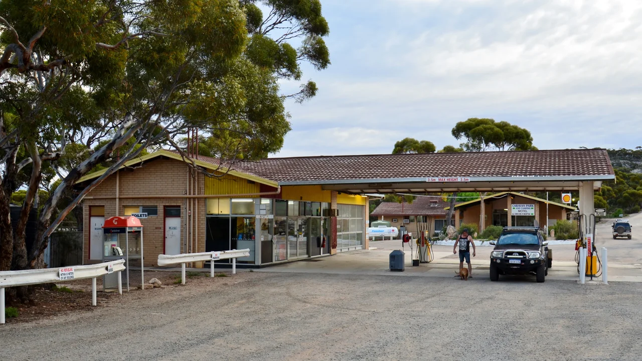
Somewhere along the Eyre Highway, a road sign tells drivers to wind their clocks forward by 45 minutes. It is one of the strangest instructions in Australian travel, and Madura sits squarely inside the small pocket of country that obeys it. Here the local time is UTC+8:45, a quarter-hour split the difference between Western and Central time, kept by a handful of roadhouses and almost no one else in the world. Madura itself is one of those roadhouses, a single fuel-and-food stop perched at the very edge of the Nullarbor, where the highway is about to fall off the plateau and run down onto the Roe Plains far below.
A Quarter Hour of Its Own
The time zone is unofficial, recognised by no state or federal law, yet it is real enough to appear on road maps and to be honoured by every business along this stretch. Central Western Time runs from just east of the South Australian border to a point near Caiguna, taking in Madura, Mundrabilla, Cocklebiddy, Eucla, and Border Village. Its roots reach back to at least 1935, when the railway timetables already used a shifted time across the Nullarbor. For the modern traveller it produces a small surreal moment: phones and government clocks refuse to acknowledge it, so the time on your dashboard and the time on the roadhouse wall quietly disagree by 45 minutes.
The Drop off the Tableland
Two kilometres west of the roadhouse, a lookout opens onto one of the great reveals of the Nullarbor crossing. From the rim of the Hampton escarpment the land falls away, and the Roe Plains spread out below, a low green shelf running south toward the Great Australian Bight. This is Madura Pass, where the Eyre Highway leaves the high tableland and winds down to the old seabed at its foot. Natural blowholes lie nearby, the desert breathing through the limestone. For drivers who have spent hours on dead-flat country, the sudden depth and distance of the view is a jolt, a reminder that the Nullarbor is not one surface but two, stacked one above the other.
Born to Breed Horses
Madura is older than it looks. It was settled in 1876, not as a roadhouse but as a horse stud, raising cavalry mounts for the British Indian Army to use on the North-West Frontier, in what is now Pakistan. The horses were walked or shipped from the coast at Eucla; the breeding operation chose this spot because it had rare free-flowing bore water in an otherwise dry land. Cervantes, north of Perth, was used for the same purpose. There is something improbable about it: animals raised on the edge of one of the world's emptiest deserts, then carried by sea to serve an empire's frontier on the far side of the Indian Ocean. The surrounding country is still the working Madura Station, today a sheep run, though in earlier eras it grazed cattle, horses, and even camels across the plain.
Oil Beneath the Emptiness
For all its surface stillness, Madura sits atop something restless. The Madura Shelf, some 265,600 square kilometres of mostly sedimentary rock, forms part of the larger Bight Basin, and surveys have found both crude oil and notable geothermal gradients locked in the layers beneath. Above ground, life is pared to essentials: a roadhouse open from six in the morning until nine at night, fuel, a meal, a bed, and the vast quiet of the Roe Plains stretching away from the foot of the pass. It is the rhythm of every Nullarbor settlement, a single bright point of human warmth on an immense and ancient landscape.
From the Air
Madura lies at 31.90 degrees south, 127.02 degrees east, at the foot of the Hampton escarpment where Madura Pass connects the Nullarbor Plain above to the Roe Plains below. From the air the key landmark is the escarpment edge itself, the abrupt line where the pale tableland drops to the lower green plain, with the Eyre Highway visibly switching back down the pass. A widened section of the highway at Madura doubles as a Royal Flying Doctor Service emergency airstrip, with runway markings painted on the road. The nearest serviced aerodrome is Forrest Airport (ICAO: YFRT) on the Nullarbor to the north, offering Avgas and Jet A1; Kalgoorlie-Boulder (ICAO: YPKG) lies far to the west. Note the local unofficial time zone of UTC+8:45 when coordinating ground times. Elevation ranges from near sea level on the plain to roughly 150 metres atop the escarpment; visibility is generally excellent, best appreciated at 2,500 to 4,000 feet on a track parallel to the scarp.
Nearby Stories
- Mundrabilla, Western Australia 24 km away
- Eyre Telegraph Station 26 km away
- Cocklebiddy, Western Australia 47 km away
- Old Homestead Cave 63 km away
- Loongana railway station 77 km away
- Twilight Cove 99 km away
- Kinclaven Station 131 km away
- Great Australian Bight 242 km away