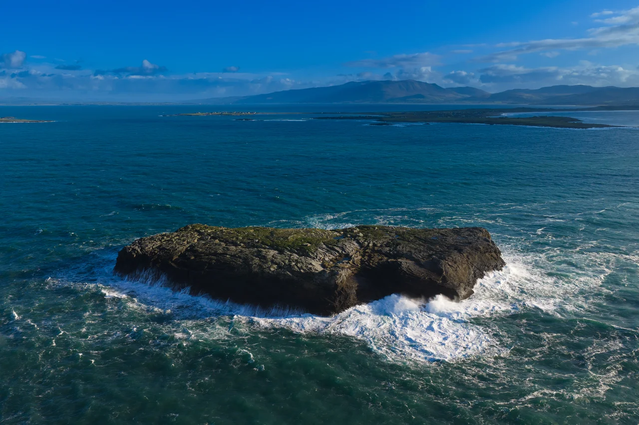

Magharee Islands
Until the early 1980s, the way to bring cattle to summer pasture on these islands was to swim them across. Farmers from Castlegregory would gather their stock at low tide on Scraggane Beach, row out in currachs alongside the swimming animals, and shepherd them across the Magharee Sound to the grass-topped islands offshore. If an animal got into trouble, the farmers tried to lash it to the boat or haul it aboard. If they could not, the animal drowned. It was a working method, not a sentimental one. Today the crossing is done with a modified flotation cage towed behind a boat, and the cattle arrive on the islands less traumatised than their grandmothers did. The cows still come every summer. The islands have been called the Seven Hogs since at least the eighteenth century, and they have always existed in this overlap between worship and grazing, geology and bird life, isolation and use.
The Seven Hogs
The Magharee Islands - the name comes from the Irish Na Machairi, meaning the plains - are a cluster of low limestone outcrops off Rough Point at the northern tip of the Maharees peninsula in County Kerry. There are seven principal islands, though the count depends on which low rocks you choose to include. The largest is Illauntannig - Oilean tSeanaigh - which hosts the famous early Christian monastic site founded by Saint Seanach. The others include Gurrig Island, Illaunboe, Illaunimmil, Illaunturlogh, Inishtooskert, and Mucklaghbeg. None of the islands is inhabited year-round. Each is small enough to walk around in an afternoon and rich enough in grass to feed cattle through the summer.
A Bird Sanctuary
BirdLife International has designated the Magharee Islands as an Important Bird Area because they support breeding populations of several seabird species. The cliffs and ledges of the islands host nesting gulls, cormorants, shags, and gannets. Terns nest on the lower beaches. The absence of human residents and most ground predators - foxes and rats are rare to absent on most of the islands - makes the group an unusually secure breeding habitat on a coast where pressure from development, agriculture, and human disturbance is otherwise heavy. Conservation status restricts landing on some of the islands during nesting season. The seabirds are not a marketing concept here. They are the active inheritance of an Atlantic shoreline whose human population has thinned while its wild population has held.
Underwater
The waters around the Magharees are among the best diving locations on the west coast of Ireland. Visibility, on the right tide, can reach twenty metres - exceptional for these latitudes. The bottom drops into kelp forests; sea anemones, urchins, and crabs occupy the rock. Atlantic grey seals haul out on the offshore ledges and curiously approach divers in the water. The PADI-certified dive centre at Scraggane Pier on the mainland organises trips out to the islands through the diving season. Snorkellers and free-divers come for the same reasons. The combination of clear water, dramatic underwater terrain, and the proximity of large marine mammals draws a steady summer trade.
Cattle and Currachs
The islands have been used for summer grazing for as long as memory runs. Cattle arrived by swimming, accompanied by men in currachs, until the practice was modernised in the 1980s. The economic logic was simple - the mainland fields could be reserved for hay or root crops while the cattle ate the free grass on the islands - and the practice survives because the islands' grass is still there and the cattle still need it. Today, a single farmhouse stands on Illauntannig, the only dwelling on any of the islands. It can be rented out on a weekly basis between April and September. The rest of the islands have no buildings, no electricity, no fresh water beyond what the rain provides. They are working pasture with very old religious bones underneath.
Getting Out There
Scraggane Pier on the western side of the Maharees peninsula is the nearest mainland landing. Boats run out to the islands in summer for divers, anglers, and visitors to Illauntannig's monastic site. The water is rarely calm. The Magharee Sound is narrow but exposed to Atlantic swell, and even a moderate wind can make the crossing rough. From the islands looking back, the view runs across the sound to the Maharees sandspit, the dunes of Brandon Bay, and the high country of the Slieve Mish mountains rising to the southeast. On a clear day, Mount Brandon to the southwest commands the horizon. The islands are remote enough to feel separate from the mainland, close enough that the mainland still owns them - by deed, by use, by the cattle that come and go every summer.
From the Air
Located at 52.33 degrees N, 10.05 degrees W, the Magharee Islands lie off Rough Point at the northern tip of the Maharees peninsula. Recommended viewing altitude 2,000 to 4,000 feet AGL to see the cluster of seven principal islands strung out in the sound, Illauntannig's monastic enclosure visible on the largest, and the relationship to Scraggane Pier and the Maharees tombolo to the south. Nearest airport is Kerry (EIKY), about thirty kilometres southeast near Farranfore. Atlantic exposure is significant - the islands sit fully outside the shelter of the bays and the wind is rarely light.
Nearby Stories
- Castleisland 7.4 km away
- Kilrush 9.1 km away
- Ring of Kerry 12 km away
- Kilgarvan 15 km away
- Inishtooskert 18 km away
- SM U-68 27 km away
- Kilkee 29 km away
- RMS Carinthia (1925) 74 km away