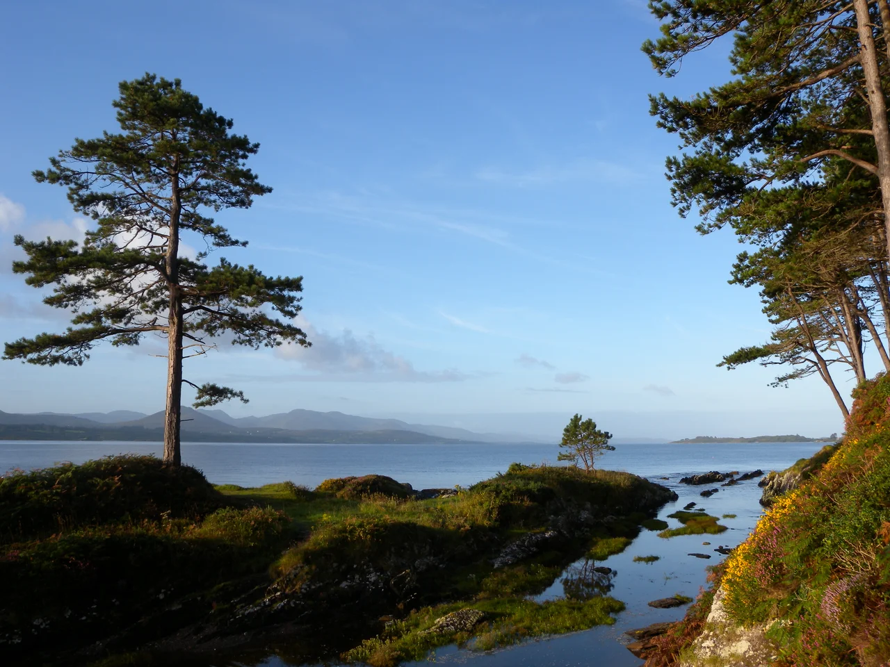

Ring of Kerry
All the tour buses go the same way. Anti-clockwise, from Killarney through Killorglin first, because the road is too narrow for two coaches to pass each other in places, and someone, somewhere, decided that everyone would simply have to agree. So they do. And if you drive yourself, the locals will tell you to go the other direction, clockwise toward Kenmare, so you meet the buses head-on at the few wide spots instead of trailing them for hours. This is the kind of thing the Ring of Kerry decides for you - 179 kilometres of road threaded around the Iveragh Peninsula in the southwest of Ireland, through mountains and lake country and along an Atlantic coast that does not let up.
The Loop the Land Made
The route is essentially a circle pinned to County Kerry's geography: the N71 south from Killarney to Kenmare, then the N70 around the peninsula through Sneem, Waterville, Cahersiveen, and Glenbeigh, then the N72 back to where you started. The road follows what the land allows - hugging the coast where the cliffs permit, climbing inland where they refuse. At Moll's Gap and Ladies View, the landscape opens into the panoramas that turned this drive into a postcard a century before postcards existed. The Iveragh Peninsula sticks west into the Atlantic between the larger Dingle Peninsula to the north and the smaller Beara to the south, and the Ring traces its rough edge. Variations exist - some loops dip out to St. Finian's Bay or Valentia Island, which the official driving route misses - but the basic shape has stayed constant for generations of visitors.
What the Drive Holds
Within the Ring sits Killarney National Park, with Lough Leane and the ruins of Ross Castle on its shore, the cascade at Torc Waterfall, and Muckross House looking out at the lakes. Further around, the road passes Staigue stone fort - a circular drystone enclosure built two millennia ago, its walls still six metres tall - and Derrynane House, the family home of Daniel O'Connell, the lawyer and statesman who won Catholic Emancipation for Ireland in 1829 and earned the title 'The Liberator'. Out beyond the coast, the jagged silhouette of Skellig Michael rises from the Atlantic, the seventh-century monastic settlement whose beehive stone cells perch on a sea-pounded rock that has stood in for an alien planet in modern cinema. The cycling Ring picks up Valentia Island, where transatlantic telegraph cables once made landfall.
Sat-Navs and Tour Buses
In 2008, news outlets reported that satellite navigation systems were sending tour-bus drivers in the wrong direction around the Ring, against the unwritten agreement that had governed coach traffic for years. The story made the Irish papers because the implications were geometric: a single bus going the wrong way on a road too narrow for two buses means a long, slow choreography of reversing into laybys. The official cycling route uses older, quieter back roads where possible, and the 214-kilometre Kerry Way walking trail roughly parallels the drive but leaves the tarmac behind for old paths through the hills. Whichever direction you choose - and whichever wheels carry you - the basic Ring problem stays the same: too much to see, not enough light in a single day, and a road that keeps insisting you stop one more time.
A Drive That Outlasts the Driving
What lingers after the Ring is not usually the road itself. It is the cumulative effect of a coastline that refuses to repeat itself - Rossbeigh's long sandy curve, the rock-strewn approach to Coomakista Pass, the moment near Caherdaniel where the road climbs and the whole Kenmare Bay opens up below. It is the patchwork of stone-walled fields, the sudden stone fort or holy well, the way the weather changes three times in an afternoon. The Ring of Kerry has been called Ireland's most famous drive for so long that the phrase has gone slightly stale, but the road has not. It is still the Atlantic on one side and the MacGillycuddy's Reeks - the country's highest mountains - on the other, and somewhere in between a stretch of asphalt trying its best to show you everything.
From the Air
Centred near 51.95 degrees N, 9.92 degrees W on the Iveragh Peninsula. From cruising altitude the peninsula reads as a green thumb pushing west between Dingle Bay to the north and Kenmare River to the south, with the MacGillycuddy's Reeks as the highest mass inland. Kerry Airport (EIKY) sits on the north side of the peninsula near Killarney; Cork Airport (EICK) lies east. Best viewing at low to mid altitudes in clear weather, when the lakes of Killarney and the indented coastline are most legible.
Nearby Stories
- Castleisland 3.2 km away
- Mountains of the Central Dingle Peninsula 4 km away
- Allihies Copper Mine Museum 4.9 km away
- Kilgarvan 5.8 km away
- Inishvickillane 12 km away
- Ballydehob 15 km away
- RMS Carinthia (1925) 113 km away
- Sao Miguel 1937 km away