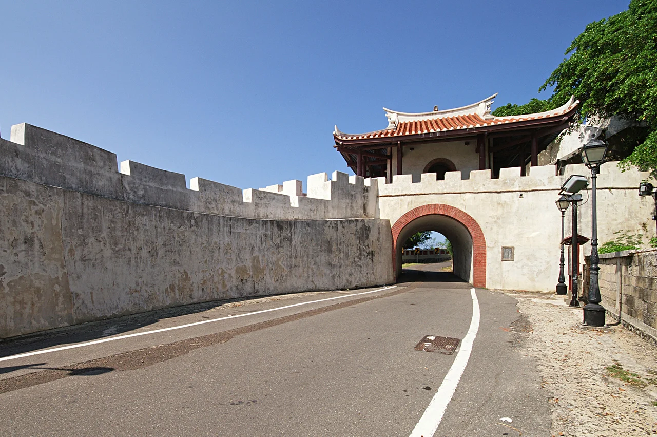

Magong Old City Wall
Of the six gates that once pierced the Magong city wall, only one has been restored to anything approaching its original form. The others were demolished — not by enemy fire or earthquake, but by urban planners during Japan's colonial administration of Taiwan, when roads needed widening and the old defensive perimeter stood in the way. What remains of the wall is a story about which pieces of history a city chooses to keep.
Built on the Edge of Empire
The wall went up at a particular moment of anxiety. Construction began in 1887 and was completed in 1889, during the late Qing Dynasty's administration of Taiwan — just six years before the Treaty of Shimonoseki would transfer the island and its outlying archipelagos, including Penghu, to Japan. The Qing authorities had reason to be concerned about Penghu's vulnerability. French forces had occupied the islands during the Sino-French War only two years before construction began, and the strategic value of the harbor was not lost on any of the regional powers circling the western Pacific.
The resulting wall was substantial: 2,762 meters in length, topped with 570 merlons — the raised sections of a battlement between which defenders could fire. Six gates controlled movement in and out of the city. It was a serious piece of defensive infrastructure, built to last.
What Colonization Took
Japan's administration of Taiwan, which began in 1895 and lasted through the Second World War, brought significant urban transformation to Magong. Colonial planners reorganized streets, expanded infrastructure, and made room for the administrative apparatus of a regional naval base — the Imperial Japanese Navy made Penghu a major installation, and the city grew to serve it.
In that process of modernization, the south wall, both southern gates, and the north and east walls and gates were torn down. The logic was practical: the walls impeded traffic, occupied land the growing city needed, and had no remaining military function in an era of naval artillery. That they also erased a physical layer of pre-colonial history was, in the priorities of that administration, secondary. The stones came down.
The Handover and the Smaller Gate
When Taiwan was transferred from Japan to the Republic of China in October 1945, the military perimeter west of the surviving wall segment became part of the Penghu Defense Command. The remaining structure found a new administrative identity: not a historical relic but an active boundary within a military zone.
At some point after the handover, the smaller west gate was restored to something close to its original form. It stands now as the most intact reminder of what the full circuit of walls once looked like — a single gate representing six, one restored entrance in place of the wall that once enclosed an entire city.
Reading What Remains
The fragments that survive carry the compressed history of Penghu itself: Qing anxiety about territorial security, Japanese colonial priorities, postwar military administration, and eventual heritage recognition by the Bureau of Cultural Heritage, Ministry of Culture. The wall did not survive intact because it was especially well protected; it survived in pieces because demolition stopped before it was finished, and because the fragment that remained happened to fall within a military zone that paused the usual pressures of urban development.
Today the Magong Old City Wall is recognized as a cultural heritage site. Visitors walking the surviving section and the restored west gate can trace the profile of a fortification system that once defined this city's boundary with the sea — before the sea, in a sense, became less of a threat than the streets pressing in from all sides.
From the Air
The Magong Old City Wall remnants are located in central Magong City at approximately 23.563°N, 119.562°E, on Penghu's main island. Approaching Magong Airport (RCQC) from the northeast, the compact urban grid of Magong is visible to the southwest of the runway threshold. The wall fragments lie within the city core, identifiable at lower altitudes by the contrast between older masonry structures and surrounding development. Recommended viewing altitude 1,500–2,500 ft. RCQC is approximately 2 nautical miles northeast of the wall site.
Nearby Stories
- 1904 Douliu Earthquake 7.1 km away
- Yanshuei District 8.2 km away
- China Airlines Flight 611 9.7 km away
- Fangyuan Lighthouse 12 km away
- Dongji Island 15 km away
- Nanxiong Formation 436 km away
- Daya Bay 483 km away
- Battle of Xiapi 1166 km away