.jpg)
The Invisible Wall of Makassar Strait
Alfred Russel Wallace noticed it first. Sailing east from Borneo across the warm, calm waters between two of the world's largest islands, he found that the animals on the far shore bore almost no resemblance to those he had just cataloged. Monkeys vanished. Cockatoos appeared. The strait he crossed was only about 120 kilometers wide, but the life on either side belonged to different continents. The boundary that now bears his name -- the Wallace Line -- runs straight through the Makassar Strait, marking one of the sharpest biological divides anywhere on the planet. Beneath the surface, this channel holds the explanation: a deep ocean trench that has remained submerged for over fifty million years, keeping the faunas of Asia and Australia apart even when ice ages drained the shallow seas elsewhere in the archipelago.
A Trench Between Two Worlds
The Makassar Strait stretches roughly 800 kilometers between Borneo to the west and Sulawesi to the east, connecting the Celebes Sea in the north to the Java Sea in the south. But its importance has never been merely geographic. During the Pleistocene ice ages, when sea levels dropped by more than a hundred meters, the shallow Sunda and Sahul shelves emerged as dry land, extending the Asian and Australian continents far into the tropics. The Makassar Strait, however, never closed. Its deepest sections remained flooded, forming a persistent marine barrier that terrestrial animals could not cross. Tigers, rhinoceroses, and elephants reached Borneo and Bali but stopped at its western shore. Marsupials and cockatoos flourished on Sulawesi and points east but never spread to Borneo. The result is a biological contrast visible from space in the character of the forests, and unmistakable on the ground in the sound of the wildlife.
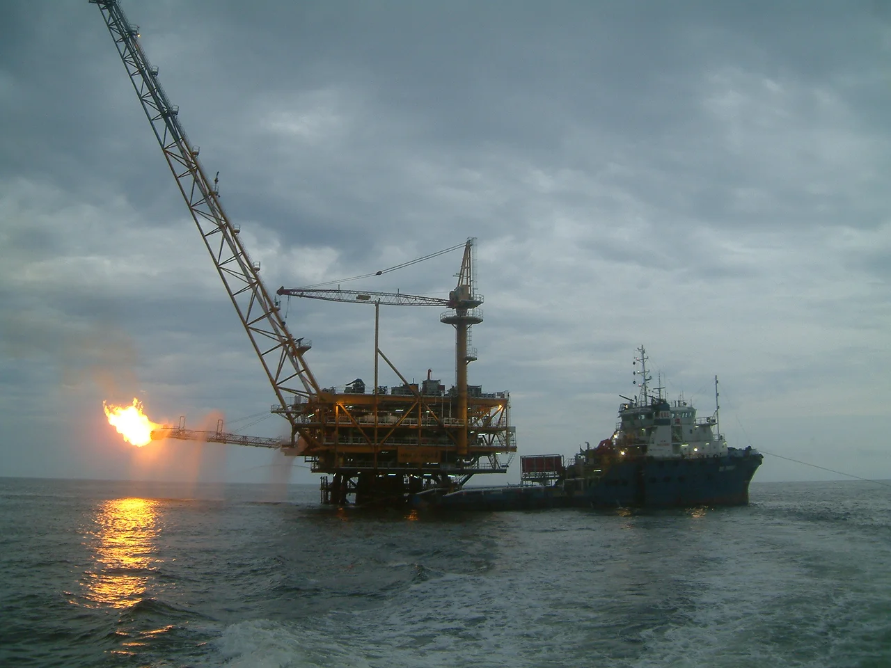
Rivers of Oil Beneath the Seafloor
The strait owes its depth to back-arc extension that began during the Eocene, some forty to fifty million years ago, as a small tectonic slab subducted to the east. The rifting opened the North Makassar Basin, and high sedimentation rates filled it throughout the Eocene and Miocene with organic-rich deposits. Those Miocene sediments now hold enormous reserves of oil and natural gas, concentrated especially in the Kutei Basin off the coast of East Kalimantan. More than six trillion cubic feet of gas and 200 million barrels of oil and condensate have been discovered in deepwater turbidite sands there. Offshore platforms dot the strait's western half, and ports like Balikpapan and Bontang on the Borneo side have grown into major energy hubs. On the Sulawesi side, the arrival of the Banggai-Sula microplate has rotated the island counter-clockwise, opening the southern Makassar Basin along the Adang-Paternoster Fault and creating yet more potential hydrocarbon traps.
Warships in the Narrows
The strait's strategic value was demonstrated in the opening weeks of the Pacific War. On February 4, 1942, an American-British-Dutch-Australian fleet under Rear Admiral Karel Doorman attempted to intercept what they believed was a Japanese invasion convoy bound for Surabaya. The destination was actually Makassar. Before the fleet could engage, sixty Japanese bombers -- Mitsubishi G4M "Betty" and G3M "Nell" aircraft -- caught the ships in the open water. USS Houston and USS Marblehead both took heavy damage, and the allied force retreated. The Japanese secured control of the strait and, with it, command of a shipping corridor that connected their conquests across Southeast Asia. Today the strait remains one of the region's busiest maritime routes, carrying tankers, container ships, and fishing fleets between the ports of Balikpapan and Makassar.
Where Currents and Commerce Converge
Two of Borneo's great rivers empty into the Makassar Strait. The Mahakam, which rises deep in the interior highlands, delivers sediment and freshwater along a 980-kilometer course before spilling into the strait near Samarinda. The Karangan River adds its own contribution further south. These inputs create nutrient-rich waters that support productive fisheries, drawing fleets from both coasts. The ports on either shore reflect different economies: Balikpapan and Bontang thrive on petroleum and liquefied natural gas, while Makassar and Parepare on the Sulawesi side serve as trading centers for agricultural products and manufactured goods. The city of Palu, tucked into its narrow bay further north, functions as the capital of Central Sulawesi. For all its biological significance as a boundary, the Makassar Strait has never stopped human traffic. It has simply organized it, channeling commerce and culture along its length for centuries.
From the Air
Centered near 0.83S, 118.17E, the Makassar Strait is visible from cruising altitude as the broad water gap between Borneo (west) and Sulawesi (east). At 35,000 feet in clear weather, both coastlines are visible simultaneously. Major airports on the Borneo side include Sultan Aji Muhammad Sulaiman Sepinggan International Airport at Balikpapan (WALL). On the Sulawesi side, Mutiara SIS Al-Jufrie Airport at Palu (WAFF) and Sultan Hasanuddin International Airport at Makassar (WAAA) serve as reference points. Offshore oil platforms are visible in the western half of the strait. The Wallace Line runs directly through this channel.
Nearby Stories
- The Mahakam: Borneo's River of Kingdoms and Dolphins 35 km away
- Equally Low: Samarinda and the Mahakam 69 km away
- The Airfield That Vanished 90 km away
- Palu: The City That Knows the Ground Can Move 115 km away
- Stone Faces in the Cloud Forest 115 km away
- Badak LNG: Borneo's Gas Giant 117 km away
- Cutting the Orchid in Half: The Proposed Sulawesi Canal 137 km away
- Borneo's Oil Capital 156 km away