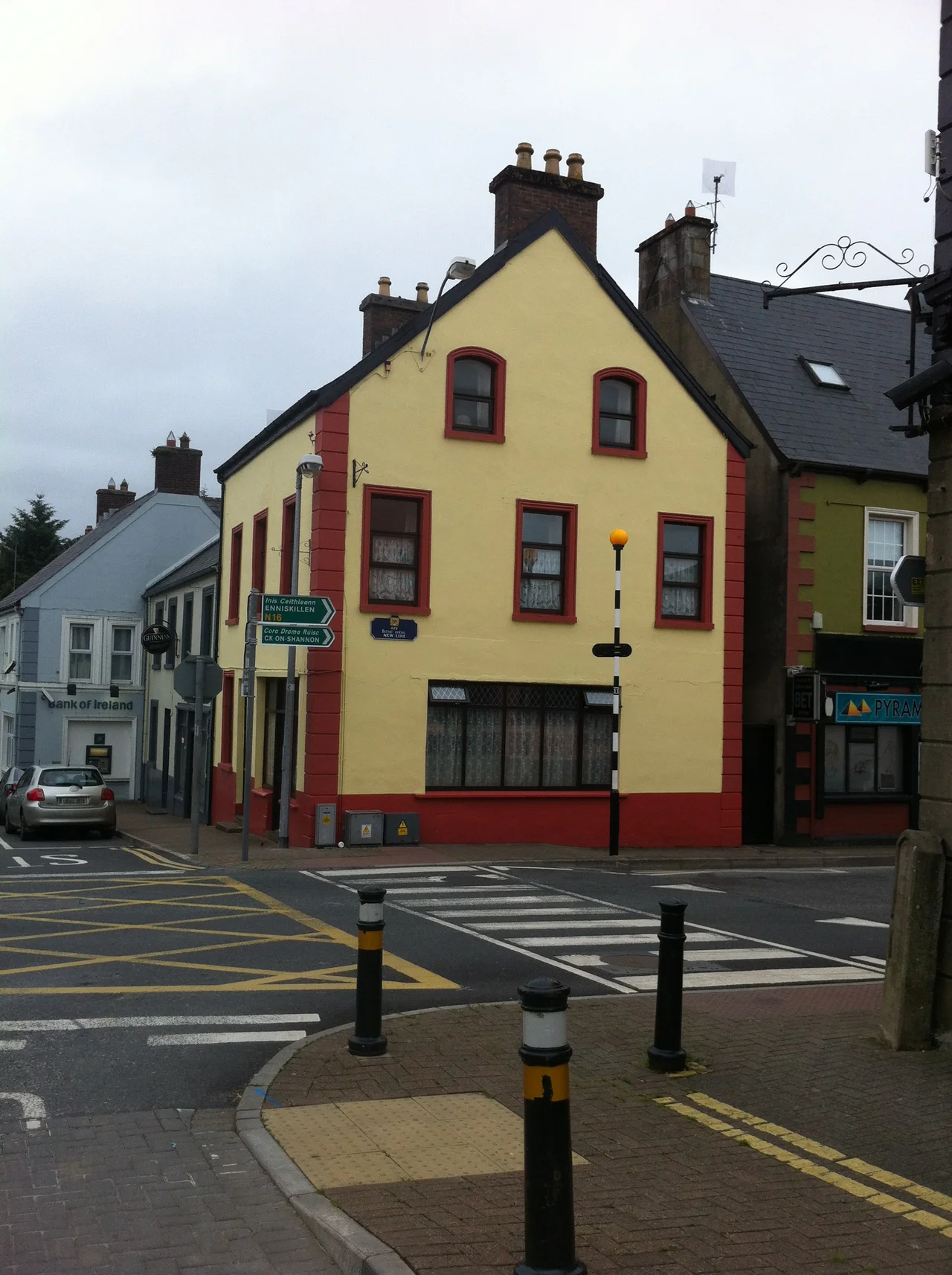

Manorhamilton
Sir Frederick Hamilton was, by all contemporary accounts, deeply unpopular. So when the soldier-of-fortune received O'Rourke lands in 1620 and built himself a fortified house at a place called Cloneen on the River Owenbeg, he made sure the walls were stout. The walls were not stout enough. In 1652 the castle was burnt out during the Cromwellian wars, and what survives today is a roofless shell on Castle Street, hidden in plain sight in a town that took Hamilton's name and now mostly forgets him. Manorhamilton has only 1,700 people, but it is the only town of any size between Lough Allen and the Atlantic coast in north County Leitrim. It is also the gateway to a district full of waterfalls, dance halls and a lake monster called the Dobhar-chu.
Hamilton's Plantation
Before 1620, this stretch of the River Owenbeg held a small Gaelic settlement called Cloneen on the west bank. After the Plantation of Ulster, Sir Frederick Hamilton arrived from Scotland with a grant of lands seized from the O'Rourkes. He built up the castle on the east bank, laid out a town along Main Street running northwest to southeast, and gave it his own name. The castle was burnt during the Cromwellian wars in 1652, and the First Protestant Church a block south of Main Street, built about the same time, is now just as ruined. St Clare's, the Roman Catholic church built in 1883 on the New Line on the east side of town, is the only church still in regular use. The town's modern street pattern, the curving New Line bypass of the original Main Street, dates only to the twentieth century.
Yeats's Waterfall
Eight kilometres west of Manorhamilton off the N16, Glencar Lough straddles the boundary with County Sligo, and at its northeast end the Glencar Waterfall drops down a wooded cliff into the lough. W.B. Yeats turned the place into one of his best-known poems, 'The Stolen Child,' describing how the faeries lure a child away into 'pools among the rushes that scarce could bathe a star.' Yeats had a slightly imperfect grasp of stellar masses, but the imagery captured the eerie quality of the limestone country here. Just north of the lough, Benbulbin rises as the great flat-topped limestone scarp that dominates this corner of Sligo. The fictional faeries are kept company by an actual creature called the Dobhar-chu, the so-called Lake Monster of Glenade, pronounced 'Dowarcoo,' which according to local tradition killed a woman named Grainne Ni Conalai in 1722. Her husband shot the monster, was pursued by its mate, and slew that one too. Offspring, possibly, are still about.
The Ballroom of Romance
At the junction of the N16 and R281 stands the Rainbow Ballroom of Romance, a preserved dance-hall from the showband era of 1950-70. The ballroom is now a museum of those Brylcreem evenings when bands like the Royal and the Capitol toured rural Ireland and young couples drove for hours to dance to live music in country halls. The name 'Ballroom of Romance' was popularised by a William Trevor short story and a 1982 BBC television play starring Brenda Fricker and Cyril Cusack. Glenfarne Demesne nearby was once the estate of Sir Edward Harland, co-founder of the Harland and Wolff shipbuilders in Belfast, the firm that built the Titanic. The estate now has walking trails and sculptures along the shore of Upper Lough MacNean, with the ruins of Glenfarne Hall lost somewhere in the conifer plantings.
Sean Mac Diarmada's Cottage
Down a back lane parallel to the R281 stands a small farmhouse that is one of the most quietly important pilgrimage sites in modern Irish republican history. Sean Mac Diarmada, born here in 1883, was one of the seven signatories of the 1916 Proclamation and one of the leaders of the Easter Rising. He was executed by firing squad at Kilmainham Gaol on 12 May 1916. The cottage is now preserved as an exhibition of farm life in the era he was born into, and visits run through the Kiltyclogher Heritage Centre five kilometres to the northwest. Also nearby is Prince Connell's Grave, a court tomb with a single chamber, 3.5 km south of Kiltyclogher on the R281. The name is misleading, since the prince in question lived a thousand years after the tomb was built, but the name has stuck.
The Pig and the Border
Stretching across several counties is a strange linear earthwork known as the Black Pig's Dyke, a ditch with embankments that probably once supported a wooden palisade. Sections near Kiltyclogher and Rossinver are well preserved. One stretch in County Monaghan has been dated to 390-370 BC, ruling out the popular theories of construction by Romans, giant black boars or huge worms. The dyke does not look like a single border defence, more like a series of barriers to block cattle-rustling routes between Gaelic kingdoms. Cross the same border today in your car and you can still pass it without noticing. One day Manorhamilton is in the Republic, then a small bridge a kilometre on takes you into County Fermanagh and out of the European Union. A red Royal Mail van might surprise you on an Irish back lane. It hasn't strayed. You have.
From the Air
Manorhamilton sits at 54.31°N, 8.18°W in a U-shaped glaciated valley between the Dartry Mountains to the west and the Arroo Mountains to the east, 26 km east of Sligo on the N16 (which becomes the A4 in Northern Ireland). Nearest commercial airport is Sligo Airport (EISG) about 30 km west, with Knock (EIKN) about 80 km southwest and Belfast (EGAA) about 140 km northeast. The town lies near several borders: County Cavan to the southeast, County Fermanagh (Northern Ireland) to the east, County Donegal to the northwest, County Sligo to the west. From altitude the steep limestone scarps of Benbulbin and Truskmore dominate the view westward. The Cuilcagh range rises to the east. Best viewing altitude 2,500-5,000 ft for context with the surrounding mountains.
Nearby Stories
- Kesh Ambush 3.4 km away
- Florence Court 3.6 km away
- Ballyshannon 4 km away
- Ireland West Airport 6.4 km away
- Carrick-on-Shannon 11 km away
- Easky 13 km away
- Border Region 25 km away
- RMS Empress of Britain (1930) 109 km away