Maranhão mangroves
Half of Brazil's shorebirds feed in these trees. The figure sounds improbable until you see the place from above - a coast that no longer looks like a coast, but like something the Atlantic is still in the process of negotiating with the land. Tides in the Maranhão mangroves can rise eight meters at the spring peak, and because the land is flat and soaked with rainfall, salt water reaches as much as forty kilometers inland. The mangroves follow the water. The result is an ecoregion of 11,300 square kilometers, or roughly the area of Lebanon, that is neither entirely ocean nor entirely terrestrial.
A Coast That Keeps Its Own Shape
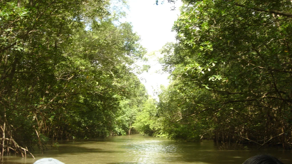
In Portuguese it is called the *Reentrâncias Maranhenses* - the Maranhão indentations - and that word is the better description. From the Pará border in the west to the mouth of the Parnaíba River in the east, the coastline is a shredded mess of bays, islands, peninsulas, and mudflats, all of it stitched together by mangrove forest. The silt that built this place came from the Amazon, carried north by ocean currents and dropped here over millennia. In the western stretch, hundreds of small islands rise just above the highest tides. To the east, past the Baía de São Marcos, sand dunes take over and mangroves retreat into pockets at the mouths of rivers. The land is still being built.
Six Species of Tree, One Architecture
Six mangrove species make up most of the forest. Closest to the sea stands *Rhizophora mangle*, the red mangrove, which can reach 25 meters and holds itself above the waterline on stilt roots that arch out from the trunk like flying buttresses. Behind the red mangrove come *Avicennia germinans* and *Avicennia schaueriana*, the black mangroves, their roots pushing pneumatophores up through the mud like a field of small snorkels. *Laguncularia racemosa*, *Rhizophora racemosa*, and *Conocarpus erectus* fill out the canopy. Because so much rain and river water flows into the system, salinity is lower than in most mangrove forests worldwide. That allows freshwater plants - palms, macrophytes, even the *açaí* palm - to grow alongside the salt-adapted species, creating a hybrid community that is not quite like anything else on the Atlantic.
The Birds That Make the Case for Protection
Seven percent of all shorebirds in South America feed in these mangroves. That statistic is what conservationists cite when they argue for Ramsar designation and protected area status, and it is earned. The mangroves support herons, egrets, and the roseate spoonbill with its improbable pink plumage and flat, rounded bill. Scarlet ibis roost here in flocks that turn mangrove crowns red at sunset. The wattled jacana walks on floating vegetation on its preposterously long toes. In the water, the tucuxi - a small river dolphin - hunts fish through the tidal channels, and West Indian manatees drift in the quieter bays. Several sea turtle species use the mangroves as breeding ground. All of these animals are either rare, endangered, or both.
A Place That Resists Easy Access
The reason the ecoregion remains mostly intact is the same reason few outsiders have visited it. There are very few roads. The human population is low. What settlement exists is spread out among the artisanal fishermen who live along the edges and paddle into the mangroves at low tide to gather crabs - the *caranguejo-uçá* that is the region's signature seafood. Mangrove wood is cut for fuel and house framing, and tannin is stripped from the bark for dye. These uses have persisted for generations without damaging the system too badly. The newer threats are different - rice paddies replacing mangrove in some areas, sewage and industrial runoff from São Luís to the southeast, pollution from small-scale gold mining in the river catchments, and commercial overfishing that pulls fish out faster than the mangroves can grow them.
What the WWF Calls Vulnerable
The World Wildlife Fund classifies the Maranhão mangroves as Vulnerable - which, in the language of ecoregion assessments, means the place is not yet in crisis but will be if current trends continue. Protection is a patchwork. The Bacanga State Park covers a small fragment near São Luís. The Lençóis Maranhenses National Park, on the eastern margin, is a Ramsar Convention wetland of international importance and a Western Hemisphere Shorebird Reserve Network site. Between and beyond those protected areas, 11,300 square kilometers of mangrove forest does what mangrove forests do, largely unobserved. The tides come in. The tides go out. The silt keeps arriving from the Amazon. The birds come south in autumn, feed in the mud, and fly north again.
From the Air
Coordinates 1.63°S, 44.75°W. Recommended viewing altitude 5,000-10,000 feet to appreciate the scale of the coastal indentations; above 15,000 feet the braided mudflat pattern reads as an almost continuous texture. Landmarks: Baía de São Marcos splits the ecoregion into western and eastern halves; São Luís lies on the east side of the bay. Nearest airport is Marechal Cunha Machado International (SBSL) in São Luís. The region has frequent afternoon convection in wet season (January-May); best visibility is in the dry season from August through November.
Nearby Stories
- São Luís 62 km away
- Alcântara Space Center 68 km away
- Parcel de Manuel Luís Marine State Park 78 km away
- Sítio Rangedor State Park 92 km away
- Santa Inês 193 km away
- São Miguel do Guamá 237 km away
- Oiapoque 927 km away
- Nadir Crater 3245 km away