Santa Inês
Around nine kilometers from here, in Pindaré, a sudden downpour cuts across the highway in September. Locals do not check the forecast when this happens. They simply call it the chuva das mangas, the mango rain, and know that it will pass within minutes, that it will bring hail sometimes, that it will be followed by the smell of wet asphalt and ripening fruit. Santa Inês sits in western Maranhão at this kind of intersection: where the Belém-Fortaleza highway meets the Carajás rail line, where two seasons collide more dramatically than the coordinates might suggest, and where a city of 89,000 people generates a Carnival considered among the best in a state famous for Carnivals.
Two Seasons, One Road
The climate here draws a sharp line. From mid-December until early June, this is a rainy place. From mid-June until early December, it is dry. March and April are the wettest months, July and August the driest. What surprises visitors is not the wet or the dry but the in-between. In May through August, predawn hours drop to 18 to 21 degrees Celsius, cold enough to be unpleasant, and morning fog rolls across the highway reducing visibility for the drivers on the Belém-Fortaleza route. The fog burns off by midmorning and the day turns hot, the predictable tropical pattern. Then September arrives and the mango rains begin: sudden, violent, out-of-season storms that punctuate the supposed dry season with wind, thunder, and occasional hail, as though the atmosphere itself is clearing its throat before the wet season proper.
Why Every Bus Stops Here
Santa Inês is a highway town in a way that São Luís, the state capital a few hundred kilometers north, is not. Every bus running between Belém and Fortaleza, the two big northern cities flanking the state, passes through or past. Drivers will stop if asked. The CFN railway, the track that carries iron ore from Serra dos Carajás in Pará to the Atlantic coast at São Luís, runs passenger trains three times a week in each direction. For ten reais, you get a four-hour ride to São Luís. Vans at the Laranjeiras fork will take you to Teresina, Imperatriz, Zé Doca, or back to São Luís at rates that undercut formal transport. This is a small city that functions as a node. The Sistema Integrado de Transporte runs ten urban buses connecting Santa Inês to Pindaré, nine kilometers away, and between neighborhoods. A taxi cooperative based in Pindaré runs the same route. Nothing is fast. Nothing is expensive. Everything eventually arrives.
Carnival and the June Parties
Maranhão Carnival is its own tradition, distinct from the Rio spectacle and the Bahian samba-reggae of Salvador, and Santa Inês throws one of the better ones in the state. Every Carnival Sunday the city hosts the Arrastão Ponta da Linha, when every carnival bloco in the city merges into a single procession and walks the main streets together. Twenty thousand participants or more show up, spilling in from nearby towns because the reputation draws them. Two weeks later, and three months later in a different form, comes the other great public celebration: the Festas Juninas in June, the festival cycle tied to Saint John, Saint Anthony, and Saint Peter that dominates northeastern Brazilian social life. Parque da Raposa, with capacity for 10,000, hosts nights of quadrilhas, forró, and bumba-meu-boi. Regional oxen from across the state come to perform. Visitors who wander into either festival without knowing what they are will know within about thirty seconds: the drums start early, the dancing never stops, and the food keeps coming.
Clay, Canvas, and Pindaré
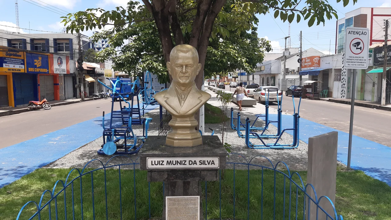
The crafts are mostly clay. Walking the Avenida da Amizade toward Pindaré-Mirim, you pass workshops where artisans shape and fire pieces for sale at roadside stalls. Canvas painters work the same corridor. Santa Inês does not sell itself the way São Luís does, with colonial tiles and UNESCO listings; its aesthetic is more functional. But nine kilometers away, Pindaré holds its own attractions: beaches along the river, freshwater lakes, and the kind of small-town tranquility that drops Santa Inês visitors into a different pace entirely. The Igreja Matriz, the Mother Church, stands at the city's historic center. Two plazas bracket the downtown: Santo Antônio Square, locally known as the Family Square, and Pastor Meton Soares Square. A sculpture honors Luiz Muniz da Silva, a figure in the city's memory. Around all of it, the highway hums day and night, every Belém-Fortaleza bus eventually pulling through, everyone going somewhere else but stopping here first.
From the Air
Santa Inês lies at 3.67 S, 45.38 W in western Maranhão. Nearest major airports are São Luís/Marechal Cunha Machado International (SBSL) about 260 km northeast and Imperatriz/Prefeito Renato Moreira (SBIZ) about 240 km southwest. Recommended viewing altitude 3,000-5,000 feet for a clear view of the BR-316 highway corridor cutting east-west through town and the Pindaré River system. The surrounding landscape transitions from Atlantic coastal forest to cerrado, with the highway running through a patchwork of cleared pasture, small woodlots, and clay pits that feed the regional brick industry.
Nearby Stories
- Baixada Maranhense Environmental Protection Area 59 km away
- Metal Open Air 99 km away
- Parnaíba Thermal Power Complex 128 km away
- Campo de Perizes 144 km away
- Chapada Limpa Extractive Reserve 223 km away
- São Miguel do Guamá 248 km away
- Juscelino Kubitschek de Oliveira Bridge 337 km away
- 2025 United Nations Climate Change Conference 361 km away