Marcahuamachuco
Start with the scale. An isolated highland mesa, five kilometers long and only 500 meters wide, juts up at the meeting of three mountain valleys. At 3,200 meters elevation, the wind never really stops. Along the spine of that mesa, someone - we are still not entirely sure who - raised curved stone walls as much as twelve meters high, a network of circular towers and galleries and plazas that extended more than three kilometers across the plateau. Construction began around 400 CE. That is six centuries before Machu Picchu. And until recently, almost no one outside La Libertad Region had ever heard of Marcahuamachuco.
Before the Inca
The site belongs to the Andean Middle Horizon, the period between the collapse of Chavín and the rise of the Inca empire, when regional powers flourished across Peru. Construction at Marcahuamachuco ran from about 400 to 800 CE, making it roughly contemporary with the Wari culture to the south - but Marcahuamachuco appears to have been independent of Wari domination. By the time the Inca armies conquered it in the 14th century, it had already been northern Peru's most important political, economic, and military center for nearly a thousand years. Then the Inca, as they did almost everywhere, incorporated it into their empire, and then the Spanish came, and the site slid quietly into the category of forgotten wonders.
The Oracle on the Mesa
Archaeologists believe Marcahuamachuco functioned as an oracle center - a place where pilgrims came to consult deities through priests, similar in purpose to the Pachacamac oracle on the central coast. Two cults seem to have been active here: an older devotion to a god named Ataujo and a later worship of Catequil, the thunder deity whose reach extended across the northern Andes. Between 650 and 700 CE, the site thrived on long-distance connections: the Mochica coast to the west, the Recuay culture to the south, Cajamarca to the north, and lesser-known cultures of the Marañón to the east. In the later phases of its history, the walls themselves became mausoleums for the elite, burials placed into the architecture in a deliberate folding of ancestry into sacred space.
The Circular Double-Walled Towers
What makes Marcahuamachuco visually distinctive is its signature architectural form: the circular double-walled structure. These multi-story galleries housed multiple families and served ceremonial functions as well, ringed in concentric stone walls that feel more like medieval keeps than anything the Inca built. The so-called castillos - castle-like compounds - contain inner galleries, rooms, and plazas arranged for both administration and ritual. Researchers John and Theresa Lange Topic, who led intensive investigations in the 1990s, proposed that occupation may have been seasonal, with a maximum population around 6,000 - limited by how much food the thin mesa-top soils could grow and how much water could be collected.
A Long Line of Visitors
The earliest known sketch map of Marcahuamachuco comes from an 18th-century document prepared by Bishop Baltazar Jaime Martinez Compañón, who toured his Peruvian diocese with extraordinary curiosity. Charles Wiener published the first topographic description in 1880 and named the major compounds. Ernst Middendorf visited in 1887 and compared what he saw to Kuelap, the fortress city of the Chachapoya further east. In 1900, Max Uhle and a young Julio C. Tello - who would become Peru's foremost archaeologist - conducted the first formal excavation for the University of California, Berkeley. In 1941-42, Theodore McCown of Berkeley returned for two seasons of digging between the galleries, producing the first precise maps and chronological sequence. Since 1981, the Canadian-backed Huamachuco Archaeological Project has worked the site continuously.
The Damage of Time and Cattle
For all the research, Marcahuamachuco has been steadily losing itself. Centuries of weather have worn at the walls. Plant roots have wedged into masonry. Grazing livestock scramble across walls that predate most of the cathedrals of Europe. The site's isolation - it was notoriously difficult to reach until a road was cut that now brings you from Trujillo in three and a half hours - protected it for a while, but also left it without the conservation infrastructure that surrounds better-known ruins. Former Culture Minister Juan Ossio publicly named Marcahuamachuco, Huánuco Pampa, and Kuelap as northern archaeological destinations that deserve the same attention as Machu Picchu. The Global Heritage Fund committed funding and technical expertise in May 2011.
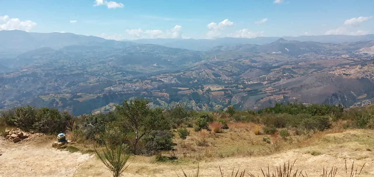
The View from the Mesa
Stand on the highest castillo at dawn, and you understand the siting. Three valleys drop away from the mesa in three directions, each catching the low sun differently. The curved walls throw long shadows that slide across the plateau as the morning advances. Below, the town of Huamachuco sprawls in its basin, modern corrugated roofs glinting where, eleven centuries ago, a different city of stone commanded the same view. The Inca saw what they wanted from Marcahuamachuco when they conquered it. The Moche traded with it. Pilgrims walked days to hear the oracles speak here. The site has been many things across its long life. For now, it is mostly wind and stone, waiting for the next round of people who might understand what it was.
From the Air
Located at 7.79°S, 78.08°W in the La Libertad highlands of northern Peru, atop a mesa more than 3,200 meters elevation. The site is roughly 180 km east-northeast of Trujillo across the western Andes. Nearest commercial airport is Trujillo (TRU/SPRU) via the new paved road, with smaller strips at Cajamarca (CJA/SPJR). Recommended viewing altitude 13,000-16,000 feet AGL. The long narrow mesa is striking from above - a table mountain with visible stone compounds along its spine.
Nearby Stories
- Pallasca District 31 km away
- Rio Abiseo National Park 50 km away
- Battle of Cajamarca 55 km away
- Gran Pajatén 59 km away
- Huacrachuco 84 km away
- Santa Ana (La Florida) 327 km away
- Piura 358 km away
- Easter Island: The Mystery of Rise and Collapse 3853 km away