Pallasca District
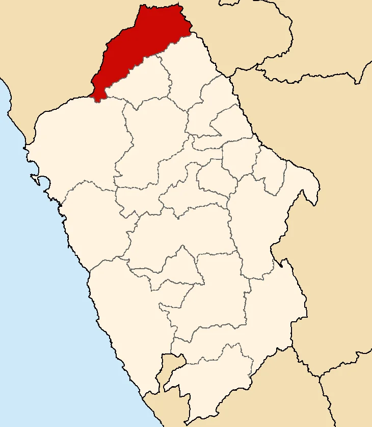
Somewhere in the Tablachaca River - known in older maps as the Andamarca - the Spanish conquistadors are said to have dumped the body of Huáscar, last legitimate Sapa Inca. Huáscar had been imprisoned by his half-brother Atahualpa's men, then drowned on orders issued from Cajamarca as Francisco Pizarro closed in. The river that carried him away flows through Pallasca, and the people who live above its canyon have been telling the story for five centuries. Pallasca sits at 3,150 meters on the northern edge of the Cordillera Negra, a town of about five thousand souls where Quechua place names coexist with a Spanish-only population, and where history refuses to stay buried.
A Name From a Noble
The name Pallasca itself comes, according to the historian Felix Álvarez Brun, from Apollacsa Vilca Yupanqui Tuquiguarac - a noble Andean figure who served the first conquistadors as they pushed down from Cajamarca, and was rewarded with a coat of arms for his trouble. That little biographical detail says everything about how the Spanish conquest actually worked in the sierra. It was not a clean line of invaders against natives. It was a web of alliances, betrayals, and accommodations, with local kurakas switching sides according to old grievances against the Incas or the promise of keeping their own power a little longer. Apollacsa chose his moment. His name survived him, folded into the geography he once helped administer, even if almost nothing else about him has.
The Quechua Belt Without the Quechua
The great Peruvian geographer Javier Pulgar Vidal classified the Andes into altitude belts, and by his scheme Pallasca lies squarely in the Quechua Region - the temperate middle zone between the hot coast and the frozen puna, where maize and wheat grow and the rain comes hard from November through March. The odd thing, as the locals will tell you, is that the Quechua language does not. The ancestral tongue of the Incas survives in millions of mouths across Peru, but Pallasca today is essentially Spanish-speaking, a pocket where the language thinned and vanished while the landscape kept its indigenous name. Farmers here raise papa, maize, and wheat on small plots, graze cattle and sheep, and still weave bayetas - rough wool floorcloths - along with ponchos for a market that keeps shrinking. Two aromatic plants, úñicá and panizará, grow wild and get steeped into infusions. Locally known. Nowhere else sold.
The Feast of San Juan
Every June, Pallasca throws itself into the feast of San Juan Bautista, its patron saint, and the town comes out in costumes that map its whole history onto a single week. There are the Osos, men dressed as bears. There is Indian Culculbambá, a character whose name dates back before the colony. And there is the Suplicio y Muerte del Inca Atahualpa - the torture and death of Atahualpa played as pageant, with a figure called Quishpe taking a central role. The same town that still whispers about Huáscar's corpse in the river reenacts his brother's execution every summer, the two Incas separated in life by civil war and in history by a few months of Spanish treachery, brought back together in the ritual calendar of a mountain district that has not forgotten either of them. Races of cintas and pedradas round out the festival, and the processions to San Juan fill the plaza with the kind of fervor that survives wars.
The Stones and Sticks Battle
When the Chilean army occupied Peru during the War of the Pacific in the 1880s, Pallasca refused to cooperate with the occupying officers. Lacking proper weapons, patriotic locals fought with stones, sticks, and whatever hand-thrown implements they could grab. The toll was, in the memory that survives, thousands killed and wounded across the broader region - a bitter episode in a war Peru lost and whose scars still shape its border with Chile today. The road that now ties Pallasca to Chimbote on the coast was finished much later, in 1973, built in its difficult final stretch by the collective labor of townspeople under the leadership of a Peruvian Army captain named Orlando Alvarez Castro. It is the road by which tourists could arrive, and do not, and by which the young leave for work in the cities and rarely come back.
From the Air
Located at 8.26 degrees S, 78.00 degrees W, at 3,150 meters elevation on the northern tip of the Cordillera Negra in Peru's Ancash Region. The district borders the La Libertad Region to the north across the Tablachaca canyon. For aerial approach, the nearest major airport is Chimbote's Teniente FAP Jaime Montreuil Morales (SPEO) about 150 km west on the coast; small strips at Huamachuco and Huaraz serve the sierra. Cruise 14,000-16,000 feet to clear the ridges. Expect torrential rains November through March; May through September offers clearest mountain visibility.
Nearby Stories
- Department of La Libertad 15 km away
- Huacrachuco 36 km away
- Huamachuco 36 km away
- Rio Abiseo National Park 39 km away
- Paiján Culture 41 km away
- Cordillera Negra 49 km away
- Chavín de Huántar 110 km away
- Easter Island: The Mystery of Rise and Collapse 3849 km away