Cordillera Negra
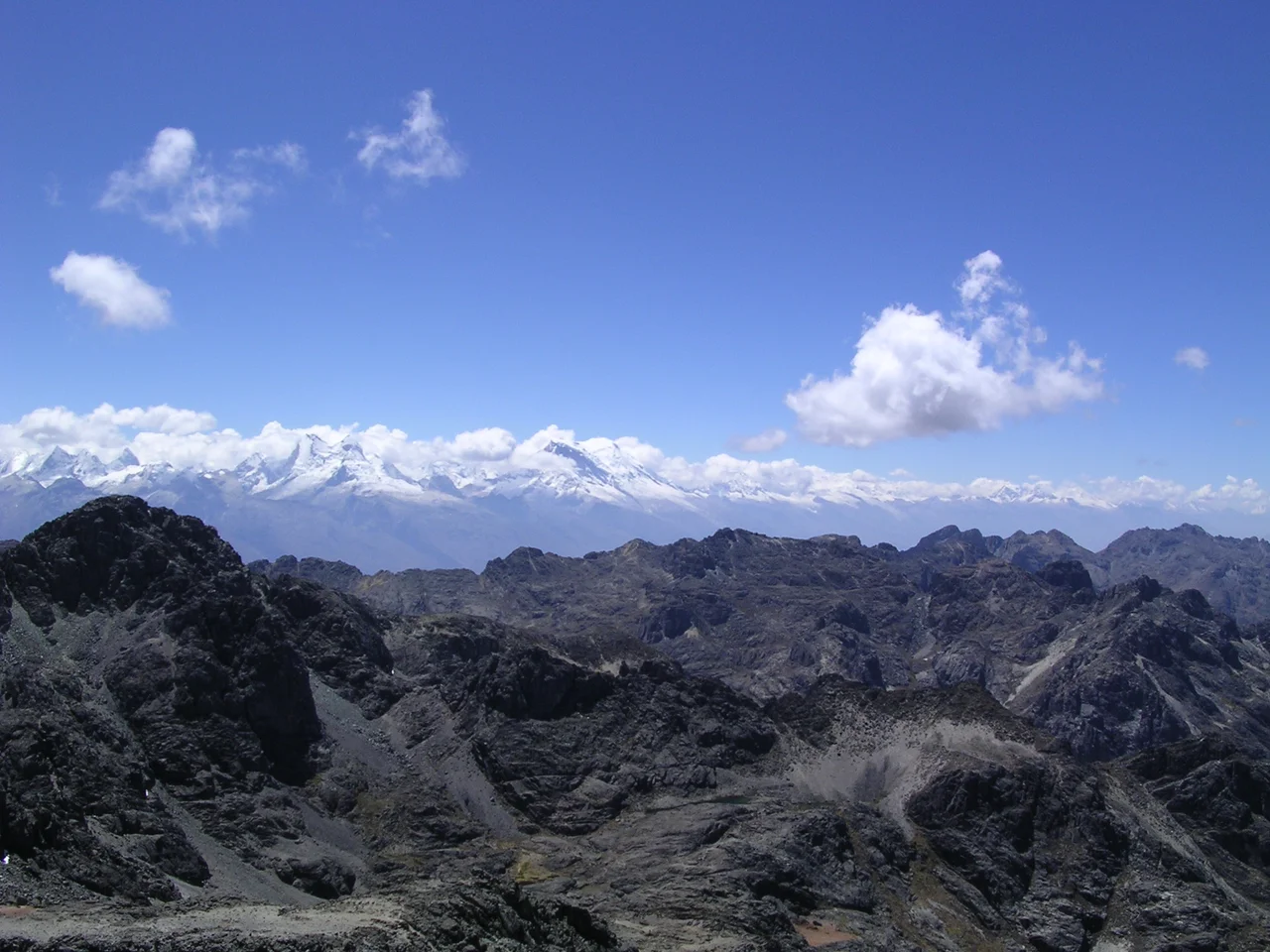
Stand in Huaraz and look east, and you see Huascarán's snow. Look west and you see the Cordillera Negra: dark, brown, almost treeless, the perpetual rain shadow of its glittering neighbor. The Spanish named it for what they could see - black range. The Quechua name, Yana Walla, means the same thing. The contrast between the two ranges is as stark as any geographic transition in the Andes. The Cordillera Blanca catches the warm Pacific air and squeezes it into snow. The Cordillera Negra, on the seaward side, gets almost nothing. The Santa River runs between them, slicing the famous Callejón de Huaylas valley, and on either side stand mountain systems that share only a parent continent.
Two Ranges, One River
The Cordillera Negra extends 230 kilometers in a north-northwest to south-southeast line, parallel to the Pacific coast about 60 kilometers inland. Its width varies between 25 and 40 kilometers. The range is bordered to the north and east by the Santa River, which runs the entire length of the Callejón de Huaylas valley before cutting west through the coastal ridge in the Cañón del Pato gorge. The Patiwillka River bounds the south. In the central section near Huaraz, the Casma River breaks through the ridge, providing one of the few natural east-west crossings. The range tops out at Quñuqranra, 5,181 meters, with about a dozen other peaks above 5,000. None of them carry permanent snow. The contrast with the Cordillera Blanca, just across the Santa River with peaks topping 6,768 meters and 485 glaciers, is geographic rain shadow at its most dramatic.
Why It Stays Dry
The Cordillera Blanca catches the moisture moving in from the Amazon basin and the Pacific. By the time air masses cross over to the Cordillera Negra side, they have given up most of their water. The result is a range of rocky peaks with very little winter snowfall, deep gloomy gullies that are dry most of the year, and mineral exposure that has made this range a treasure house for miners. Gold, silver, and copper have been pulled from these mountains since pre-Columbian times. The Spanish exploited the silver. Modern mining operations continue, scattered along the high ridges where roads can be cut to reach the deposits. The lack of glaciers means almost no year-round water, which limits how many people can live up here, but the indigenous communities that do farm wheat, maize, and oats above 4,000 meters elevation.
The Casma-Huaraz Road
One of the more striking drives in northern Peru is the route from Casma on the coast up over the Cordillera Negra to Huaraz. The road begins paved at Yaután, then turns to dirt as it climbs up the western slope, following the Casma River through deepening gorges. Past Pariacoto, the grade gets serious. The route is narrow, the abysses are real, and there are almost no towns along it - only Pira offers any services worth mentioning. What you see instead are scattered rural districts with chacras, the small Andean smallholdings, planted in potatoes, wheat, barley. Cattle and sheep graze the steep slopes. The highest pass on the route, Wank'ap'iti, sits at 4,680 meters above sea level. For a road crossing a non-glaciated range, that is high enough to feel.
Bones in the Cave
In the 1960s, archaeologists excavated a cave on the northern edge of the Cordillera Negra called Guitarrero Cave. Inside they found bones of mastodon and llama, alongside stone tools and other evidence of human occupation. The dates pushed back surprisingly far: between 10,950 and 10,230 BC, making this one of the earliest known human sites in South America. The people who left those tools were hunting at the very end of the Pleistocene, when the megafauna of the Americas - mastodons, ground sloths, the now-extinct horses - were still walking the high valleys. Within a few thousand years, the megafauna would be gone, hunted out and pushed out by climate shifts. The cave itself remained in use for millennia afterward, layered with the discarded evidence of changing diets and changing tools.
What the Range Gives
The Cordillera Negra is what mountains look like when you take the snow away. Brown ridges fold into brown valleys. Roads switchback up faces that have nothing soft about them at all. The villages cling at altitude where life is hard but the mineral wealth has always made staying worth something. Five thousand meters of bare rock catches the morning sun differently than 6,000 meters of ice does, and the people of the Callejón de Huaylas have always understood that the two ranges form a single system. The Blanca gives water. The Negra gives metal. The valley between them is where Peruvian agriculture and Andean culture have made their accommodation with vertical geography for thousands of years. Drive from Huaraz toward the coast and the transition happens fast: the white range behind you, the dark range under you, the desert ahead.
From the Air
Coordinates 9.05°S, 77.92°W, parallel to the Pacific coast in the Ancash Region of Peru. Maximum elevation 5,181 meters at Quñuqranra. Recommended viewing altitude: 6,500-7,500 meters AGL to clear the highest peaks. The range runs about 230 km north-northwest to south-southeast and 25-40 km wide. The Santa River and Callejón de Huaylas valley separate it from the snowy Cordillera Blanca to the east - a striking visual contrast from altitude. Nearest airport is Anta - Comandante FAP German Arias Graziani Airport (SPHZ) at Huaraz. Generally clear weather year-round on the seaward slopes; occasional fog in winter.
Nearby Stories
- Huacrachuco 30 km away
- Chavín de Huántar 36 km away
- Pampas Grande 38 km away
- La Galgada 47 km away
- Lanzón 63 km away
- Department of La Libertad 88 km away
- Paiján Culture 118 km away
- Easter Island: The Mystery of Rise and Collapse 3803 km away