Pampas Grande
They tried to build the church somewhere else. The Spanish founders of the new town liked a different plot - flatter, more convenient, closer to their chapel at what is now La Victoria. They set down the effigy of San Jerónimo, went to sleep, and in the morning the saint was gone. After days of searching, they found him standing where the main church of Pampas Grande stands today - on ground they had not wanted, rocky and full of red-flowering pucakantu bushes. They tried again at Cañipampa. Same thing. San Jerónimo walked back. The third time, the Spanish gave up and built where the saint insisted.
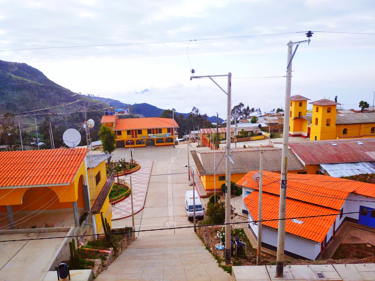
The Plateau at 3,690 Meters
Pampas Grande sits on a plateau in the Callejón de Huaylas, on the western slope of the Cordillera Negra, where the land rises from the populated center of Sensen at 550 meters above sea level up to the Laguna Hurguacocha at 4,600. The town itself sits at 3,690 - high enough that summer averages 17 degrees Celsius and winter averages 12, and the Cordillera Negra fault beneath everything is still sinking the whole valley at a millimeter per year. The Pira and Vado rivers drain the high country, joining to form the Chacchán, which feeds the Casma basin on its way to the Pacific. Up on the puna, taruca deer graze with llamas and spectacled bears. Andean condors circle. In the stony ground between, vizcachas bolt into their burrows and swallows nest in the wetlands through winter.
Huaylas Before the Incas
The Kajur archaeological site, at 1,250 meters above sea level, marks one of the oldest human settlements in this part of the Cordillera Negra. Up near the Canchón summit, the Cuchicoto site shows the influence of the Recuay culture through the Early Intermediate Period. By the time the Incas came, around 1430-1450 under Pachacútec, the people here were Huaylas - confederated with the Conchucos, Piscopampas, Siguas, and Huaris against the expanding empire. They resisted for years. Their most important temple, Pumacayán, was destroyed when they finally surrendered. As vassals, their kurakas were forced to send their daughters to the Sapa Inca as secondary wives. After submission the Inca administrators divided them into Hanan Huaylas and Hurin Huaylas, Upper and Lower - Pampas fell to the lower half, under the administrative center of Recuay Viejo.
Dispute Over Stolen Land
The Huaylas surrendered to the Spanish without a fight, partly to be rid of the Incas. What came next was worse for most of them. The conquerors began handing out land and founding plantations and sugar mills, using native labor drawn from the old communities. The Pampas territory became part of the encomienda of Recuay, held first by Jerónimo de Aliaga - one of the original conquistadors - until he sailed back to Spain in 1550. After that the encomienda passed through dispute and consolidation, ending up merged with Huaraz under Don Hernando de Torres. Colonial documents from 1605 show the huaranga of Ichocpoma, belonging to the saya of Lurin-Huaylla, in what is today Pampas Grande. In 1651 the doctrine of La Asunción de Huaylas was founded with two partialities, Allauca and Ichoc. The ayllu Poma lived here, west of Cajamarquilla. Under all the Spanish paperwork, the old divisions of kin and land stayed roughly in place.
The Name Change
For most of its history the district was simply Pampas. The parish was recognized by Simón Bolívar himself in 1825, three years after independence. The district was officially created on July 25, 1857, during Ramón Castilla's stabilization of the young republic. Over the next century Pampas kept shedding pieces - La Libertad split off in 1907, Huanchay in 1933, Colcabamba in 1941 - each new district carved out of the old parish. In 2009 the town held a popular consultation to rename itself, and on March 15, 2012, Law No. 29846 formally made it Pampas Grande. The bigger name does not match the trajectory. Population has been declining for twenty years, dropping by more than five hundred inhabitants as young people leave for Lima and Huaraz in search of work. The typical dances the old people still teach - negrazos, pastorcillos - depend on dancers. Agricultural plots of half a hectare do not hold them. But at the center of town, in the church the saint chose, San Jerónimo still presides over a community that keeps returning to him, even as it thins.
From the Air
Located at 9.66 degrees S, 77.83 degrees W, at 3,690 meters in Peru's Ancash Region. About 4 hours by road from Huaraz and 9 from Lima. Aerial access via Huaraz's Comandante FAP Germán Arias Graziani Airport (SPHZ) roughly 60 km east; the coastal airport at Chimbote (SPEO) sits about 90 km west. Cruise 14,000-16,000 feet to clear Cordillera Negra ridges. Torrential rains November through March; clearest visibility May through September. The Pira and Vado river valleys provide visual navigation from coast into the sierra.
Nearby Stories
- Chavín de Huántar 18 km away
- Cordillera Negra 30 km away
- Huaricanga 73 km away
- Huacrachuco 82 km away
- Raura Mountain Range 90 km away
- Department of La Libertad 147 km away
- Paiján Culture 176 km away
- Easter Island: The Mystery of Rise and Collapse 3769 km away