
Mary Kathleen, Queensland
Drive the Barkly Highway between Mount Isa and Cloncurry and you can miss it entirely - a turnoff, a cattle grid, then a grid of empty streets in the spinifex. There are kerbs here, and gutters, and bitumen roads that curve past house lots holding nothing but concrete slabs. A town stood on this spot for less than thirty years. Mary Kathleen was planned, built, lived in, loved, and then unbuilt so completely that today you have to imagine the rest. It is one of the strangest places in outback Queensland: a settlement that was not abandoned so much as taken apart and carried away.
A Wife's Name on a Mountain of Ore
The story begins in July 1954, when prospectors Clem Walton and Norm McConachy were working the Selwyn Range and their Geiger counters began to scream. They had found uranium - a rich deposit at a time when the atomic age was hungry for it. McConachy named the find for his late wife, Mary Kathleen, and the name carried from the orebody to the township that would grow beside it. By 1955 the British-Australian mining giant Rio Tinto had formed Mary Kathleen Uranium Limited to develop both the mine and a town to serve it. The geology itself was a curiosity: the ore formed through a rare contact-metasomatic process, the uraninite locked up with garnet, and Mary Kathleen remains the only commercial mine of its exact type ever worked.
The Model Town in the Spinifex
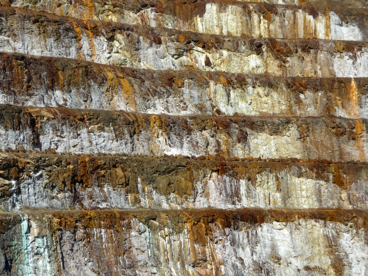
What Rio Tinto built between 1956 and 1958 was no rough mining camp. Mary Kathleen was an architect-designed town, laid out in graceful curves rather than a brutal grid, its streets following the contours of the land. A dam on the Corella River created Lake Corella and gave the town reticulated water - a genuine luxury in a region defined by drought. There were neat houses, a school, a swimming pool, shops, and St Peter's Catholic Church, completed in 1958. Families came for the work and stayed for the community. Photographs from the period show a tidy, almost suburban town blooming improbably out of red dirt and silver-grey spinifex, the open-cut pit terraced into the hills above like an amphitheatre cut for giants.
Boom, Bust, Boom
Mary Kathleen lived two lives. The first uranium contract, signed with Britain's Atomic Energy Authority in 1956, kept the mine running until the early 1960s, when falling demand shut it down. For more than a decade the town sat half-dormant. Then, in the mid-1970s, fresh contracts brought it roaring back. The population, which had dwindled to around 80 in August 1974, surged to 700 within a single year and peaked at roughly 1,200 by 1981. For a few bright seasons Mary Kathleen was a full town again - children in the school, cars on the curving streets, the pit working around the clock. But uranium markets are fickle, and this revival, like the first, was always on borrowed time.
Sold for Parts
When the last contracts were filled in late 1982, the mine closed for good - and this time the town went with it. Rather than leave Mary Kathleen to crumble into a conventional ghost town, the company auctioned it off. Buyers came and bought houses, fittings, and whole buildings, then dismantled them and trucked them away, many to nearby Cloncurry. St Peter's Church was carted off to Mount Isa to become a shelter shed at a Catholic school. Piece by piece, the model town disappeared. By the end of 1984 almost nothing remained above the foundations. The mine site itself became Australia's first major uranium rehabilitation project, completed in 1985 at a cost of around nineteen million dollars - though seepage of mildly radioactive water from the tailings dam, faster than anyone predicted, has kept hydrologists watching the site ever since.
What the Land Keeps
Today Mary Kathleen is a destination precisely because there is so little to see. Travellers turn off the highway to walk its empty streets, to stand on slabs where living rooms once were, and to climb to the lookout above the old open cut, where the abandoned pit has filled with water of an unreal, mineral turquoise - a beautiful, slightly menacing blue that owes its colour to dissolved metals. The rehabilitated land is grazed by cattle now. What endures is the eerie tidiness of it all: not ruins, exactly, but the careful erasure of a place that people built with optimism and then, just as deliberately, took back. Mary Kathleen is less a ghost town than the ghost of one - the outline of a community, drawn in kerbstone and concrete on the floor of the Selwyn Range.
From the Air
Mary Kathleen sits at roughly 20.78°S, 139.98°E in the Selwyn Range, about 50 km east of Mount Isa and 56 km west of Cloncurry, immediately south of the Barkly Highway. From the air the most striking landmark is the flooded open-cut pit above the townsite - a vivid turquoise lake ringed by terraced rock, unmistakable against the surrounding ochre ranges. The faint grid of the former town's streets is still visible from low altitude on clear days. The nearest controlled fields are Mount Isa Airport (ICAO YBMA) to the west and Cloncurry Airport (ICAO YCCY) to the east; both make natural waypoints for an overflight. Best viewing is mid-morning, when low sun rakes the terraces of the old pit and the lake glows; the semi-arid dry season (April to November) offers the clearest skies and minimal haze.
Nearby Stories
- George Fisher mine 10 km away
- Underground Hospital, Mount Isa 14 km away
- Ernest Henry Mine 16 km away
- Quamby 29 km away
- Eloise Copper Mine 39 km away
- Kuridala Township site 47 km away
- Moonah Creek Hanging Tree 81 km away
- Cannington Mine 90 km away