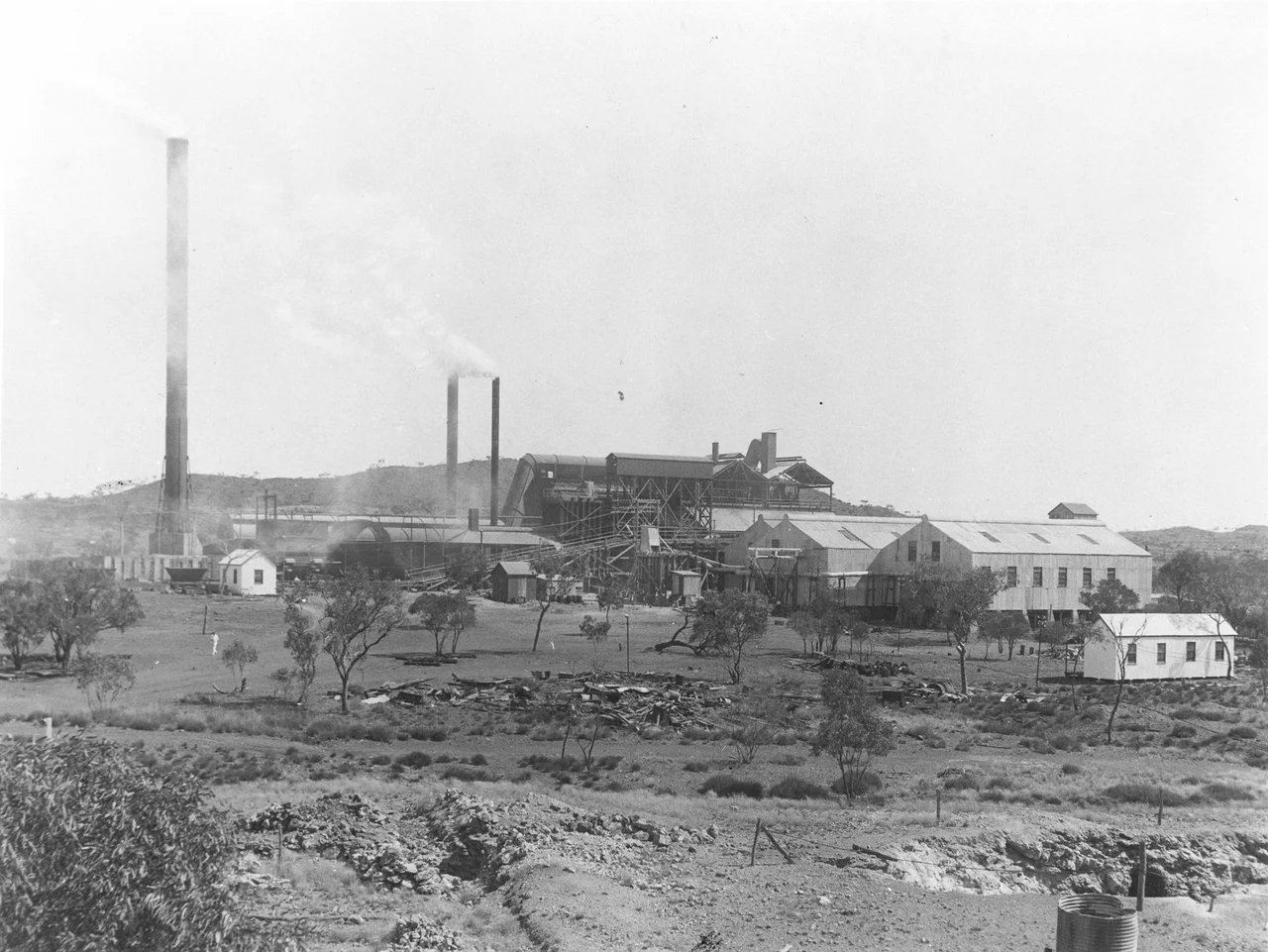
Kuridala Township site
Stand on the open plain at Kuridala today and there is almost nothing to see: a rusted iron chimney, a long grey slag dump, lines of cracked concrete where buildings used to be. Yet a century ago this was the busiest place in north-west Queensland - a copper town of 2,000 people with six hotels, five stores, four billiard saloons, three dance halls, a cinema, and Chinese market gardens along the creek. Its smelter once set an Australian record. Then the copper price broke, and within a few short years the whole town simply walked away. Kuridala was the region's first great mining boom, and it became one of its most complete ghosts.
Eagle Hawk Country
The name Kuridala is an Aboriginal word meaning eagle hawk, though which language it comes from is now uncertain - a small reminder that this land had names and meaning long before any survey peg was driven. Europeans arrived chasing copper. In January 1884, two pastoralists, William McPhail and Robert Johnson, found the deposits on their lease, Eureka, and the place was first called Hampden. The mine changed hands through the 1890s before a Melbourne syndicate - investors nicknamed the 'Broken Hillionaires' for the fortunes they had made at Broken Hill - took it over in 1897. The town that grew here was renamed twice more, from Hampden to Friezland, before settling on Kuridala in 1916.
The Record and the Rush
A rising copper price in 1905 and the government's decision to push the Great Northern railway out to Cloncurry transformed prospects overnight. By 1908 the Hampden Cloncurry company and its great rival, Mount Elliott, jointly financed a rail line to carry ore and machinery into this remote country. When the Hampden Smelter fired up in 1911, the timing was perfect: the First World War sent copper demand surging. In a single month in 1915 the smelter produced 813 long tons of copper - an Australian record at the time. The town swelled to match. At its 1920 peak it held 2,000 residents, four churches, a court house, banks, and a school with up to 280 pupils. For a moment, the desert had a city.
The Collapse
It ended almost as fast as it began. When Britain dropped wartime copper price controls in 1918, the floor fell out of the market. A cyclone that December wrecked part of the powerhouse and smelter. Smelting limped on, postponed to 1919, then leaning on ore trucked in from the Trekelano mine. The smelter pushed nearly 70,000 long tons of ore through in 1920 - but the company was forced to stop everything when the Commonwealth Bank pulled its funding on copper waiting to be exported. The population crashed from 2,000 to 800 within four years. The Hampden Cloncurry company ceased to exist in 1928. Houses were dismantled and carted away; the boom town emptied house by house.
The Last Resident
Even ghost towns die slowly. The Kuridala post office kept operating until 1975, and the last inhabitant, a woman named Lizzy Belch, did not move into Cloncurry until around 1982 - nearly a century after the first copper was found. What she left behind is now an archaeological landscape of rare completeness. The Hampden Smelter holds the only surviving early water-jacket blast furnace of its kind in Queensland, and its slag dump is second in size only to the one at Chillagoe. Foundations mark the bakery, the police station, the skating rink, the hospital. One chimney still bears the inscription AD 1913, and some bricks were cast from recycled slag. Largest of all is the cemetery - among the biggest mining cemeteries in North Queensland, and the surest record of the lives spent here.
From the Air
Located at 21.28°S, 140.51°E, on an open plain about 65 km south of Cloncurry at roughly 345 m elevation, ringed by rugged hills. From the air the township reads as a faint street grid and a prominent grey slag dump beside a single iron chimney - subtle, and easiest to spot with low winter sun raking the foundations. The nearest major airfield is Cloncurry Airport (YCCY/CNJ); Mount Isa Airport (YBMA/ISA) lies further west. The clearest navigation cue is the old Cloncurry–Kuridala rail formation, whose embankments and cuttings still trace across the plain. Best visibility is the dry season, May–September.
Nearby Stories
- Eloise Copper Mine 16 km away
- Mount Elliott Company Metallurgical Plant and Mill 42 km away
- Cannington Mine 54 km away
- Underground Hospital, Mount Isa 60 km away
- Casa Grande, Mount Isa 83 km away
- Combo Waterhole 116 km away
- Boulia Camel Races 143 km away
- Diamantina National Park 194 km away