.jpg)
Matai'an Wetland Ecological Park
The name comes first: Matai'an, which in the language of the Amis people means 'tree bean.' It refers to the Matai'an tribe of the Amis, who have inhabited the area around this wetland long enough that the land and the people share a name. In Amis, a place is not merely a geographic coordinate — it carries the identity of those who live there. The wetland park that now draws ecotourists and birdwatchers to this corner of Guangfu Township, Hualien County, has grown from that original relationship: a community and a wetland, each shaping the other across generations. It is also called the Fataan Wetland Ecological Park, an alternate romanization of the same Amis name.
A Wetland at the Mountain's Foot
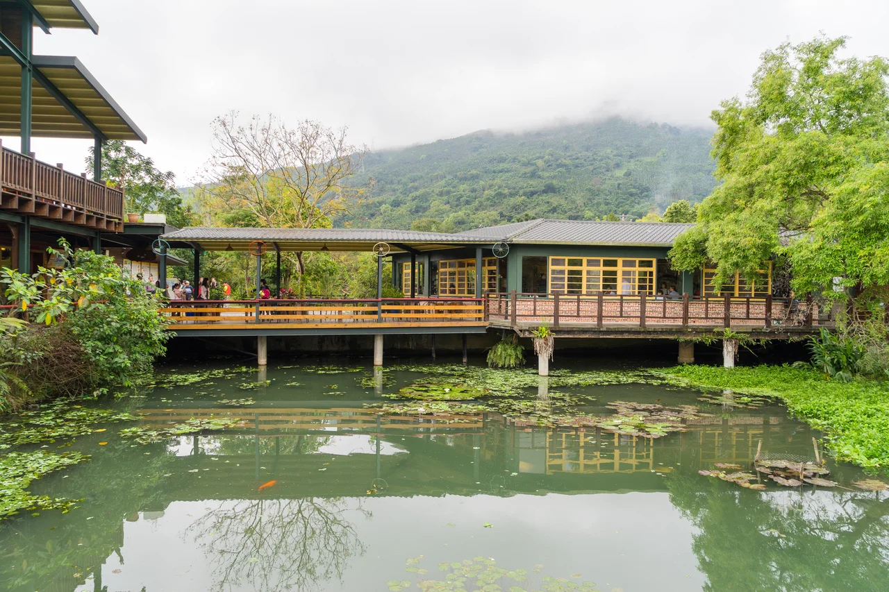
The Matai'an Wetland lies at the foot of Mount Masi, covering nearly 100 hectares of what would otherwise be valley farmland. Wetlands at this scale are not common in the Huatung Valley, where the pressure to convert land to agriculture has been persistent across the twentieth century. This one survived because the Amis community here maintained their relationship with it — using it not as wasteland to be drained but as a productive ecosystem that rewarded careful stewardship. The wetland's shallow water and dense aquatic vegetation create a habitat that supports a remarkable range of species: aquatic fish, amphibians, shorebirds, and an estimated 100 species of aquatic plants. Butterfly populations build through the winter and peak dramatically in spring, when certain species move through the area in numbers that draw visitors specifically to witness them.
The Palakaw: Fishing by Ancient Method
The Amis of Matai'an practice a traditional fishing method called palakaw — the construction of bamboo and brushwood structures placed on the wetland floor that provide shelter for fish and eels, allowing them to congregate and be harvested without nets or poisons. The palakaw method is ecologically gentle: it works with the wetland's natural dynamics rather than against them, concentrating fish in predictable locations while allowing the broader population to maintain itself. This approach to fishing has been practiced here for generations, and it is part of what the community now shares with visitors to the eco-tourism programs that have developed around the wetland. The palakaw represents a form of knowledge — about fish behavior, water flow, and seasonal timing — that belongs specifically to the people who have cultivated it in this place.
From Subsistence to Stewardship
The area around the wetland has long been used by the local Amis community for farming and fishing — two activities that, in a wetland environment, are not always separate. Rice cultivation along wetland margins, fishing in the open water, harvesting aquatic plants: these activities formed a traditional livelihood that sustained the community and, by maintaining the wetland's integrity, preserved the habitat itself. In recent years, the community has developed eco-tourism infrastructure, including three small inns near the wetland that allow visitors to experience the landscape over multiple days. The shift toward tourism is both economic adaptation and cultural expression — the Amis sharing the wetland they have tended, on terms that keep them central to the story rather than peripheral to it.
When the Mountain Dam Broke
In July 2025, Tropical Storm Wipha triggered a massive landslide that blocked Matai'an Creek and created a barrier lake — a natural impoundment of water held behind a wall of debris — in the mountains above the wetland. Barrier lakes are not unusual in Taiwan's seismically and meteorologically active terrain; since the 1970s, natural disasters have created 88 such lakes across the island, though most disappear within a year as the debris dam erodes or is cleared. The Matai'an barrier lake held for two months. Then, in late September 2025, Typhoon Ragasa brought sustained heavy rainfall that pushed the barrier lake past its capacity. Sixty million tonnes of water discharged — roughly two-thirds of the lake's total volume of about 91 million tonnes. The flood swept away a bridge on Provincial Highway 9 and inundated Guangfu, Fenglin, and Wanrong Townships. Sixty percent of Guangfu's population — approximately 5,200 people — were forced to shelter in the upper floors of their homes. The disaster that originated in the mountains above Matai'an spread far down the valley. The wetland park that had drawn visitors for its tranquility was, in that season, close to the source of one of eastern Taiwan's most serious floods in recent memory.
A Living Place
What makes the Matai'an Wetland Ecological Park worth visiting — and worth understanding — is not simply its biodiversity, though that is genuine. It is the continuity of human relationship with a specific landscape. The Amis community here did not discover the wetland and then decide to conserve it. They were already there, already using it, already embedded in its rhythms. The park's formal designation recognized something that was already true: that this wetland had been managed, in the broadest sense, by people who depended on it and knew how to keep it healthy. Walking the paths beside the reed beds, watching herons work the shallows, you are in a place that has been tended — not just protected in the contemporary sense, but actively inhabited and understood — for a very long time.
From the Air
The Matai'an Wetland Ecological Park is located at approximately 23.66°N, 121.41°E, southwest of Guangfu Station in the Huatung Valley, Hualien County. From the air, the wetland appears as a distinct dark-green area of standing water and dense aquatic vegetation on the otherwise cultivated valley floor, at the base of the hills leading up toward Mount Masi. The nearest airport is Hualien Airport (RCYU), approximately 28 km to the north-northwest. Recommended viewing altitude is 2,000–3,500 feet to distinguish the wetland from surrounding farmland. The site is accessible on foot from Guangfu Station on the Taiwan Railway Taitung line.
Nearby Stories
- Paper Dome 4 km away
- Liyu Lake 5.2 km away
- Hai'an Range 11 km away
- Xitou Nature Education Area 15 km away
- Namasia District 25 km away
- Twin Forts of Romblon 1201 km away
- Sinking of MV Sewol 1209 km away
- Sibuyan Island 1250 km away