Mendi
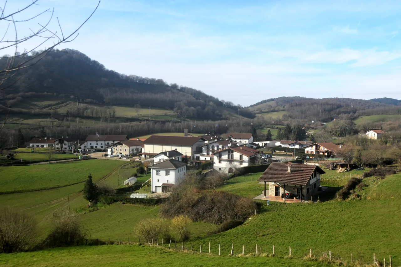
In the 1950s this place was called Murumbu. After Papua New Guinea's independence in 1975, it gradually reclaimed its older name: Mendi. The word names the river, the town, the valley, and the people who live in the surrounding country. Mendi sits at 1,675 meters above sea level on a gentle volcanic slope, population 56,108 as of 2021, making it the third-largest of Papua New Guinea's 41 cities. Temperatures run from 7 to 24 degrees Celsius, cold enough at night that the highlands around town occasionally take crop-damaging frosts. Coffee and garden vegetables are the main crops. Mount Giluwe, at 4,368 meters the second-highest peak in the country, dominates the skyline to the northeast.
A Valley Shaped by Stone and Water
The Mendi Valley is bounded on the west by a wall of limestone peaks that separate it from the Lai Valley beyond. Mount Giluwe rises to the northeast, an extinct shield volcano whose flanks still show glacial cirques from the last ice age - yes, glaciers, even this close to the equator, at altitudes where the air thinned enough. Two rivers run through town: the River Mendi and the Magani River, which combine and flow south toward the River Lai, eventually feeding the Purari system and, hundreds of kilometers later, the Gulf of Papua. The valley floor itself is a gentle slope, volcanic in origin, fertile enough to support the dense population - most of the Southern Highlands' half-million people live in country like this, gardening kaukau sweet potato and raising pigs.
Clans That Cross Mountains
Mendi residents live in clans whose relationships extend well beyond the town. The same names turn up in Kandep, Ialibu, Tambul, the Lai valley, and Kagua - marriage ties, trade partnerships, compensation networks that have held for generations. In the highlands, clan is not a nostalgic identity. It is the primary framework of land rights, obligation, and security. The word Mendi refers not just to the place but to the people, and the people do not stop at city limits. This is one of the reasons the Southern Highlands is so difficult to govern conventionally. Boundaries drawn on a map rarely match the social geography underneath, and the Highlands Highway's southern spur runs through country where every kilometer belongs to someone specific.
The Year 2000
In 2000, Mendi suffered major inter-tribal violence. Around 50 people were killed. Although the town has been relatively quiet since, tour operators still shun Mendi and the neighboring township of Tari, and the Southern Highlands retains a reputation for volatility that the rest of Papua New Guinea sometimes overstates but cannot dismiss. The government declared a State of Emergency for the province in 2006. Conflict here is usually a matter of land, pigs, or women - the traditional trio - but modern grievances have entered the pattern too: resource royalties that did not arrive, elections disputed, accusations that hardened into feuds. Between episodes, life goes on entirely normally. Markets open. Coffee gets picked. Children walk to school. But the adventurous traveler is the one who comes through.
Getting In, Getting Out
Air Niugini flies between Port Moresby and Mendi once a week - one flight, both ways. The Highlands Highway reaches Mendi on its southern spur, passing through Mount Hagen. From the highway a road system connects Mendi to Lae, Goroka, Madang, and Tari, though the quality of any given stretch depends on the weather and the year. Landslides close roads regularly. When the dirt road to Tari is open, a well-equipped four-wheel drive can make the 75-mile trip in a long, hard day. When it is not, people fly to Tari's airstrip separately, or do not go at all. The Mendi Travellers Inn sits in the center of town on Old Compound Road, advertising itself as international standard with direct access to the CBD. That is the Mendi way - modest, practical, running on the resources it has.
Lake Kutubu and the Huli Beyond
Drive southwest from Mendi and you descend into Lake Kutubu country, one of the most biologically significant lakes in Papua New Guinea. At 800 meters above sea level, Kutubu counts as lowland by Southern Highlands standards, though it is still high by most measures. Thirteen of the lake's fourteen native fish species occur nowhere else on Earth. The lake is reachable by road from Mendi or, thanks to oil extraction infrastructure, by direct flight from Port Moresby to Moro Airport. Drive west from Mendi toward Tari and you enter Huli country - the land of the Huli wigmen, whose young men spend months alone in the jungle developing skills and growing the long hair that will eventually become ornamental ceremonial wigs. Ambua Lodge near Tari, built in traditional Huli round-house style, offers birdwatching and access to some of the most traditional culture still visibly alive in Papua New Guinea. It also costs about 200 dollars a night.
What Independent Travel Looks Like
Mendi is not a tour-bus town. It never has been. The Wikivoyage entry for Mendi describes it frankly as a location for the independent, adventurous traveler. That framing matters. This is a place where you need a reason to be here - a research interest, a cultural connection, a willingness to sit with the slow rhythms of highlands life and accept that plans may rearrange themselves around weather, road closures, or the unpredictable choreography of clan obligations. In exchange, you get coffee that has grown at elevation on volcanic soil, views of a 4,368-meter mountain from town, and a valley that has held a recognizable human community since long before anyone outside it had a name for the place.
From the Air
Mendi sits at 6.15 degrees S, 143.66 degrees E, in the Mendi Valley of the Southern Highlands Province. Elevation 1,675 meters. Mendi Airport (AYMN / MDU) has an airstrip dating to 1950 and handles Air Niugini weekly flights from Port Moresby. Recommended viewing altitude 10,000-15,000 feet to see the valley framed by Mount Giluwe (4,368 m) to the northeast and the limestone ridge to the west. Tari Airport (AYTA) lies about 75 miles west. Mount Hagen (AYMH / HGU) is the nearest major airport, about 100 km northeast. Weather: afternoon thunderstorms and rapid cloud buildup routine; mornings offer clearer views. Approach and departure require careful attention to the surrounding terrain.
Nearby Stories
- Purari River 15 km away
- Kuk Swamp 21 km away
- Mount Hagen 24 km away
- Lake Kutubu 32 km away
- Highlands Highway 35 km away
- 2018 Papua New Guinea Earthquake 37 km away
- Great Papuan Plateau 63 km away
- Fly River 182 km away