Meroë
There are more pyramids at Meroë than in all of Egypt. Steeper, smaller, packed tightly together in a field above the middle Nile, they mark the tombs of the kings and queens of Kush from around 300 BC to 350 AD. In the first century BC, the Greek historian Diodorus Siculus had already heard the stories. In the fifth century BC, Herodotus described the city as a great city, said to be the mother city of the other Ethiopians. And in 61 AD, when the Emperor Nero sent a Praetorian reconnaissance party under a tribune and two centurions to probe the limits of the world, they reached Meroë, were given an escort, pushed on upstream until the swamps of the Sudd stopped them, and went no further. This was where Africa, from a Roman perspective, became impossible.
The Kushite Capital
The Kingdom of Kush spans nearly twelve hundred years, from about 800 BC to 350 AD. For most of its earliest phase, the main capital was farther north at Napata, in what is now northern Sudan. Around 591 BC, just after the Egyptian pharaoh Psamtik II sacked Napata, King Aspelta moved the Kushite capital south to Meroë. Historian Martin Meredith explains why: Meroë sat between the Fifth and Sixth Cataracts of the Nile, on the fringe of the summer rainfall belt, and the area was rich in iron ore and the hardwood needed to smelt it. The location also gave access to trade routes toward the Red Sea. The native name of the city was Medewi. By the reign of Arakamani around 280 BC, the royal burial ground too had moved south from the old pyramids at Nuri and Gebel Barkal, and for the next six and a half centuries Kushite monarchs were buried at Meroë.
The Birmingham of Africa
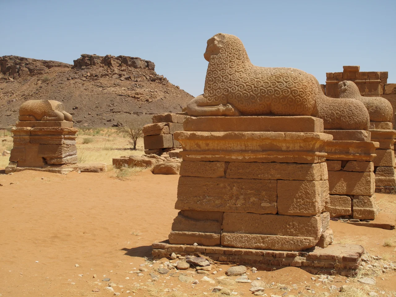
The British Egyptologist Archibald Sayce famously called Meroë the Birmingham of Africa for its iron production, an attribution modern scholars debate but never entirely abandon. Whatever the volume, iron mattered, alongside pottery fine and elaborately decorated, textiles woven from cotton (Nubian cotton-working peaked around 400 BC and may have been the finest in the world at the time), jewelry, gold (the Egyptian word for gold, nub, may have given Nubia its name), and trade in exotic animals from farther south. Meroitic culture layered southern African deities onto Egyptian ones. Apedemak, the lion-son of Sekhmet or Bast, was worshipped alongside Amun, Isis, Horus, Thoth, Tefnut, and Satis. And in the third century BC, the Meroites developed their own alphabet, with 23 letters, derived from Egyptian hieroglyphs but encoding a language whose family still cannot be definitively identified.
The Kandake
The king of Meroë was an absolute ruler who shared power with only one other person: his mother, called the Kandake. Queen Mother, Queen Dowager, regent, co-sovereign; the role's precise nature is still debated by historians, but she appears repeatedly in Meroitic inscriptions, alongside kings, buried in her own pyramids in the West Cemetery. The administration underneath them included treasurers, seal bearers, heads of archives, and chief scribes. At its peak, Meroë controlled the Nile Valley north to south for more than a thousand kilometers as the crow flies. The power was based not on territory but on people: labor determined production, and controlling labor mattered more than controlling land. It was a political model uniquely African and uniquely Meroitic, one Rome never fully understood.
The Fall
By 300 AD, archaeological evidence points to economic and political decline in Meroë. The external trade with other Nile Valley states that had sustained royal power was collapsing. Then in 350 AD, the kingdom of Axum, in what is now Ethiopia and Eritrea, destroyed the city. A Greek inscription commissioned by the Axumite king Ezana records his claims. Some historians read this as proof that Axum's forces ended the Kingdom of Kush; others point out that the kingdom had been weakening for decades. Either way, the pyramids fell silent. The iron furnaces cooled. The royal palace, whatever it was, was abandoned. And the Meroitic script, an alphabet whose language family may be Afro-Asiatic (like Egyptian) or Eastern Sudanic (like Nobiin), fell out of use, and has not been fully deciphered to this day.
The Pyramids Rediscovered
Meroë was brought back to European attention in 1821 by the French mineralogist Frédéric Cailliaud, who published an illustrated folio describing the ruins, including the southernmost Latin inscription then known. In 1834, the Italian Giuseppe Ferlini excavated (or more accurately, looted) several pyramids and sold the jewelry to museums in Berlin and Munich. He also, notoriously, dynamited the top of at least one pyramid trying to find treasure inside. Between 1905 and 1910, Sir Reginald Wingate, governor of Sudan, supervised a more scientific dig. The best temple reliefs were taken down stone by stone and divided between the British Museum and the museum at Khartoum. In 1910, John Garstang excavated the city itself on behalf of the University of Liverpool, uncovering a palace and several temples. Today the pyramids of Meroë are a UNESCO World Heritage Site, and a visitor who crosses the desert finds them standing almost alone, sharp-edged against the sky, the remains of an African kingdom that outlasted pharaonic Egypt and held the Roman Empire at arm's length.
From the Air
Meroë lies at 16.935°N, 33.751°E in Sudan, on the east bank of the Nile roughly 200 km northeast of Khartoum. Nearest major airport is Khartoum International (HSSS). The terrain is flat desert with the Nile valley cutting southwest to northeast; the pyramid field is visible from altitude as a dense cluster of steep-sided stone structures. Recommended cruising altitude 10,000-15,000 ft in clear weather. Check Sudan airspace advisories; civil aviation has been disrupted by ongoing conflict since 2023.
Nearby Stories
- Musawwarat es-Sufra 33 km away
- Ghaba 51 km away
- Naqa 78 km away
- Northern Sudan 193 km away
- Red Sea State 240 km away
- Kassala 250 km away
- Monastery in Ghazali 251 km away
- El-Gadarif 341 km away