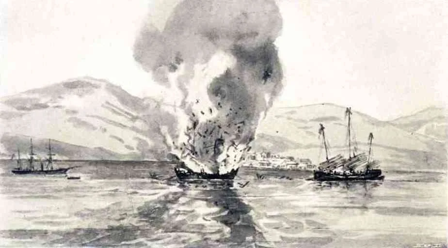

Mirs Bay
In the spring of 1898, an American naval squadron dropped anchor in Mirs Bay and waited. Commodore George Dewey — not yet an admiral, not yet famous — was preparing his fleet for what would become the decisive battle of Manila Bay in the Spanish-American War. He chose this bay, then a remote corner of British Hong Kong, as his refuge and repair station. Within weeks, he would sail for the Philippines and destroy the Spanish fleet in a single morning. Mirs Bay does not often make the history books, but it has a habit of being in the right place at the right moment.
A Bay Between Two Worlds
Look at a map of northeastern Hong Kong and Mirs Bay opens up like a parenthesis — roughly oval, bounded to the south by the Sai Kung Peninsula and Kat O, and to the north and east by the Shenzhen districts of Yantian and Dapeng. The bay is known by several names: Tai Pang Wan and Dapeng Wan in Chinese (both meaning roughly the same thing, referencing the Dapeng Peninsula on the bay's northeastern shore), and the older English name Mirs Bay, whose origin is murkier. The bay is large enough to contain multitudes — Tung Ping Chau (Ping Chau) stands near its eastern reach, and a cluster of smaller islands crowds its northwestern quarter: Double Island, Crescent Island, Crooked Island (Kat O), Grass Island, and Round Island. To the south, the bay's waters eventually merge with the South China Sea.
Pirates, Forts, and the Ming Frontier
Long before American warships arrived, Mirs Bay was contested water. During the Ming Dynasty, the coastlines of the South China Sea were plagued by piracy, and the bay's many inlets and islands provided natural cover for raiding parties. The Ming imperial response was fortification: Dapeng Fortress, built on the northeastern shore, was one of several military installations intended to project authority over the bay and protect coastal settlements. The fortress, which still partially survives on the Shenzhen side of the border, was garrisoned with soldiers whose families eventually formed the local population of the Dapeng area. The bay's geography — sheltered from ocean swells, studded with islands that could conceal a fleet — made it both valuable and difficult to police. Empires and pirates alike understood this.
Dewey's Waiting Room
The Spanish-American War of 1898 was fought across the Pacific, and Mirs Bay found itself briefly at its center. Commodore George Dewey had been ordered to the Far East in anticipation of hostilities with Spain, and when war was declared he needed a neutral harbour where his Asiatic Squadron could assemble and prepare without violating the restrictions that Britain imposed on belligerent warships in its ports. Mirs Bay, technically within Hong Kong waters but remote from Victoria Harbour's scrutiny, served the purpose. The ships gathered, repaired, and took on supplies. Then they left for Manila. The battle that followed, on May 1, 1898, lasted less than seven hours and destroyed the Spanish fleet entirely. Dewey was promoted to admiral. Mirs Bay returned to its usual quiet.
Controlled Waters
The 1949 establishment of the People's Republic of China transformed the bay's political geography overnight. The colonial government of Hong Kong moved quickly to regulate movement across its waters, and Mirs Bay became subject to strict controls. Under the Public Order Ordinance of 1949, all watercraft were prohibited from moving in the bay between 10 PM and 6 AM without written permission from the Hong Kong Police Force. The dividing line between Tolo Channel and Mirs Bay was formally drawn from Wong Chuk Kok Tsui to Ngo Keng Tsui. These measures reflected anxieties about illegal immigration and cross-border movement that would shape Hong Kong's relationship with the mainland for decades.
Islands and Inlets
Today Mirs Bay is most celebrated for what surrounds it. The islands of its northwestern cluster — Kat O, Ap Chau, and their neighbours — are part of the Hong Kong UNESCO Global Geopark. The bay's eastern anchor, Tung Ping Chau, is Hong Kong's most remote inhabited island and a geological anomaly: the only sizeable island in the territory made of sedimentary rather than volcanic rock. On the Hong Kong shore, the bay receives numerous inlets: Kat O Hoi, Hoi Ha Bay, Tai Tan Hoi, Starling Inlet, and Wong Chuk Kok Hoi, among others. Each inlet has its own ecology, its own small settlements, its own claims on the imagination. Mirs Bay holds all of them loosely, the way a large bay does — not claiming anything, just providing the water that makes everything else possible.
From the Air
Mirs Bay centres on approximately 22.57°N, 114.37°E, a broad oval of water visible from cruising altitude between Hong Kong's northeastern New Territories and the Shenzhen coast. From 5,000–8,000 feet, the bay's full extent is striking: the Sai Kung Peninsula forms its southern shore, while the Dapeng Peninsula curves across the northeast. Tung Ping Chau appears as a small kidney-shaped island at the bay's eastern margin. The cluster of northwestern islands — Kat O, Ap Chau, and neighbours — is visible near the bay's western edge. Primary airport: VHHH (Hong Kong International Airport), approximately 60 km to the southwest. Shenzhen Bao'an International (ZGSZ) lies across the bay to the north. The Tolo Channel leads southwest toward Tai Po and the urban New Territories.
Nearby Stories
- Basalt Island 7.1 km away
- Ngong Ping 360 7.5 km away
- China Southern Airlines Flight 3456 11 km away
- Huizhou (Guangdong) 27 km away
- Dongguan 27 km away
- Battle of Penghu 471 km away
- Penghu Air Raids 477 km away
- Checheng Fu'an Temple 593 km away