Montanhas de Teresópolis Municipal Nature Park
Three rocks rise from the forest like animals frozen in mid-motion - Tartaruga, the turtle, its domed back visible from kilometers away; Camelo, the camel, humped and patient; Santana, watchful. Below them, in the northwest corner of Teresópolis municipality, the Atlantic Forest is busy forgiving. Quarries that once gouged the hillsides are softening under new vegetation. Bird species that had almost vanished are returning. At 4,397 hectares, this is the largest fully-protected municipal conservation unit in the state of Rio de Janeiro - an imperfect park still writing its own recovery story.
A Park Born from Damage
When municipal decree 3.693 created this park on 6 June 2009, it did not create a pristine landscape - it created a rescue mission. For decades before protection arrived, the land had been mined for minerals, the forest thinned for timber, the waterways degraded. The founders understood this. The park's stated objectives read like a recovery prescription: preserve ecosystems of ecological importance, enable scientific research, permit gentle ecotourism and education. As of 2016, there was still no management plan. The work of restoration is the plan. The partnership with the Federal University of Rio de Janeiro, which supplies seedlings of native Atlantic Forest trees for the most damaged patches, is the plan. The relationship with surrounding communities, who have almost eliminated the trapping and hunting of birds, is the plan.
The Swiss Zoologist's Homestead
The Santa Rita center, where the park headquarters now stands, was founded in 1891 by Émil Goeldi - a Swiss zoologist whose name still attaches to one of Brazil's most important natural history museums, the Museu Paraense Emílio Goeldi in Belém. He chose these mountains for their climate, their biodiversity, their resemblance to the Alps of his homeland. A century later, in 1990, INCRA expropriated the property and turned it into a rural settlement of roughly 100 plots. Then in January 2011, disaster arrived - one of the deadliest landslide events in Brazilian history swept through the mountains of Rio de Janeiro, killing hundreds. The Santa Rita area was battered. By 2014, the headquarters had been rebuilt: administrative center, auditorium, library, space for exhibitions and permanent research. The 42 hectares were purchased outright by the municipality in late 2012, a quiet act of civic commitment to a place that had almost been lost twice.
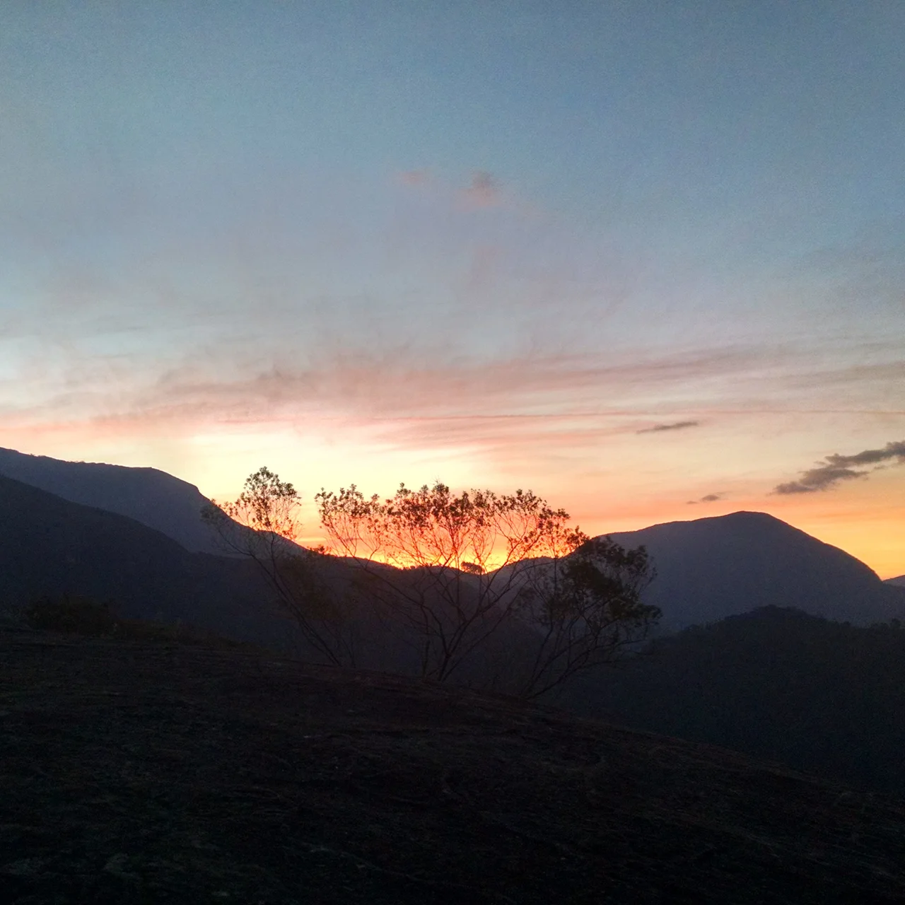
The Rocks and Their Climbers
The Pedra da Tartaruga center takes its name from Turtle Rock, the massive granite outcrop that, with Camelo and Arrieiro, forms the park's signature skyline. This is the accessible face of the park - easy trails, a camping area, clean water, toilets. Climbers come for the vertical walls. Hikers come for the views. Abseilers rig their ropes and drop. The honesty of the place is that it admits its pressures: motorcyclists tear up the trails, granite extractors still chip at the margins. Conservation is not a completed project here but a daily negotiation. The rocks themselves are older than any of it - the deep-time weathering that shaped them into a turtle, a camel, a silent watcher predates every human quarrel about how to love this landscape.
The Forest That Remembers
The Ponte Nova center, closed to the public, contains what a pre-disturbance Atlantic Forest looks like - tall, layered, rich with vines and epiphytes, bird-loud at dawn. Ecological surveys have catalogued 121 bird species within the park, 31 mammals including some that are endangered, 19 reptiles, 10 amphibians, eight distinct insect groups. Some organic farmers still work the Ponte Nova margins, but intensive agriculture presses in from São José do Vale do Rio Preto next door. The park adjoins Serra dos Órgãos National Park at the Caleme Dam, stitching together a corridor of protection through one of the most threatened forest biomes on Earth. The Atlantic Forest once covered 15 percent of Brazil; less than 12 percent of the original remains. Every hectare here is a small argument against disappearance.
Teaching the Next Watchers
The municipality's Alpine Farming School sends students into the park for environmental education projects - a partnership between the environment and education departments that treats the forest as both classroom and pupil. The kids learn about birds and seedlings, but the park also learns about itself through their eyes. Montanhas de Teresópolis was built on the assumption that recovery requires patience measured in generations, not election cycles. The quarries will close fully, the ipê trees will grow, the Coroado Puri names for these mountains will be studied in school, and Émil Goeldi's ghost will have company among the tree frogs of his adopted home.
From the Air
22.33°S, 43.02°W. The park sits in the Serra dos Órgãos mountain complex northwest of Rio de Janeiro, with rugged terrain rising above 2,000 meters. Recommended viewing altitude 3,500-5,500 m AGL to appreciate the ridge contours and the Tartaruga-Camelo rock formations. Nearest airports: SBGL (Rio de Janeiro/Galeão) 60 km south, SBJR (Jacarepaguá) 50 km southwest. Mountain-obscuration and sudden fog common in the late afternoon; prefer morning flights for visual clarity.
Nearby Stories
- Nova Friburgo 15 km away
- Rio de Janeiro 28 km away
- Juiz de Fora 53 km away
- Ibitipoca State Park 58 km away
- Desengano State Park 73 km away
- Military Academy of Agulhas Negras 89 km away
- Basilica of Our Lady of Aparecida 169 km away
- Grytviken 3551 km away