Desengano State Park
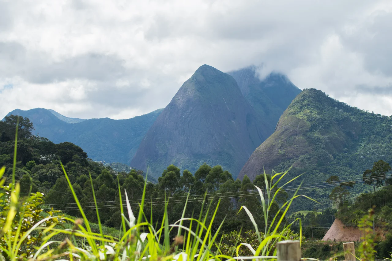
The word desengano in Portuguese means disillusionment - the moment of being stripped of a comforting false idea. It is a strange name for a mountain, and strange names often have stories. The mountain earned it, some accounts say, because its peak looked close from a distance but proved almost impossible to climb. The rugged range containing Pico do Desengano rises to 1,761 meters in the north of Rio de Janeiro state, and in 1970 it became the oldest conservation unit the state would ever create. Half a century later, its slopes of up to 75 degrees still protect the last continuous stretch of Atlantic Forest in this region.
The Terrain That Saved Itself
Desengano's scarps are nearly impossible to clear. Loggers need flat ground to fell trees safely and haul them out. Cattle ranchers want pasture that their animals can walk on. The 75-degree slopes that define this park are too steep for either. For centuries while surrounding lowlands were stripped bare for sugar and coffee, the Desengano massif kept its forest simply because nobody could easily take it. The park covers 21,444 hectares across three municipalities - Santa Maria Madalena, Sao Fidelis, and Campos dos Goytacazes - at elevations from 200 meters to the summit of Pico do Desengano itself. Additional peaks include Pico Sao Mateus at 1,576 meters and Pedra Agulha at 1,080 meters. The ridges stand out from the surrounding agricultural landscape like the rib cage of a buried animal.
A Tiered Forest
The vegetation climbs in layers. Dense submontane rainforest covers the lower slopes from 200 meters up. Montane rainforest takes over from around 500 meters and continues up. Above 1,600 meters the forest gives way to alpine meadows - high-altitude grasslands dotted with rocky outcrops and wind-pruned shrubs. Each zone holds its own community of species, and the transitions between them are where biologists find the rarest birds. Many watercourses rise inside the park, feeding the settlements below. The Vernec, Bonita, and Tromba d'Agua waterfalls pour off the ridges. The main rivers - the Rio Grande with its tributaries, the Colegio, the Imbe, and half a dozen smaller streams - eventually feed Lagoa de Cima (the Upper Lake) and from there the Ururai River flowing to Lagoa Feia, one of Brazil's largest lagoons.
Four Hundred Birds
About 410 bird species have been recorded in the Desengano region, which puts it in the first rank of neotropical biodiversity hotspots. The high-altitude meadows alone hold 283 species, of which 22 are endemic and exist in low numbers. Endangered birds you might see include the black-fronted piping guan, the solitary tinamou, the white-necked hawk, and the black-and-white hawk-eagle. Red-browed amazon parrots, once common across the Atlantic Forest, are now largely confined to protected areas like this one. Penelope guans, tinamous, bellbirds with their otherworldly metallic calls - the park is a refuge for species that would have vanished from the region entirely if not for the inaccessible terrain.
The Muriqui Returns
The big story in Desengano's research history happened in July 1999. A team observed a muriqui - the southern woolly spider monkey, Brazil's largest primate, one of the most endangered mammals on earth. Muriquis were thought to have vanished from this part of Rio de Janeiro state. Their unexpected presence in Desengano generated enormous scientific interest and a wave of investment in research and conservation programs. The park's mammal list is impressive on its own: maned sloth, cougar, coati, paca, howler monkeys, nine-banded armadillo, tayra, collared and white-lipped peccaries, titi and robust capuchin monkeys, brown four-eyed opossum, furao, and the crab-eating raccoon. Some of these species require unbroken forest to survive. Having them here in 2026 means the conservation model is working, if imperfectly.
Guarding What Remains
The park was created on April 13, 1970 by state decree-law 250. A 1983 state decree expanded the surrounding environmental protection area. Management falls to Inea, the Rio de Janeiro State Environmental Institute, whose rangers spend much of their time on patrols that catch hunters and illegal loggers. In June 2015 they seized 35 wild-caught birds and a shotgun in the town of Monte Cafe. In October of the same year they charged a landowner in Agulha do Imbe, part of Santa Maria Madalena municipality, with environmental crimes for illegal logging. These are small stories, the kind that do not make national news, but they are the grain of the actual work. Conservation in Brazil is rarely about grand designations. It is about the daily argument, at the edge of the forest, over who gets to use what the forest contains. Desengano's 75-degree slopes won one round against the chainsaws. The question is how long they can keep winning.
From the Air
Located at 21.87 degrees S, 41.90 degrees W in northern Rio de Janeiro state. Best viewed from 5,000 to 8,000 feet AGL to appreciate the dramatic relief - Pico do Desengano rises to 1,761 meters above surrounding lowlands at just 200 meters. The sugarloaf peaks and pointed summits resemble the profile of Serra dos Orgaos north of Rio de Janeiro city. The park sits about 250 km northeast of Rio de Janeiro city. Nearest airports are Campos dos Goytacazes (SBCP), about 40 nm southeast, and Macae (SBME), about 50 nm south. Afternoon orographic cloud buildups are common year-round - the alpine meadows above 1,600 meters often peek above the cloud tops.
Nearby Stories
- Leopoldina, Minas Gerais 15 km away
- Três Picos State Park 31 km away
- Macaé 34 km away
- Paraiba do Sul 49 km away
- Serra dos Órgãos 63 km away
- Muriaé 66 km away
- Guarapari 170 km away
- Roncador Field 685 km away