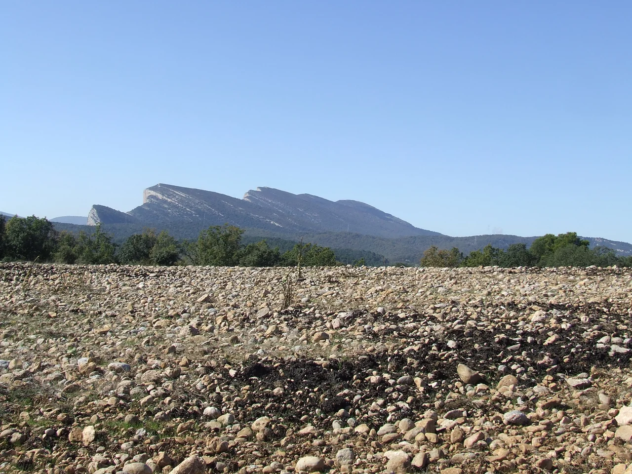

Montsec Range
From the plains of Lleida, the Montsec rises like a wall that someone built and then walked away from. Its southern face is almost sheer, a forty-kilometer rampart of pale limestone broken only by a distinct step about two-thirds of the way up. The name captures it exactly. Montsec comes from the Latin Montus sectus, the cut mountain, a reference to the sharp, sliced look of its rock. Stand at its foot near Ager and the peaks seem to seal off the sky; climb to the highest of them, Sant Alis at 1,675 meters, and the world opens in both directions, the plains of Lleida rolling south and the true Pyrenees stacking up to the north.
Three Massifs, Three Rivers
The Montsec is not one ridge but a chain of calcareous ranges running roughly east to west, and three of Catalonia's important rivers have carved it into three distinct blocks. The Segre and the Noguera Pallaresa cut off the eastern massif, the Montsec de Rubies; the Noguera Ribagorcana separates the western one, the Montsec d'Estall, which lies across the regional line in Aragon's province of Huesca; between them sits the central Montsec d'Ares. Where the rivers sawed through the limestone they left spectacular gorges, the congostos of Terradets and Mont-rebei, canyons opened by the combined patience of running water and the slow shove of tectonics. The whole range marks the southern edge of the Pallars country, straddling the border of Catalonia and Aragon. End to end it runs about forty kilometers and covers nearly 187 square kilometers of ridge and gorge.
A Cretaceous Sea Turned to Stone
To read the Montsec is to read deep geological time. Its rock began as sediment laid down thousands of meters thick on the floor of a Cretaceous sea, later partly drowned again beneath an Eocene sea, and finally heaved skyward by the folding that raised the Pyrenees. All that marine history left the mountain full of fossils. Remains from the Mesozoic era are relatively easy to find across the range, and at Vilanova de Meia the deposits rank among the most important in the world. The great wall you see from the plain is, in effect, an ancient seabed stood on end. Every stratum in that sliced face records an episode from a time when this dry, sun-baked country lay underwater.
A Frontier of Watchtowers
For centuries the Montsec was a strategic barrier, sheltered from the icy northern winds and commanding the plains below, and it mattered greatly during the long frontier wars of the Reconquista. In the 10th century, when the caliphate of Cordoba was at its height, Balaguer stood as the northernmost Arab city, and the castles of Castello de Farfanya, Algerri, and Os de Balaguer, linked by a chain of well-placed watchtowers, formed a line of defense along the southern flank of the mountain. In later centuries the range was, surprisingly, one of the most densely populated parts of Catalonia. That reversed in the 20th century. Today emigration has hollowed the highlands, and a number of its villages stand virtually abandoned, their houses waiting on empty streets. The land never made life easy. Irrigation is difficult across the range, so farming has always been sparse, a matter of some barley and almonds coaxed from thin soil, with hydroelectric power off the dammed rivers as one of the few other resources. The mountain is also riddled with caves, another lure for those who come to explore it.
The Darkest Skies
The same emptiness that drained the villages became the Montsec's modern gift. With little rain, little light pollution, and real altitude, the range offers some of the clearest night skies in Catalonia, and the Montsec Astronomical Park above Ager has made the most of them. In 2013 the mountain earned a rare dual Starlight certification, as both a reserve and a tourist destination, an accreditation endorsed by UNESCO and held by only a handful of places on Earth. By day the range draws kayakers to its reservoirs, hikers to its gorges, and gliders to the reliable air rising off that great southern wall. By night it draws people who simply want to see the stars the way most of the world no longer can, spread thick and undimmed above the cut mountain.
From the Air
The Montsec range runs east-west near 42.044 N, 0.766 E, forming a sharp limestone wall along the border of Lleida (Catalonia) and Huesca (Aragon) in the Pre-Pyrenees. From 6,000-8,000 feet the range is a standout landmark: a near-vertical southern face above the plains, the deep Mont-rebei and Terradets gorges slicing through it, and the Tremp basin dropping away to the north. The Ager valley and the Astronomical Park sit at its southern foot. Nearest airport is Lleida-Alguaire (LEDA) to the south; Reus (LERS) and Barcelona-El Prat (LEBL) lie further southeast. Expect mountain-wave and ridge turbulence in wind, and superb night visibility.
Nearby Stories
- Palauet de la muralla de Balaguer 8 km away
- Battle of Graus 9.4 km away
- Catalan Romanesque Churches of the Vall de Boi 17 km away
- Cardona 31 km away
- Cave of Saint Ignatius 38 km away
- Ordesa y Monte Perdido National Park 42 km away
- Mequinenza 52 km away
- Cave of Niaux 53 km away