Mount Rinjani National Park
Every year the park closes. From January through March, when the monsoon turns Lombok's highlands into a vertical river system, Mount Rinjani National Park shuts its trails and sends its trekkers home. The closure is not bureaucratic caution -- it is an acknowledgment that this landscape, for all its beauty, remains fundamentally hostile to human ambition. Rinjani is Indonesia's second-highest volcano, rising 3,726 meters above a small island in the Lesser Sundas. Its caldera holds a sacred lake. Its slopes shelter endangered species. And its geology sits atop the ruins of Mount Samalas, which in 1257 produced one of the most catastrophic eruptions in human history. The park protects all of this: the beauty, the danger, and the deep cultural meaning the Sasak people have woven into every ridge and crater.
Where Two Worlds Collide
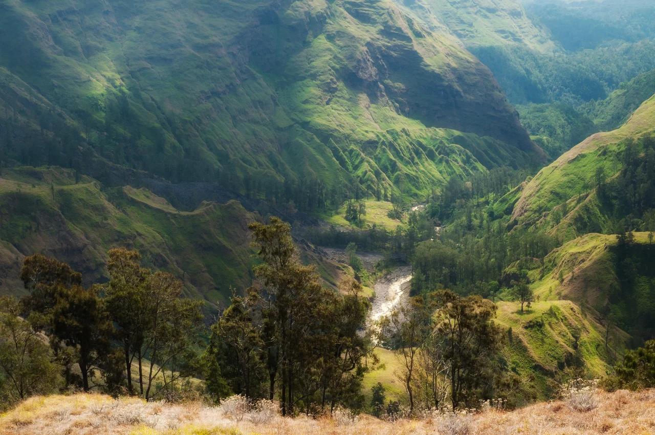
Mount Rinjani National Park covers approximately 41,330 hectares of mountainous terrain in the North Lombok Regency. The park sits on a biogeographical boundary -- the eastern edge of the Indomalayan realm, where Asian species begin yielding to Australasian ones. This transition zone, known as Wallacea, gives the park's forests an unusual character. Mahogany trees (Swietenia macrophylla) and towering fig species (Ficus superba) share the lower slopes with Toona sureni, a cedar relative whose aromatic timber once made it a target for loggers. Higher up, the canopy thins into stands of edelweiss-like Anaphalis and curtains of Usnea lichen that drape the branches in pale green. Wild orchids from the Vanda genus bloom in the forest gaps. The vegetation shifts dramatically with altitude, from tropical rainforest at the base to subalpine grassland near the summit -- a vertical journey through several climate zones compressed into a single morning's climb.
Creatures of the Crossroads
The park's wildlife reflects the same biogeographical mixing. Rusa deer browse the lower forests alongside Indian muntjac -- small, barking deer that startle trekkers on dawn approaches. Sunda porcupines forage through the undergrowth at night, their quills rattling against fallen branches. Surili monkeys, among the rarest primates in Indonesia, move through the mid-canopy in small family groups. The birdlife is equally distinctive: helmeted friarbirds call from the upper branches, several species of cockatoo flash white against the green canopy, and the scaly-crowned honeyeater -- a species with an extremely limited range -- feeds on nectar in the flowering trees of the lower slopes. Many of these species exist on the knife-edge between Asian and Australian faunal zones, making the park not just a refuge but a living laboratory for understanding how species distribute themselves across island archipelagos.
The Sasak Heartland
For the Sasak people, who make up the majority of Lombok's population, Rinjani is not a park. It is a sacred realm. The mountain is believed to be the home of Dewi Anjani, the Queen of the Spirits, a guardian figure whose legend has been transmitted through oral tradition for centuries. The primary trekking gateway at Senaru connects to the village of Bayan, one of the oldest traditional Sasak settlements and the site of the historic Bayan Beleq Mosque. Sasak Wetu Telu communities -- adherents of a syncretic faith that blends Islam with animist and Hindu elements -- regard the caldera lake, Segara Anak, as the spiritual heart of the island. The annual Mulang Pekelem ceremony brings pilgrims to the lakeshore, where they submerge offerings of precious metals into the water. The ritual is a contract with the mountain: gratitude for its fertility, respect for its power, and a request that the balance between the human and natural worlds endure.
The Trek to the Rim
Two main routes lead into the caldera. The Senaru trail, approaching from the northwest, is the classic path to the crater rim, where trekkers first glimpse the blue sweep of Segara Anak some 600 meters below. The Sembalun route, beginning from a highland valley to the northeast, is the primary approach for those attempting the summit -- a pre-dawn push through scree and volcanic gravel to reach Rinjani's 3,726-meter peak before clouds obscure the view. Most treks take two or three days. The reward at sunrise is panoramic: Bali's Mount Agung to the west, Sumbawa's peaks to the east, and the Java Sea glinting on the northern horizon. Below, the caldera unfolds in improbable scale -- the crescent lake, the steaming cone of Gunung Barujari, the vertical walls of rock that record 800 years of geological violence. The park that protects this view covers less than half a percent of Indonesia's total land area, but it contains a disproportionate share of the country's volcanic drama and cultural memory.
From the Air
Mount Rinjani dominates northern Lombok at approximately 8.41S, 116.42E, rising to 3,726 meters (12,224 feet). From the air, the volcanic complex is unmistakable: a massive dark peak with a gaping caldera on its western face containing the vivid blue crescent of Segara Anak lake. The smaller cone of Gunung Barujari is visible within the caldera. Lombok International Airport (WADL) is roughly 70 km south of the summit. Bali's Ngurah Rai International Airport (WADD) lies across the Lombok Strait to the west. In clear conditions, Mount Agung on Bali and the peaks of Sumbawa to the east are visible from cruising altitude.
Nearby Stories
- Lombok 25 km away
- The Invisible Frontier: Where Asia Ends and Australia Begins 26 km away
- Nusa Penida: Bandit Island Turned Bali's Last Refuge 55 km away
- The Island Diana Chose 56 km away
- Eight Patrols and a Midnight Torpedo 66 km away
- Forty-Five Men and Thirty-Six Depth Charges 73 km away
- The Island That Shook the World 100 km away
- Isuzu: The Cruiser That Refused to Sink 129 km away