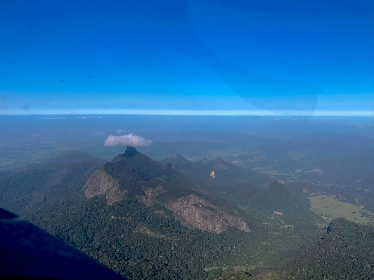

Mount Warning
Long before any European saw it, this peak had a name and a Law. The Bundjalung people call it Wollumbin - cloud-catcher, weather-maker, the chief of the mountains - and to them it is one of the most sacred places in their Country. When Lieutenant James Cook sailed past in May 1770 and saw the same craggy summit, he read it differently: as a hazard. He named it Mount Warning, a marker to alert seafarers to the treacherous reefs at nearby Point Danger. The two names sit on the one mountain still, and they tell two very different stories about the same 1,157 metres of rock.
The Heart of a Volcano
Wollumbin is not a mountain in the ordinary sense - it is the solidified throat of an extinct volcano. Around 23 million years ago, the Tweed Volcano erupted here as eastern Australia drifted over a hotspot deep in the mantle. What you see today is its central plug: lava that cooled and hardened inside the volcano's core, far harder than the layers around it. Over the millions of years since, rain and rivers stripped away the softer slopes, leaving this stubborn remnant standing alone at the centre of an enormous eroded basin. The summit is composed of tough volcanic rock that resisted what the rest could not. Stand anywhere in the Tweed Valley and the peak draws the eye - a steep, fluted pinnacle of the deepest green, catching cloud around its head exactly as its Bundjalung name describes.
A Place of Lore
For the Bundjalung Nation, Wollumbin is woven into the Dreaming - a site tied to traditional Law, ceremony, and ancestral story. It is not simply a scenic place; it is a place of power, and access to it is governed by cultural rules that long predate any park boundary. Under Bundjalung Lore, the summit is a restricted area where, by tradition, only certain initiated people are permitted to go. That principle has guided the mountain's care for thousands of generations. In 2014, the summit was formally recognised as an Aboriginal Place under New South Wales law, acknowledging in the modern legal system what the Bundjalung have always understood: that this is sacred ground, and that the wishes of its traditional custodians come first.
First Light, and a Sailor's Warning
There is a popular claim, repeated across the Tweed, that Wollumbin is the first place on mainland Australia to catch the sunrise. It is more poetry than precise geography - the timing only holds around the equinoxes, and the continent's true easternmost point lies down the coast at Cape Byron - but the image endures because it feels right for such a commanding peak. Cook's name carries its own logic. Sailing north along an unfamiliar coast, his crew aboard the Endeavour found themselves among hidden reefs, and he used the unmistakable mountain as a navigational warning for those who would follow. Two ways of seeing the same summit: a place where the day begins, and a beacon marking where the sea turns dangerous.
World Heritage Wilderness
The mountain anchors the Gondwana Rainforests of Australia, a World Heritage area that protects some of the oldest surviving rainforest lineages on Earth - living descendants of the forests that cloaked the ancient supercontinent of Gondwana. The slopes climb through subtropical jungle into cool, misty highland forest, home to creatures found almost nowhere else. The richness here is no accident: it grew from the volcano itself, whose deep basalt soils and dramatic terrain created a sanctuary of niches and microclimates. To look at Wollumbin is to read deep time and living culture at once - a fragment of fire turned to stone, holding both the memory of an eruption and the Lore of the people who have always called it home.
From the Air
Wollumbin / Mount Warning stands at roughly 28.40 degrees south, 153.27 degrees east, in the Tweed Valley of far northern New South Wales, its summit reaching 1,157 metres. From the air it is one of the most distinctive landforms on the east coast: a sharp, isolated peak of dark green rising from the floor of a vast circular basin - the eroded caldera of the Tweed Volcano - ringed by the McPherson and Tweed ranges along the New South Wales-Queensland border. The town of Murwillumbah sits a short distance to the northeast, with the Pacific coast and Point Danger beyond. The nearest field is Gold Coast Airport (ICAO YBCG), about 47 km north; Ballina Byron Gateway Airport (ICAO YBNA) lies to the south. Mountain weather forms quickly around the summit - cloud frequently caps the peak even on clear days, true to its name. View only from a respectful distance: this is a sacred Bundjalung site and its summit is closed to access.
Nearby Stories
- Cape Byron Marine Park 5.5 km away
- Spicers Gap Road 17 km away
- The Channon 18 km away
- Glow-Worm Caves Tamborine Mountain 23 km away
- Cape Byron 27 km away
- Allan Cunningham Monument 42 km away
- Bald Rock National Park 56 km away
- HMS Porpoise (1799) 682 km away