Napo moist forests
Consider a patch of forest one hundred meters on each side, the size of two American football fields. In the Napo moist forests of western Amazonia, that single hectare contains more than 310 different tree species. For comparison, the entire contiguous United States holds roughly 700 native tree species. Now scale up. The Yasuni Biosphere Reserve, a portion of this ecoregion in Ecuador, contains around 4,000 plant species, at least 70 species of mammals, more than 500 species of birds, and over 400 species of fish in its rivers. There are places on Earth more famous for biodiversity. There is no place more biodiverse than this one.
Where the Andes Surrender
The Napo moist forests span 25 million hectares across Colombia, Ecuador, and Peru, wrapping around the base of the Andes where the mountains finally exhaust themselves into floodplain. To the west, the Cordillera Oriental montane forests climb the slopes of the range. To the south the Ucayali moist forests begin. To the east, the region transitions into the Caqueta and Solimoes-Japura moist forests. The Napo itself is named for the river that drains the region, a major tributary of the Amazon that rises on the flanks of Cotopaxi volcano and flows 1,075 kilometers before joining the main river near Iquitos. Elevation drops gently from about 600 meters at the Andean foothills to 100 meters in the eastern lowlands - a gradual grade across hundreds of kilometers of forest floor.
The Physics of Profusion
Rainfall in the western Napo exceeds 4,000 millimeters per year. Even in the drier east the total remains above 3,000 millimeters. Temperatures hover near 26 degrees Celsius year-round. The soil, layered from ancient Guiana Shield material mixed with younger Andean sediments, supports both towering emergent trees and a dense understory of saplings, lianas, and epiphytes. River meanders in the Santa Cecilia region of northwest Ecuador have shifted repeatedly over geological time, creating physical barriers that split populations into isolated pockets where new species evolved. Below 300 meters of elevation in the Ecuadorian Napo, botanists have catalogued 138 species of orchid alone. The extraordinary biological density of these forests is not luck. It is the predictable result of high rainfall, stable warmth, diverse terrain, and the evolutionary time that rivers and climate shifts have given species to diverge.
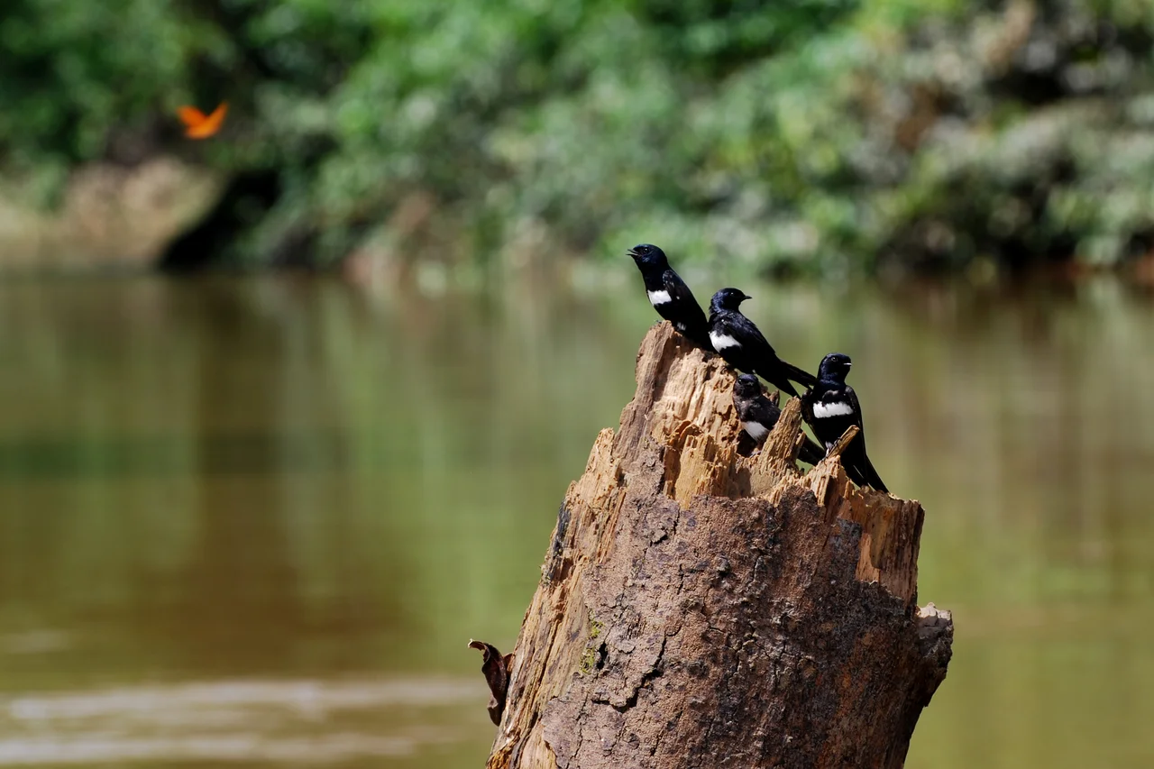
Everything That Moves
The Yasuni Biosphere Reserve, at the heart of this ecoregion, is one of the best-documented examples. Among its mammals are thirteen species of primates - silvery woolly monkeys, Venezuelan red howlers, white-bellied spider monkeys, monk sakis - swinging through the high canopy. Jaguars prowl below, the largest cat in the Americas. South American tapirs leave the muddy tracks that hunters have been reading for millennia. White-lipped peccaries move in herds that can run into the hundreds. Amazon river dolphins surface in the Napo and its tributaries alongside tucuxi, their smaller gray cousins. Giant otters, reaching nearly two meters in length, fish in cooperative family groups. Above it all, the spectral bat, with a wingspan near a meter, glides through the night - the largest bat species in the New World. Endangered species fill the list: mountain tapir, giant otter, white-bellied spider monkey, wattled curassow, Johnson's horned treefrog.
The Price of Oil
Ecuador's Amazon holds significant petroleum reserves. In the 1960s, Texaco began extracting oil from the Oriente, and in the decades since, roads built to service oil wells have served as arteries of deforestation. Where the roads go, colonists follow. Where colonists settle, forest becomes cattle pasture or cropland. The World Wildlife Fund rates the Napo moist forests as Critical/Endangered. Studies in Yasuni have shown that wherever oil company roads are not policed, they become conduits for colonization. Where access is restricted, the forest remains, but the wildlife near settlements collapses under hunting pressure. The Huaorani, who have lived in these forests for centuries, face their own dilemma: market integration brings schools, healthcare, cash for goods - and also brings pressure to farm more land, hunt more commercially, cede more of what was communal to what is individual.
Those Who Have Chosen Silence
Yasuni National Park was established in 1979 and designated a UNESCO Biosphere Reserve in 1989, joined with the surrounding Waorani Ethnic Reserve to form a protected landscape of 2.8 million hectares. Within its boundaries live the Tagaeri and Taromenane, clans of the Huaorani who have chosen not to contact the outside world. They hunt with blowguns and spears, move camps seasonally, and have killed oil workers and loggers who entered their territory. Their choice to remain apart is a statement. The oil under their forest, some of it in the disputed ITT block, was the subject of a 2013 Ecuadorian referendum that ultimately permitted extraction in part of the park. Activists and indigenous leaders continue to fight it. The ecoregion remains one of the richest biological hotspots on the planet and one of the most threatened. What happens in the Napo in the next decade will shape what remains.
From the Air
Located at 2.50 degrees S, 74.95 degrees W, centered on the western Amazon basin. The ecoregion sprawls across the Peru-Ecuador-Colombia borderlands. Nearest airports include Francisco de Orellana Airport (SECO) at Coca, Ecuador, and Iquitos Airport (SPQT) in Peru. From cruising altitude the region presents as a uniform green carpet braided by rivers - the Napo, Putumayo, Morona, Pastaza, Tigre, and Curaray among them. Weather is typically humid with frequent convective storms building in the afternoons.
Nearby Stories
- Department of Loreto 134 km away
- Yasuni-ITT Initiative 139 km away
- Nuevo Rocafuerte 155 km away
- Iquitos 194 km away
- Yasuní National Park 206 km away
- 2021 Northern Peru Earthquake 233 km away
- La Macarena 503 km away