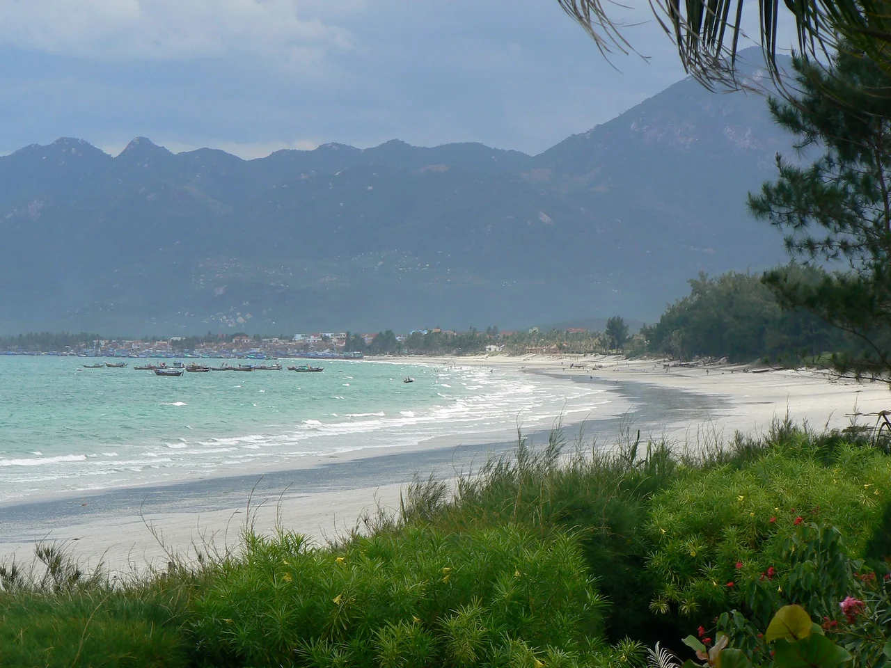

Nha Trang
After the Vietnam War ended, the Soviet military expanded its presence at Cam Ranh Bay, just south of Nha Trang. When those officers retired, a surprising number of them stayed. They opened guest houses and restaurants, married locally, and brought relatives from home. For years, signs in Russian outnumbered signs in English in the main tourist district of Nha Trang — a detail so specific to this particular coastal city that no other story would open quite this way. That Russian thread is just one strand in the improbable weave of this place: a bay that the Cham developed over a thousand years ago, that the French turned into a resort, that American soldiers chose for rest and recreation, and that Vietnamese families pack to capacity every summer weekend.
The Bay Before the Beach Hotels
Traces of Cham settlement in the area around Nha Trang predate the Vietnamese presence by centuries. The most visible remnant is the Po Nagar Cham Tower complex, four brick towers on a granite outcropping overlooking the Cai River, built between the 7th and 12th centuries and dedicated to the goddess Yan Po Nagar, mother of the Cham kingdom. The towers still function as a place of worship — Vietnamese women make offerings there today, the religious continuity outlasting the political change of hands. When Vietnamese rule replaced Cham authority along this coast, Nha Trang remained small fishing villages for a long time. It was the French who saw what the bay could become: a perfect crescent of white sand, blue water, and offshore islands, sheltered enough for bathing and beautiful enough to justify building a resort town around. The transformation accelerated during the 20th century and has not stopped since.
Islands and the Business of Going Under
A string of islands sits just offshore from Nha Trang, close enough to reach by day-trip boat and varied enough to sustain the country's most concentrated dive industry. About two dozen dive shops operate in the city, creating fierce competition that has kept prices accessible and quality reasonably high. PADI open-water certification courses are widely available; a two-dive boat trip with equipment runs cheaply by international standards. The underwater picture is more honest than promotional: coastal construction has stirred up sediment that reduces visibility, and the area is heavily fished. You would not make a special journey from abroad just to dive Nha Trang. But for someone already in central Vietnam and curious about what lies beneath the surface, the infrastructure is good and the divemasters — mostly local men with years of stories — make the experience worth having. The dive-boat ecosystem is characteristically Vietnamese: a group from shop A might share a boat with divemasters from shop B and an independently owned vessel, the whole arrangement negotiated freshly each morning.
How the Vietnamese Use a Beach Town
Foreign tourists are visible in Nha Trang, but the city's real rhythm is set by Vietnamese visitors, who come in enormous numbers and operate on their own schedule. The beach is busiest in the early morning and late afternoon, when the sun is tolerable — the middle of the day belongs to naps and air conditioning. Vinpearl Land, an amusement and water park on Hon Tre Island reached by cable car across the bay, is sometimes called Vietnam's Disneyland; it draws Vietnamese families by the thousands and has essentially nothing to do with the fishing village history of the place. Mud baths are another distinctly local enthusiasm — the area has thermal mineral springs, and bathing in the warm volcanic mud is held to have therapeutic properties. The Nha Trang that exists for foreign travelers and the Nha Trang that exists for domestic tourists overlap geographically but operate in largely parallel universes.
What the City Eats
Banh Can is Nha Trang's signature street food: small rice cakes cooked in a specialized clay mold and mixed with egg, meat, or seafood, served six at a time. Around the Central Market, the narrow side streets function as a continuous open-air canteen — Banh Hoi, snail soup, spring rolls, Pho, all available from stalls that have operated in more or less the same locations for generations. The local seafood is exceptional, drawn from waters that have sustained fishing communities here for centuries. The beach promenade, Tran Phu avenue, is lined with restaurants of every price point; the further you walk from the main tourist concentration, the more the clientele shifts from international visitors to Vietnamese families eating the same food at half the price. Coffee is serious here, as it is throughout Vietnam, filtered slowly through individual metal drippers into glasses heavy with sweetened condensed milk.
North of Town, Where the Coast Gets Better
About 50 kilometers north of Nha Trang, a stretch of coastline that most visitors never reach contains some of the finest beaches in Vietnam — wider, less developed, with clearer water and gentler gradients than the city beach. Doc Let Beach and Jungle Beach are the main destinations, connected by an inland road that avoids the busy highway. Getting there requires a motorbike or a long, infrequent bus ride, which is precisely why the beaches remain uncrowded. This is the pattern along the central Vietnamese coast: the famous places are full, the places just beyond them are empty, and the difference is often a single road junction that most people don't bother to turn onto. Nha Trang is the base from which to reach them — lively enough to be interesting, well-connected enough to move on from easily.
From the Air
Nha Trang sits at 12.245°N, 109.192°E along the south-central Vietnamese coast. The bay is one of the most visually striking from altitude in Southeast Asia — a broad crescent of pale sand, deep blue water, and a cluster of offshore islands clearly visible in good visibility. The Cai River mouth marks the northern edge of the main beach; the old airport site defines the southern tourist district. Cam Ranh Bay, a strategically important deep-water anchorage, lies approximately 30 km south and is clearly distinct from Nha Trang Bay. Recommended viewing altitude 3,000–6,000 feet. Cam Ranh International Airport (VVCR) serves Nha Trang, approximately 30 km south of the city center.
Nearby Stories
- Cam Ranh 5.1 km away
- Linh Phước Temple 15 km away
- Đà Lạt Plateau 25 km away
- Chư Yang Sin National Park 49 km away
- Vũng Rô Bay 52 km away
- South-East Asian Theatre of World War II 220 km away
- Kashmir Princess 361 km away
- Battle of the Paracel Islands 494 km away