
Nichoria
The tablets say its name plainly — TI-MI-TO A-KO — scratched in Linear B clay by scribes at the great palace of Pylos sometime in the late thirteenth century BC. Nichoria was already old by then, already an outpost of empire on its limestone ridge above the Messenian Gulf, already trading olive oil and terebinth resin beyond the horizon. When Pylos burned around 1180 BC, Nichoria burned with it. But here is the thing the ruins reveal that the tablets could not: Nichoria came back.
Province of an Empire
In the heyday of Mycenaean civilization, Nichoria sat at the northwestern corner of the Messenian Gulf as a productive node in Pylos's 'Trans-Aigolaia' province. At its peak extent — roughly five hectares during the Late Helladic IIIA:2 period — the settlement operated its own megaron, the great rectangular hall-and-hearth structure that served as the center of Mycenaean authority. It was smaller than the megaron at Pylos but unmistakably the same design, the same ambition. According to scholar Thomas Palaima, Nichoria appears on ten administrative tablets from Pylos touching on bronze working, regional taxation, weapons production, coastal defense, gold, livestock, and flax — and as much as ten percent of its surrounding land may have been devoted to olive cultivation. It was a place of real economic weight: not a capital, but a town that kept the empire fed, armed, and organized.
The Tholos and Its Dead
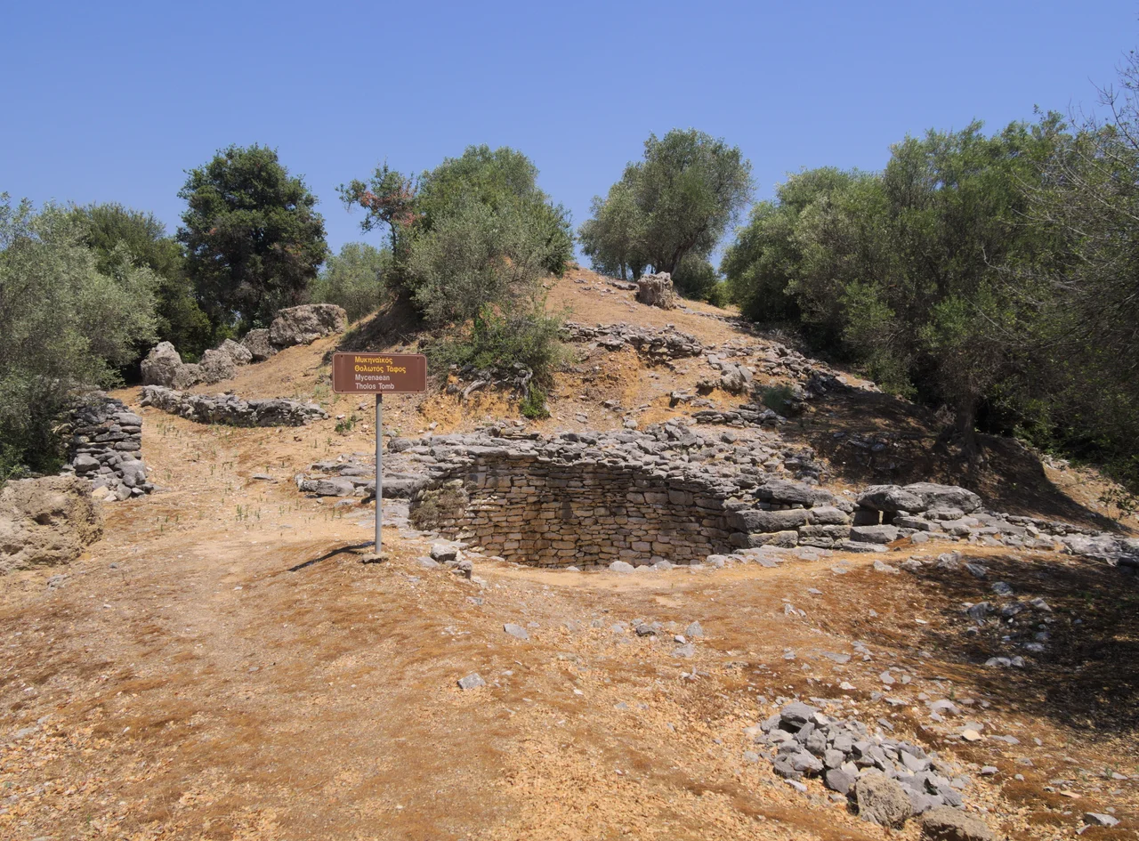
At the foot of the Nichoria acropolis, excavators found a burial circle holding the collective remains of seven people, used through the Late Helladic IIIA period. Beside it stood a tholos tomb — the beehive-shaped chamber tomb associated throughout the Mycenaean world with high status. Though looted in antiquity, it still yielded significant finds: pottery, carved sealing gems of semi-precious stone, small objects of gold, ivory, and faience. Between two of its four interior pits, excavators uncovered a cache of bronze vessels and tools, including a bent sword with an ivory handle. The tomb occupied a deliberate position at the northwestern end of the acropolis, visible from a distance, speaking authority in the language all Mycenaean communities understood. Its use spanned Nichoria's prime, roughly 1400 to 1200 BC, though later Classical and Hellenistic-period activity at the site suggests people returned to honor ancestors here long after the Bronze Age had collapsed.
Surviving the Dark
The civilization that built Nichoria disappeared in the catastrophe archaeologists call the Late Bronze Age collapse — a wave of destructions across the eastern Mediterranean whose causes remain debated. Pylos burned. The palace system ended. Writing vanished. What did not entirely vanish was Nichoria itself. Excavations in the area of Karpophora, where the main settlement street and residential buildings lay, revealed an apsidal megaron — an elongated hall with a rounded end — from the Sub-Mycenaean period, the centuries immediately after the collapse. It measured 13.6 meters long and 8 meters wide, accompanied by a circular paved structure whose purpose may have been ritual. This is one of the largest known buildings from the Greek Dark Ages in all of Greece. Two more megaron-type structures belong to the Mycenaean peak periods. The necropolis surrounding the acropolis holds tombs spanning the fifteenth to the eighth century BC — an archaeological record of continuous, if diminished, human presence across a gap in history when the rest of the Aegean world went largely silent.
What the Excavators Found
The University of Minnesota Messenia Expedition, led by William Andrew McDonald, surveyed the area in the 1960s and began formal excavations at Nichoria in 1969. The project became foundational to scholarship on both Mycenaean provincial life and the Dark Ages that followed. The ridge above Rizomylos yielded layers of occupation that no single dramatic narrative could capture — instead a long accumulation of everyday life, administrative obligation, death, and resilience. The site itself is modest in appearance now, a rural hilltop above the Gulf. But the acropolis and the necropolis together stretch across centuries, from the Middle Bronze Age to the Hellenistic period, making Nichoria one of the few places in Greece where you can trace, in the soil, the full arc of Bronze Age rise, collapse, and slow, stubborn recovery.
From the Air
Nichoria sits at approximately 37.002°N, 21.914°E on a ridgetop near the village of Rizomylos, at the northwestern corner of the Messenian Gulf. From the air at 2,000–4,000 feet, the ridge is visible above the coastal plain, with the blue-green waters of the gulf to the southeast. The nearest airport is Kalamata International (LGKL), approximately 25 km to the northeast. Approach from the northeast along the gulf shoreline for the best perspective on the ridge's elevated position relative to the agricultural lowlands below.
Nearby Stories
- Las (Greece) 1.3 km away
- Karyes 3 km away
- Psari, Messenia 10 km away
- Diocese of Amyclae 11 km away
- 2023 Messenia Migrant Boat Disaster 20 km away
- Kalamakia Cave Site 36 km away
- Agios Andreas, Katakolo 46 km away
- El-Kouf National Park 445 km away