.jpg)
North Devon Coast
Sixty-six years ago, in September 1959, a working group at the National Parks Commission drew a line on a map and made the North Devon Coast the first Area of Outstanding Natural Beauty in Devon. The line followed cliffs and burrows from Combe Martin near the Exmoor border, looped around the mouth of the Taw and Torridge estuary, and finally hooked west and south along the Hartland promontory to Marsland Mouth on the Cornish border. Inside that line sit 171 square kilometres of some of the most varied coastline in Britain. A planner in 1959 was nervous about a proposed holiday camp at Watermouth. That was the only public objection.
A Coast in Two Directions
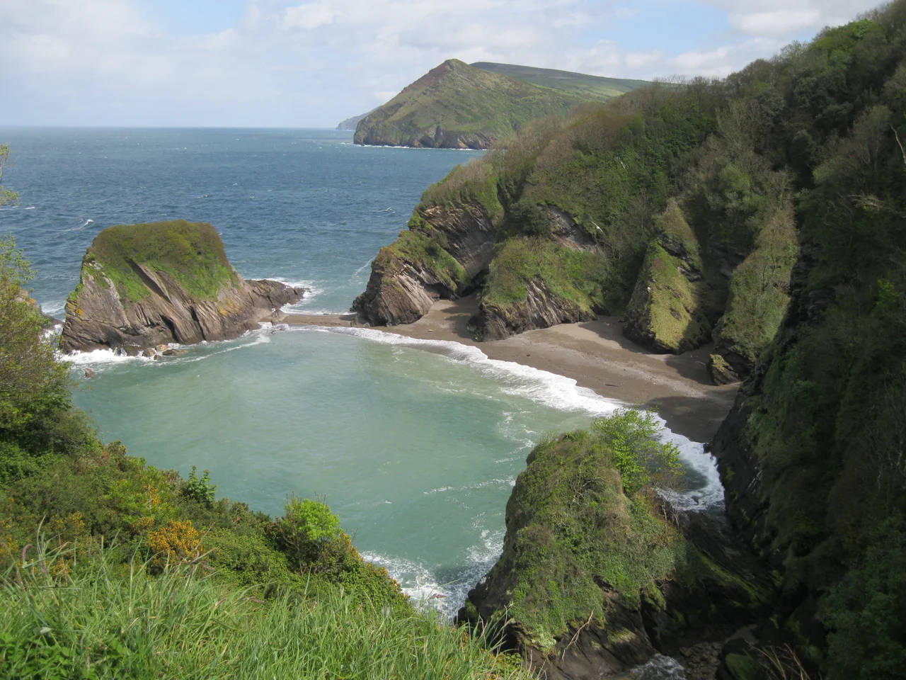
The geography here does something unusual. From Combe Martin to Hartland Point, the cliffs face north into the Bristol Channel - a broad sheltered arm of sea between England and Wales. At Hartland Point, the coast pivots ninety degrees and runs south, now facing west into open Atlantic. The two coasts feel different. The north-facing stretch carries Victorian resort architecture, lush wooded combes, and the gentler beaches at Woolacombe and Croyde. The west-facing stretch is wilder: dense shale cliffs in tilted layers, few roads, and surf that never really stops. Between them, where the Taw and Torridge estuaries meet the sea, sits a wide flat shelf of sandbanks and salt marsh.
Braunton Burrows
At the centre of the AONB sits one of the largest sand-dune systems in Britain. Braunton Burrows runs along the back of Saunton Sands, mile after mile of shifting hills bound together by marram grass. In 2002, UNESCO re-designated Braunton Burrows as the core area of North Devon's Biosphere Reserve - the first "new style" UK biosphere under the revised Man and the Biosphere Programme. The whole of the AONB falls inside the larger Biosphere boundary. The dunes are home to orchids, butterflies, and a long, surprising military history: American troops practiced D-Day landings here in 1944, and concrete bunkers from those rehearsals still appear among the marram.
Eleven Landscapes
When Natural England and Devon County Council studied the AONB in 2006 and 2007, they divided it into eleven distinct landscape character types. The list reads like a taxonomy of the British shore. Open coastal plateaux of dense elm hedges between Bude and Ilfracombe. Farmed lowland moorland inland from Hartland Point, flat and thinly populated, with conifer plantations standing in tidy blocks. Scarp slopes - narrow steep valleys, dense broadleaf woodland, sparsely settled stone hamlets. Settled coastal slopes and combes around Ilfracombe and Clovelly, with their Victorian resort terraces stacked above the water. Steep open slopes between Morte Point and Braunton, looking out over surf beaches. Valley floors at Braunton, where the medieval open-field strip system still survives in Braunton Great Field - one of the last working examples in England.
Where People Live
About 12,000 people live within the AONB. Combe Martin and Hartland are the largest places inside the boundary. Clovelly, Berrynarbor, and Croyde - all picturesque, all small - sit further along the coast. The bigger towns of Ilfracombe, Bideford, and Braunton fall just outside the line but function as gateways. The economy runs on agriculture and tourism, in shifting proportions across the year. In high summer, Croyde and Saunton Sands fill with surfboards and ice cream queues. In winter, the same beaches empty out completely, and the wind off the Atlantic gets the place to itself. Clovelly stays cobbled and cliff-clinging, its single high street running straight down to the harbour at impossible gradients.
Wildlife and Time
The AONB is a patchwork of habitats. Culm grasslands around Hartland - a wet, acid grassland community unique to the southwest. Coastal woodlands near Clovelly. Heathlands around Morte Point. The orchids of Braunton Burrows, the bluebells of the coastal combes, the seabirds threading along the cliff faces. The historic record runs as deep: prehistoric earthworks, medieval field systems, the abandoned manganese mines at Combe Martin, the lighthouse at Hartland Point that ran from 1874 to 2012. The North Devon AONB Partnership, set up in 2004, manages the area now in close coordination with the Biosphere. The point of the designation has not changed since 1959: keep this stretch of coast looking like itself.
From the Air
The North Devon Coast AONB stretches from 51.20 N (Combe Martin) southwest to 50.95 N (Marsland Mouth), with Hartland Point at 51.02 N, 4.53 W marking the major coastal pivot. Best flown at 2,000 to 3,000 feet to take in the contrast between Bristol Channel and Atlantic coastlines, with Lundy Island visible 10 nm northwest of Hartland Point. Watch for strong onshore winds and rapid cloud build-up off the Atlantic. Nearest aerodromes: Eaglescott (Devon), Dunkeswell, Newquay (EGHQ), with Haverfordwest (EGFE) and Swansea (EGFH) across the Channel.
Nearby Stories
- HMHS Glenart Castle 11 km away
- Castle Drogo 12 km away
- Exmoor 13 km away
- North Cornwall Railway 14 km away
- Mumbles Lifeboat Disaster 21 km away
- Horton and Port Eynon Lifeboat Station 28 km away
- Padstow Lifeboat Station 29 km away
- Castlemartin Training Area 34 km away