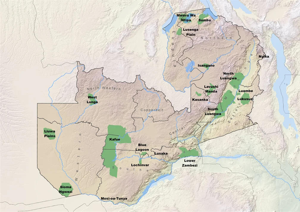
North Luangwa National Park
You walk here. That is the essential fact about North Luangwa. This is not a park for open-sided Land Rovers cruising a well-graded loop at forty kilometers an hour. Bush walking is the defining experience, which means you are on foot in open country, in grass that at certain seasons stands taller than a person, among lion prides measured in double digits and buffalo herds that can number in the thousands. There is no shop here. There is no restaurant. The camps are self-contained. Until 2005 the park was closed to day visitors entirely, reserved for a handful of safari operators holding government concessions. Even now, the 200-kilometer track linking North Luangwa to its famous southern sibling takes eight hours to cross in a 4x4, and the descent from the Muchinga Escarpment from the east is something you commit to, not something you accidentally stumble into.
The River and the Escarpment
The Luangwa River forms the park's eastern boundary, the same river that frames South Luangwa downstream. To the west, the land rises dramatically into the Muchinga Escarpment, a geological wall that separates the Luangwa Valley from the plateau above. Through the middle of the park flows the Mwaleshi River, east to west, cutting its own corridor through the landscape. South of the Mwaleshi lies a strict wilderness zone, where not even the safari operators go - land left to itself. The ecology North Luangwa shares with its southern counterpart is nearly identical: the same mopane and mixed miombo woodlands, the same sausage trees leaning over riverbanks, the same dry-season concentrations of game funneling toward whatever water remains. The difference is absence. Absence of people, absence of infrastructure, absence of the gentler edges that make South Luangwa so beloved. North Luangwa is quieter and rawer, and that is precisely why anyone comes.
The Return of the Rhinos
Black rhinos were poached to local extinction in this park during the 1970s and 80s. The same slaughter reduced elephant numbers across the valley to a shadow of what the landscape had once supported. Delia and Mark Owens documented the worst of that fight in their 1992 book The Eye of the Elephant, an account that is equal parts nature writing and combat memoir. Then in 2003, black rhinos were reintroduced to North Luangwa - the first of several translocations that rebuilt a population from nothing. Elephants have recovered too. The park has not become South Luangwa in its famousness or its visitor numbers, but it has done something arguably more meaningful: it has held its ground. Poaching has almost entirely stopped. The rhinos are back. The book closes on a better ending than its authors dared write, though the work that produced that ending stretched across decades and was fought mostly by people whose names are not on the cover.
What You See on Foot
Cookson's wildebeest move here in herds specific to this valley - a subspecies you will not find elsewhere. Crawshay's zebra graze alongside them. Antelopes proliferate: puku, impala, kudu, eland, the occasional sable. Lions travel in prides large enough that you will hear them across the floodplain long before you see them. Buffalo herds can dominate a visible horizon. Bird life is thick on the water - storks, herons, the African skimmer skimming just above the Luangwa's surface. The tracking is done by professional guides who work for the camps, carrying rifles that are almost never fired. The idea is that you move slowly and quietly enough that the animals do not feel threatened. You read signs - broken branches, fresh tracks, the direction a herd of impala is looking. You learn what the alarm call of a baboon means, or the snort of an impala. After three days of this, the way you experience a landscape has permanently changed.
Getting In and Staying
Charter flights run from Mfuwe, at the entrance to South Luangwa, to the Mwaleshi airstrip in the north - a 45-minute hop. By 4x4 from the south, the track from South Luangwa takes about eight hours. By 4x4 from the east, you descend the escarpment from the Lusaka-Dar es Salaam trunk road through a series of switchbacks. The roads are few and rough enough that on any given day you are unlikely to see another vehicle. Two bush camps operate inside the park: Mwaleshi Camp and Buffalo Camp. For campers, Natwange at the western entrance is community-run, with private camping enclosures and shared ablution - unfenced, which means elephants walk through at night. Chifunda, across the Luangwa on the eastern side, is enclosed and safer for those who prefer a barrier between themselves and whatever is out there. The lodges provide all meals. Everyone else is self-sufficient. This is not a place you come to be served. It is a place you come to be changed.
From the Air
Located at approximately 12.00°S, 32.00°E in the Luangwa Valley of eastern Zambia. The park covers 4,636 km² bordered on the east by the Luangwa River and on the west by the Muchinga Escarpment. The Mwaleshi River flows east-west through the park's center. Mwaleshi Airstrip serves charter flights from Mfuwe Airport (FLMF), 45 minutes south. The strict wilderness zone lies south of the Mwaleshi. Visible landmarks from altitude: the dramatic Muchinga Escarpment wall to the west, the Luangwa floodplain's serpentine oxbows, and in the dry season (June-October), dense game concentrations around remaining water. Recommended viewing altitude 3,000-6,000 ft AGL for wildlife spotting. Access by commercial flight is Mfuwe only; private charter aircraft land on Mwaleshi.
Nearby Stories
- Luambe National Park 28 km away
- Lundazi 59 km away
- South Luangwa National Park 79 km away
- Chama (Zambia) 80 km away
- Shiwa Ngandu 80 km away
- Lavushi Manda National Park 91 km away
- Chambeshi Monument 113 km away
- Kanyika mine 114 km away