
Northampton
Walk down Abington Street on a Tuesday and you may not realise that the building you are passing was once a factory where men stitched welt to upper by hand for ten hours a day, turning out the shoes that British soldiers, civil servants, prime ministers, and eventually pop stars would wear. Northampton has been making shoes since the Middle Ages and was making them at scale by the seventeenth century. In 1642 the town supplied four thousand pairs to Cromwell's army. By the late nineteenth century there were over two thousand shoemakers in the wider region. Most of the factories are gone now, converted into flats and offices, but the names survive in places that matter to anyone who knows leather: Church's, Crockett & Jones, Tricker's, Edward Green, Barker. The town's football club, Northampton Town, is nicknamed The Cobblers. There is no escaping the trade. There has never been any reason to want to.
How a county town became Shoe Town
Northampton had the right combination of resources: oak bark for tanning from the surrounding woods, a steady supply of cattle hides, a market town's wagon networks, and from the seventeenth century onward a steady demand from the army. The trade became the town's central employer through the Victorian era and the early twentieth century. The post-war years brought engineering as a second pillar; British Timken opened a shadow factory at Duston in 1941 to keep tapered roller bearings flowing while the main Birmingham works was at risk from bombing, and at its peak Timken employed over four thousand people. The factory closed in 2002. The shoe industry has shrunk to a handful of specialist firms making goods in much the same way they always did, by hand, slowly, for a market that values the work. Doc Martens, the manufacturer's name R Griggs and Co Ltd, still has its UK base in Wollaston just outside Northampton, where the eight-eye boot was first stitched onto an air-cushioned sole in 1960.
A market square that survived the fire
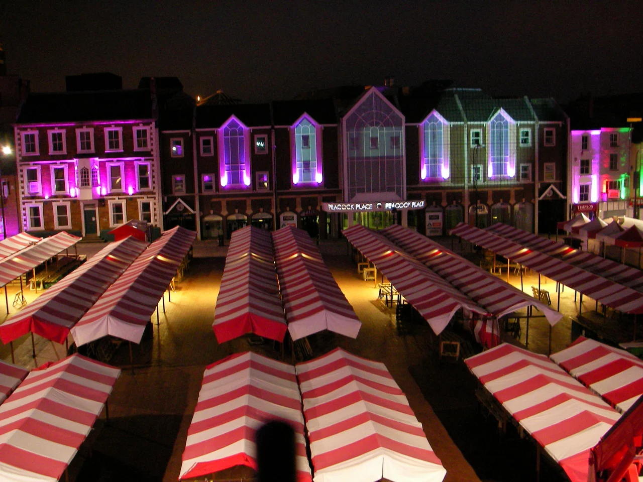
The Great Fire of Northampton in 1675 burned through the centre of the town and almost destroyed All Hallows' Church, a great Norman building that stood where All Saints' Church now stands. Only the medieval tower and the vaulted crypt came through. By 1680 the church had been rebuilt with the help of donations from across England, including a thousand tons of timber sent by Charles II; his statue still stands above the portico, a thank-you cast in stone. The poet John Clare used to sit beneath that portico writing verses. The market square in front of the church has held its commercial role since the early Middle Ages and is among the oldest in England, claimed in some histories to be the largest open marketplace in the country. The Royal & Derngate theatre, the Cultural Quarter, and 78 Derngate, the only English house designed by Charles Rennie Mackintosh, all sit within a short walk.
The Beatles played at the Deco
The Deco, a 900-seat Art Deco building on Abington Square, was a cinema in the 1960s. The Beatles played there twice in 1963. The first appearance was as unknowns, sharing a bill with Tommy Roe and Chris Montez when they had not yet had their first number one. By the end of that year they were headlining their own UK tour, and the Deco saw them again. The building survived being closed and reopened more than once, was restored by the Jesus Army for use as the Northampton Jesus Centre, and remains in use as a theatre and conference venue. Bauhaus formed in Northampton in 1978, often cited as the godfathers of goth, and the spin-off bands Love and Rockets and Tones on Tail came out of the same scene. The rapper Slowthai grew up here and talks about it constantly in his lyrics. Sophie, the pop musician and producer who died in 2021, was born in Northampton. The town has produced more musicians than its size suggests.
Saints, Cobblers, and a tower called the Cobblers' Needle
Northampton Saints, the rugby union side, play at Franklin's Gardens and won the English Premiership in 2014 and again in 2024 after a final at Twickenham in front of eighty-two thousand. The Saints have an average home attendance higher than any other professional sports team in the town. Northampton Town, The Cobblers, play at Sixfields Stadium and have been in the Football League since 1920. The National Lift Tower, 127.5 metres tall and visible across most of the town, was built in the 1980s for the Express Lifts factory to test new elevator systems. A Terry Wogan phone-in once nicknamed it the Northampton Lighthouse, on the basis that Northampton is one of the furthest places from the sea in England; locals more often call it the Cobblers' Needle. The factory closed years ago but the tower is a listed building. It is the first thing you see coming in along the A45.
A town in flight
From above, Northampton reads as a roughly oval town set in a bend of the River Nene, with the dark spire of All Saints' Church near the centre and the white needle of the Lift Tower just to the west. The market square is a wide rectangle near the church. Franklin's Gardens sits in St James End to the west. The Grand Union Canal terminates in the town and links by lock and lift through to the Nene, the Wash, and the North Sea. Sywell Aerodrome lies five nautical miles northeast, the nearest airfield to the town. The M1 motorway slides past on the western edge. Silverstone Circuit, the home of the British Grand Prix, lies thirteen nautical miles southwest. Northamptonshire calls itself the rose of the shires, a phrase that doesn't quite fit a town built on leather and lasts, but Northampton has always been a working county town with more depth than its passing visitors notice.
From the Air
Coordinates 52.237°N, 0.896°W, county town of Northamptonshire in the East Midlands of England. Recommended viewing altitude 2,500-4,000 ft AGL. Visual landmarks: the 127m National Lift Tower (the Cobblers' Needle) visible from many miles in clear weather, the Nene loop around the southern edge, the dark spire of All Saints' Church near the central market square, and Franklin's Gardens stadium in the western St James area. Nearest airfield is Sywell Aerodrome (EGBK), 5 nm northeast. Cranfield (EGTC) lies 13 nm southeast; East Midlands (EGNX) 33 nm north-northwest.
Nearby Stories
- Battle of Bosworth Field 3.6 km away
- Murder of Ross Parker 7.2 km away
- Royal Leamington Spa 8.8 km away
- Buckingham 9 km away
- St Neots 9.4 km away
- Letchworth 10 km away
- Uppingham School 11 km away
- Sudeley Castle 39 km away