.jpg)
Norwich Historic District
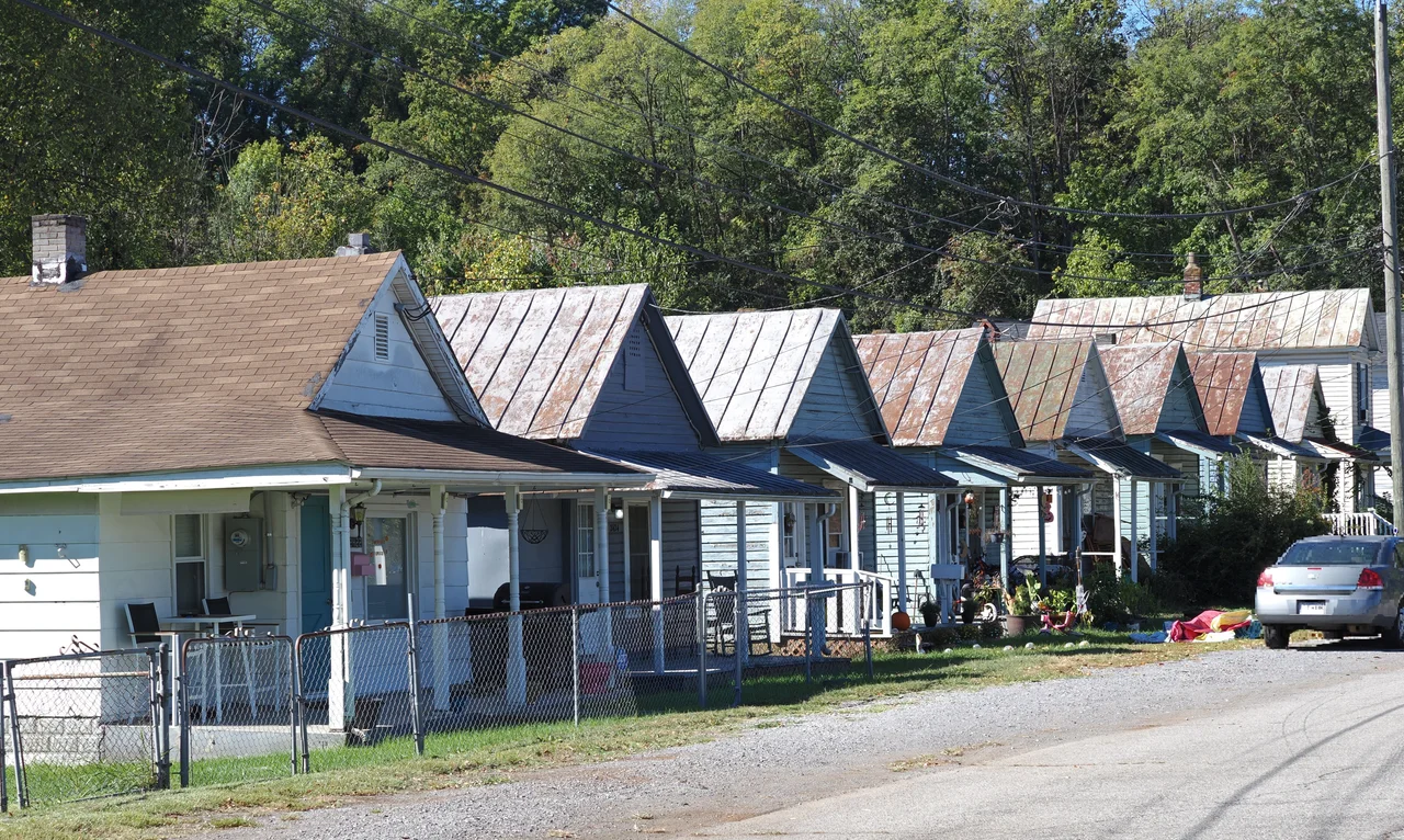
The houses run in rows, nearly identical, packed tight against each other along streets that dead-end into the ridge. Shotgun cottages mostly - narrow, deep, the kind built fast and cheap for workers who needed somewhere to sleep between shifts. There are over a hundred of them, and they have been standing here, in this bowl of land south of the Roanoke River, since the 1890s. Most American mill towns lost their workers' housing to demolition decades ago. Norwich did not. Listed on the National Register of Historic Places only in 2024, it is the only intact collection of late-1800s workers' housing left in the city of Roanoke - and one of vanishingly few extant anywhere in the South.
The Magic City and Its Magic
To understand Norwich you have to understand Roanoke in 1890. After the Norfolk and Western Railway located its headquarters in the small town of Big Lick in 1882, the population exploded. By 1890 the place had earned the nickname The Magic City. Land speculation was everywhere. In October of that year, the Roanoke Development Company was chartered with $1.1 million in capital - $500,000 to buy land, the rest to lure industry to it. The company bought 1,300 acres southwest of the city and platted the Turkey Bottom area by the end of 1891. Bridges, roads, streetcar service. Industry came: the Norwich Lock Company built a factory and, in the practice of the era, built housing for its workers right next to it. Then the Panic of 1893 swallowed the venture. The Roanoke Development Company closed after only two years. But the neighborhood, named for the lock factory, stayed.
Disowned by Both
Norwich sat in a bowl of low ground bordered by the Roanoke River to the north and a pronounced ridge to the south. That isolation made it cohesive and forgotten in equal measure. In its early years, Norwich was technically part of Roanoke County - but the county considered it Roanoke City's problem, and the city considered it the county's. Norwichians, one local historian wrote, were disowned and neglected by both. The Norwich Lock building passed to the Roanoke Cotton Mill Company in 1899, which continued building employee housing. The workers at the cotton mill included children. Many of the subjects photographed there by Lewis Hine were barefoot, working with dangerous equipment, and claiming to be fourteen despite often looking much younger. The mill changed hands again in 1910, and the site was eventually razed in the mid-20th century.
Walker Foundry's Long Goodbye
Another industrial mainstay outlasted the cotton mill by a century. The Walker Machine and Foundry Corporation built its Norwich factory in 1920 and ran it almost to 2020. Its closure became a small civic drama. Roanoke City wanted to extend its Roanoke River greenway through the district and needed a 30-foot strip at the edge of the Walker property. The foundry argued that giving up the land would cost them an air-quality permit they held only through a grandfather clause. Lawsuits followed. The Walker foundry closed in 2019, and the company alleged that the city's threat of eminent domain had caused the closure. The two parties settled in 2020. Walker got $750,000 and a railroad spur. The city got nearly five acres of property and, eventually, its greenway bridge across the river - the Bridge the Gap, opened in 2023, connecting Roanoke to Salem along the river the workers' children once played beside.
What 116 Cottages Mean
The 2024 National Register listing counted 116 contributing resources in Norwich, including two sites and one structure. Only 21 homes in the district were built after 1920 - the rest are the original mill worker housing, densely packed and architecturally near-identical, with the consistent setbacks and rhythms that come from being built fast and cheap in a single short window. That sameness, which once might have been read as monotony, now reads as history preserved. Workers' housing was the first thing demolished when mill towns redeveloped. Most cities cleared theirs decades ago in the name of urban renewal. Norwich survived partly because its bowl of land was too obscure to be worth clearing, partly because the people who lived there refused to leave. The district endures as a rare, dense remnant of what 19th-century industrial labor actually looked like at home.
From the Air
Norwich Historic District lies at 37.27 N, 79.98 W in southwest Roanoke, about two miles west of downtown along the south bank of the Roanoke River. Cruise at 3,500 to 5,500 feet MSL for good visual orientation. The bowl-shaped neighborhood sits between the river to the north and a pronounced ridge to the south. Nearest airport is Roanoke-Blacksburg Regional (KROA), about 4 nautical miles east. Mill Mountain and the illuminated Roanoke Star lie east of the city.
Nearby Stories
- Battle of Galudoghson 1.8 km away
- Franklin County, Virginia 14 km away
- Poplar Forest 17 km away
- Pulaski County, Virginia 18 km away
- Alleghany County, Virginia 18 km away
- Draper's Meadow Massacre 19 km away
- Hargrave Military Academy 29 km away
- 2020 Williamsburg Massacre 42 km away