November 2023 Mindanao Earthquake
At 4:14 in the afternoon on November 17, 2023, the ground beneath Sarangani province began to shake. Students were still in school. Shoppers were in malls. Fishermen were hauling in their afternoon catch. Within seconds, walls collapsed, landslides buried roads, and the sea receded ominously from the coast near Alabel. The magnitude 6.8 earthquake -- generated by the same Cotabato Trench that produced a catastrophic magnitude 8.0 event in 1976 -- killed eleven people, injured more than 700, and left thousands homeless across southern Mindanao. President Bongbong Marcos was halfway around the world at the APEC summit in San Francisco when the news broke.
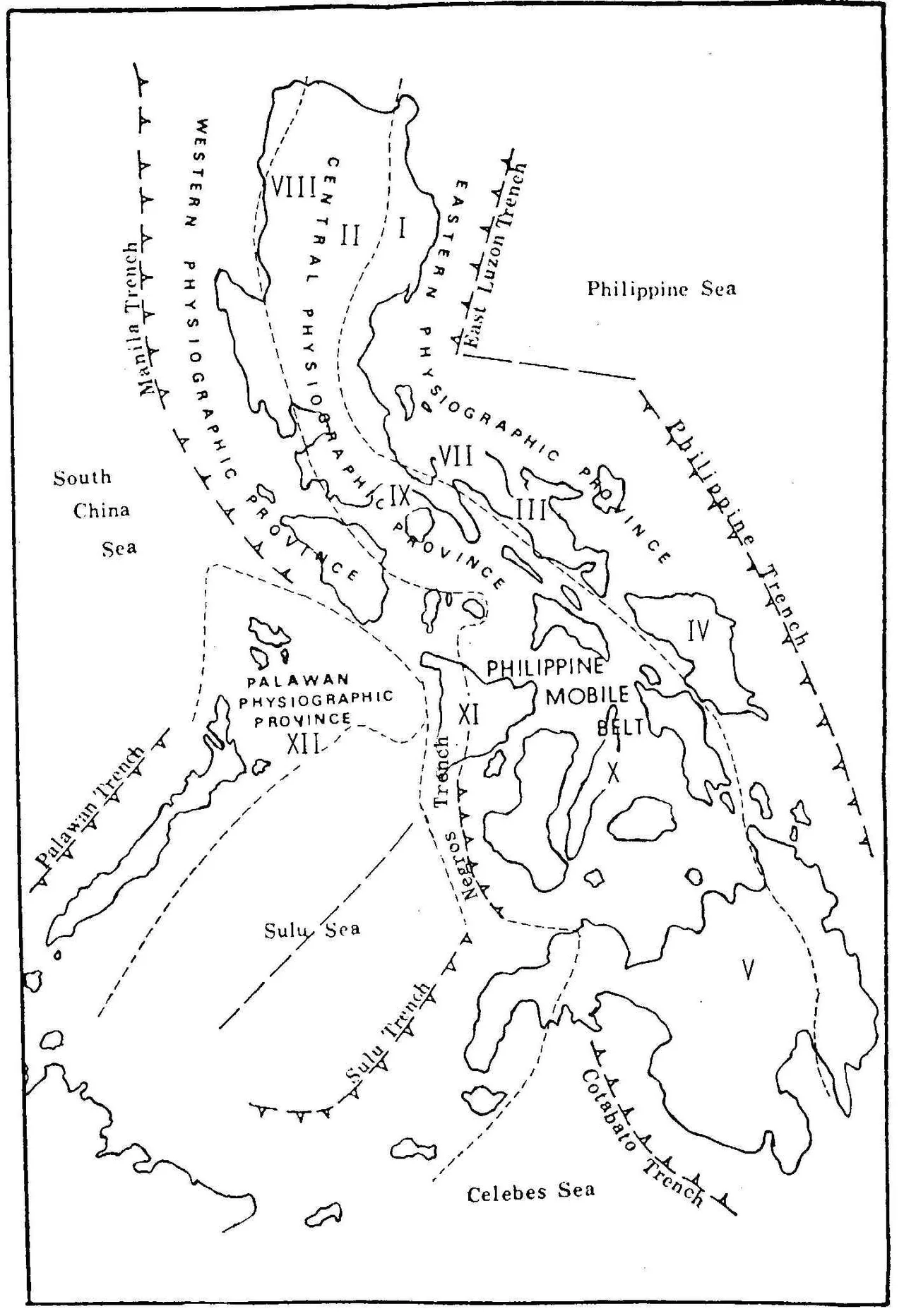
A Collision Zone Beneath the Sea
Southern Mindanao sits atop one of the most complex tectonic boundaries on the planet. The Sunda Plate and the Philippine Sea Plate converge here obliquely, their collision accommodated by subduction along the Cotabato Trench and a network of strike-slip faults that thread through the region like cracks in old plaster. The November 2023 earthquake was a reverse-faulting event at intermediate depth, driven by the same forces that have shaped Mindanao for millions of years. This is not a region that is occasionally seismic. It is perpetually so. In 1976, a magnitude 8.0 earthquake along the Cotabato Trench generated a tsunami that killed approximately 8,000 people in the Moro Gulf -- one of the deadliest seismic disasters in Philippine history. The 2023 event was smaller, but the geology that produced it has not finished.
Four Minutes of Terror in Glan
The town of Glan, in Sarangani province, bore the worst of the shaking. Instruments recorded Destructive intensity -- level VII on the Philippine seismological scale -- in Glan, where walls buckled, roofs caved in, and the ground itself cracked open. Four people died in Glan alone: a couple crushed by a collapsing wall, others struck by falling debris. In nearby General Santos, three more died, including a woman killed by debris at a shopping mall. A mother and her child were buried by a landslide and recovered the following day. Students in a gymnasium in General Santos were injured in a stampede of panic as the building shook. Two people suffered fatal strokes apparently triggered by the terror of the quake. The tremor was felt as far as neighboring Indonesia, where residents in Manado, Bitung, and the Sangihe Islands reported shaking.
The Cost of Living on the Ring of Fire
The physical toll was staggering for a quake that lasted less than a minute. At least 542 houses collapsed outright. Nearly 8,800 more suffered damage across the Soccsksargen and Davao regions. In Glan alone, 295 homes were destroyed and 4,752 damaged; in Malapatan, 3,253 homes were damaged, 136 of them seriously. A landslide blocked the road between Glan and Malapatan. Sixteen roads and five bridges were affected. In Davao City, part of a construction crane broke loose from a high-rise condominium and crashed onto a house in the Matina district. In Polomolok, South Cotabato, 43 homes collapsed. Fifty-four fishing boats were damaged -- the working tools of families who depend on the sea. The town of Glan was placed under a state of calamity on November 21, formally acknowledging what its residents already knew.
Response and Resilience
The Philippine government's disaster response machinery engaged quickly. The National Disaster Risk Reduction and Management Council dispatched teams to the affected areas within hours. The Department of Social Welfare and Development had 140,579 family food packs staged at offices across Mindanao, drawing on a disaster response fund of 1.34 billion pesos. President Marcos, continuing his APEC trip but ordering all available agencies to respond, visited General Santos on November 23 to inspect damage and distribute aid. He was accompanied by former senator and boxing champion Manny Pacquiao, who hails from the region. The earthquake generated more than 120 aftershocks in the days that followed, including a magnitude 5.2 tremor four days after the mainshock. For the people of Sarangani, the shaking was a reminder of a truth they have always lived with: the same tectonic forces that created their islands can, in an instant, reshape them.
From the Air
Epicenter at approximately 5.59N, 125.05E, in the province of Sarangani on southern Mindanao. General Santos Airport (RPMR/GES) is the closest major airport, approximately 30km from the worst-affected areas. From altitude, Sarangani Bay and the Sarangani Islands are visible to the south. The Cotabato Trench lies offshore to the southwest. Recommended viewing altitude: 15,000-25,000 ft to see the full extent of the affected region from Glan to General Santos to Davao City.
Nearby Stories
- 1913 Sulawesi-Mindanao Earthquake 42 km away
- Japanese Destroyer Hokaze 215 km away
- 1955 Lanao Earthquake 251 km away
- 2018 Lamitan Bombing 288 km away
- Taluksangay Mosque 335 km away
- Japanese Minelayer Tsugaru 426 km away
- Tawi-Tawi 484 km away
- Munakata Taisha 3159 km away