Japanese Minelayer Tsugaru
She was built to carry 600 naval mines and a reconnaissance seaplane, commissioned six weeks before Pearl Harbor, and spent the next two and a half years criss-crossing the Pacific in support of nearly every major Japanese operation in the war's first phase. The minelayer Tsugaru -- named for the peninsula in northwest Aomori Prefecture -- participated in the invasion of Guam, the seizure of Rabaul and Kavieng, operations at Lae, the Coral Sea campaign, the Guadalcanal supply runs, and the relief of Biak. By June 1944, she was limping through the waters off Halmahera with torpedo damage, trying to reach Manila. She never made it.
A Ship for Every Operation
Tsugaru was funded under Japan's Maru-3 Supplementary Naval Expansion Budget of 1937, designed as an improvement over the earlier minelayer Okinoshima. She could carry 600 Type 6 naval mines, was equipped with an aircraft catapult for a Kawanishi E7K reconnaissance seaplane, and mounted four 127mm Type 89 dual-purpose guns intended to improve her anti-aircraft capabilities. Launched at Yokosuka Naval Arsenal on 5 June 1940, she was commissioned on 22 October 1941 -- less than seven weeks before the attack on Pearl Harbor. From that moment, Tsugaru was in constant motion. Assigned to Mine Division 19 under the IJN 4th Fleet, she deployed to Saipan and immediately supported the invasion of Guam in December 1941.
From Rabaul to Guadalcanal
The pace of operations was relentless. In January 1942, Tsugaru deployed from Jaluit alongside Okinoshima for Operation R -- the invasion of Rabaul and Kavieng. In March, she supported the invasion of Lae and Salamaua in New Guinea, where ninety American aircraft attacked the invasion force and left Tsugaru with light damage. In May, she was assigned to the Tulagi invasion force as part of Operation Mo, but the Battle of the Coral Sea forced cancellation of the Port Moresby landings. Reassigned to Operation RY targeting Nauru and Ocean Island, that operation too was cancelled after Okinoshima was sunk. By mid-1942, Tsugaru was running supply missions to Guadalcanal -- dangerous runs through waters increasingly dominated by American air and naval power. On 3 September 1942, B-17 Flying Fortress bombers found her, killing 14 crewmen and wounding 30.
Damage, Repair, Repeat
The pattern of Tsugaru's later career was damage followed by repair followed by more damage. After the Guadalcanal bombing, she continued transport runs to the Solomon Islands until February 1943. Repairs at Yokosuka kept her in drydock until May. Returning to Rabaul in August, she was torpedoed on the 5th, north-northeast of the base, and had to limp to Truk for emergency repairs before returning to Yokosuka, where she stayed until year's end. Reassigned to the Third Southern Expeditionary Fleet in December 1943, she deployed from Palau to mine the Balabac Strait in the Philippines -- one of those mines would later sink an Allied vessel in July 1944. By May 1944, she was transporting reinforcements from Zamboanga to Biak in a desperate attempt to counter American landings.
Two Torpedoes Off Halmahera
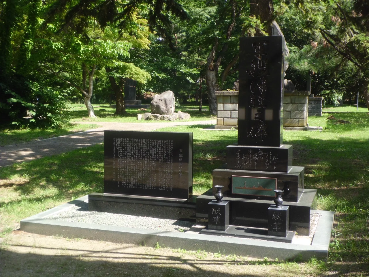
On 21 June 1944, departing Sorong for Halmahera Island, Tsugaru was torpedoed by the Royal Netherlands Navy submarine. The damage was severe but not immediately fatal. After temporary repairs, she attempted to reach Manila. Eight days later, on 29 June, an American submarine spotted her near Biak and fired a full spread of six torpedoes. Two struck home. Tsugaru sank in less than 25 minutes, taking most of her crew, including her captain, to the bottom of the sea. She was removed from the Imperial Japanese Navy list on 10 August 1944. Today, a memorial to her crew stands in Hirosaki, Aomori Prefecture -- far from the equatorial waters where the ship and the men who served on her went down.
From the Air
Tsugaru's final sinking position is near 2.32°N, 127.95°E, in the waters between Halmahera and Biak in the Molucca Sea. The area is open tropical ocean with the distinctive four-armed shape of Halmahera visible to the south. No specific wreck site marker exists on the surface. Nearest airports: Sultan Babullah Airport (ICAO: WAMN) on Ternate to the southwest, and Leo Wattimena Airport (ICAO: WAMG) on Morotai to the northeast. Deep oceanic waters with strong equatorial currents.
Nearby Stories
- Morotai Island 12 km away
- USS Shark (SS-174) 40 km away
- North Halmahera Regency 48 km away
- Sangihe Islands 200 km away
- Karangetang 211 km away
- Siau Island 268 km away
- The Ocean's Hidden Crossroads 278 km away
- Hatohobei 314 km away