Sangihe Islands
The word Sangihe comes from Sang Ihe -- Strong Sailor, Brave Fisherman. It is a fitting name for an archipelago that sits on one of the most geologically restless stretches of ocean on Earth, halfway between Sulawesi and Mindanao, where the Celebes Sea meets the Molucca Sea and the ground beneath your feet rides its own named tectonic plate. The Sangihe Islands are volcanic, fertile, and stubbornly inhabited by more than 200,000 people who have built their lives atop mountains that occasionally remind everyone who is really in charge.
Fire and Fertile Soil
The archipelago runs roughly north to south: Sangir Besar at the top, then Siau, Tagulandang, and Biaro trailing southward like stepping stones between two larger landmasses. Together they total 813 square kilometers of mountainous, volcanic terrain. The largest island, Sangir Besar, is crowned by Mount Awu, an active volcano that rises 1,320 meters and has erupted violently multiple times in recorded history. The volcanic soil is extraordinarily fertile, a consolation for living on land that periodically shakes, slides, and erupts. The Sangihe tectonic plate -- named for this very island arc -- is among the most seismically active on the planet. In 1913, a magnitude 7.9 earthquake offshore triggered mudflows on Sangihe Island that buried 117 people. The islands sit squarely on the Pacific Ring of Fire, and they behave accordingly.
Between Two Worlds
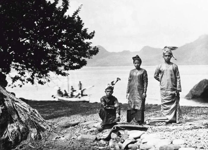
Geographically and culturally, the Sangihe Islands occupy a borderland. They lie roughly equidistant between the Philippine island of Mindanao to the north and the Indonesian island of Sulawesi to the south. The Sangir language, an Austronesian tongue, is spoken not only across the archipelago but also on some Philippine islands and the northern tip of Sulawesi -- a linguistic footprint that predates the national borders drawn across these waters. The Dutch arrived in 1677 and held the islands as part of the Netherlands East Indies until Indonesian independence in 1945. That colonial legacy shaped everything from religion to administration, but it could not change the fundamental character of a place whose people have always looked seaward. Tahuna, the chief town on Sangir Besar, serves as both the main port and the home of Naha Airport, the islands' only airfield.
The Damage Below the Surface
Marore Island, at the northern fringe of the Sangihe group, serves as one of the coordinate points used to define Indonesia's maritime baselines -- a technical distinction that underscores the archipelago's geopolitical significance at the edge of Indonesian sovereignty. But Marore also tells a more troubling story. Fifteen years of illegal blast fishing devastated the island's coral reefs and mangrove ecosystems. Dynamite fishing is brutally effective and brutally destructive: it kills everything in the blast radius, shatters coral structures that took centuries to grow, and strips the nursery habitat that sustains fish populations. By 2012, coral around Marore had begun to recover, but the mangroves -- slower to regenerate and critical to coastal protection -- had not. The damage illustrates a tension that runs through island life everywhere: the sea provides, but only if you do not take too much.
An Archipelago Divided and Enduring
In 2007, the Sangihe Islands were administratively split. The southern islands of Siau, Tagulandang, and Biaro became the Sitaro Islands Regency -- the name itself a portmanteau of the three islands -- while the northern islands retained the Sangihe Islands Regency name. The combined population across both regencies reached an estimated 212,000 by 2022. Life here revolves around fishing, farming the rich volcanic slopes, and the occasional eruption or earthquake that sends everyone scrambling. It is a place where the landscape demands resilience, and the people have provided it for centuries. The Brave Fisherman sails on.
From the Air
Located at approximately 3.00N, 125.50E, the Sangihe Islands form a north-south chain between Sulawesi and Mindanao. Naha Airport (WAMH) on Sangir Besar is the only airfield. From altitude, the chain is clearly visible as a string of volcanic islands marking the eastern edge of the Celebes Sea. Mount Awu (1,320m) on Sangir Besar is the dominant visual landmark. Recommended viewing altitude: 15,000-25,000 ft for the full chain. The Molucca Sea lies to the east, the Celebes Sea to the west.
Nearby Stories
- Karangetang 9.2 km away
- Japanese Destroyer Hokaze 16 km away
- Bunaken National Park 129 km away
- Bunaken 162 km away
- USS Shark (SS-174) 195 km away
- 1913 Sulawesi-Mindanao Earthquake 245 km away
- Japanese Minelayer Tsugaru 247 km away
- Basilan 472 km away