Bunaken National Park
Drop below the surface off Bunaken Island and the reef does not slope gently into the depths. It falls. Vertical coral walls plunge 25 to 50 meters straight down, encrusted with 13 genera of hard coral, swarming with fish whose combined species count represents more than 70 percent of everything known to swim in the Indo-Western Pacific. Bunaken National Park protects 890 square kilometers of this underwater world off the northern tip of Sulawesi, Indonesia, and it sits at the geographic center of the Coral Triangle -- the patch of ocean between the Philippines, Papua New Guinea, and the Solomon Islands that holds the highest marine biodiversity on Earth.
Five Islands, Ninety-Seven Percent Sea
Established in 1991 as one of Indonesia's first marine parks, Bunaken National Park is overwhelmingly water. Ninety-seven percent of its area is marine habitat. The remaining three percent is land, distributed across five islands: Bunaken, Manado Tua, Mantehage, Nain, and Siladen. The southern boundary reaches the Tanjung Kelapa coast on the Sulawesi mainland. Manado Tua, a volcanic cone rising directly from the sea, serves as the park's most recognizable landmark -- visible from the air as a near-perfect circle of green surrounded by turquoise reef flats. The islands themselves are small, but each supports a distinct community of fishermen and, increasingly, tourism operators whose livelihoods depend on the same reefs the park was created to protect.
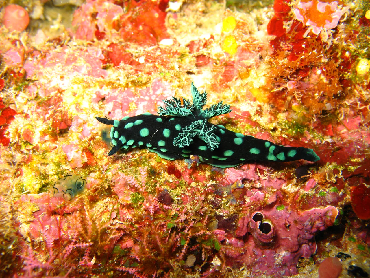
Walls of Coral, Chambers of Nautilus
The park's signature feature is its fringing and barrier reef system, dominated by the vertical coral walls that give Bunaken its reputation among divers. These walls host 390 species of coral and an ecosystem that extends from the sunlit surface to the darkness below 50 meters. Seaweeds including Caulerpa and Halimeda anchor themselves to the reef structure. Seagrass meadows -- Thalassia hemprichii and Enhallus acoroides in particular -- carpet the shallows around Mantehage and Nain. Among the mollusks, the roster is remarkable: giant clams wedged into the reef, horned helmet shells patrolling the sand, and the chambered nautilus, a living fossil that has drifted through these waters for hundreds of millions of years. Coelacanths -- another species once thought extinct -- have been documented in the park's deeper waters, adding to Bunaken's reputation as a place where time moves on a different clock.
Macaques on Shore, Cuscus in the Canopy
Above the waterline, the park's terrestrial life is surprisingly rich for such small islands. Palm, sago, woka, silar, and coconut trees cover the land. The Celebes crested macaque, an endangered primate found nowhere outside Sulawesi, inhabits the forested areas alongside Timor deer and the Sulawesi bear cuscus -- a marsupial with a prehensile tail that moves through the canopy at night. Mangrove forests of Rhizophora and Sonneratia fringe the coastlines, supporting populations of crabs, lobsters, and sea birds including gulls, herons, sea doves, and storks. The mangroves serve a dual purpose: they stabilize the shoreline against erosion and function as nurseries for the juvenile fish that will eventually populate the reef walls offshore.
Thirty Thousand Visitors and a River of Plastic
Tourism arrived early and grew steadily. Between 2003 and 2006, annual visitor numbers ranged from 32,000 to 39,000, with 8,000 to 10,000 international tourists each year. Accommodations span from backpacker cottages on the beach to five-star dive resorts. The tourism economy has been a powerful argument for conservation -- reefs that attract divers generate revenue that dead reefs do not. But the threats are not only underwater. Plastic waste flowing from the rivers of nearby Manado posed a growing problem until 2024, when the No-Trash Triangle Initiative installed river barriers to intercept debris before it reached the park. The intervention addressed a symptom, not the cause, but it signaled a recognition that Bunaken's survival depends not only on what happens within its boundaries but on the behavior of the million-person city upstream.
From the Air
Located at 1.67°N, 124.65°E off the northwest coast of the Minahasa Peninsula, North Sulawesi, Indonesia. From altitude, Manado Tua island is the park's most visible landmark -- a conical volcanic island surrounded by reef. The five park islands are clustered in the Celebes Sea northwest of Manado. Nearest airport is Sam Ratulangi International Airport (WAMM) in Manado, approximately 15 km from the mainland portion of the park. Reef structures are visible through clear water from lower altitudes. The deep blue of the Celebes Sea contrasts sharply with the turquoise of the reef flats.
Nearby Stories
- Tangkoko Batuangus Nature Reserve 17 km away
- Tomohon 23 km away
- Mount Ruang 47 km away
- Siau Island 122 km away
- Gorontalo 148 km away
- Otanaha Fortress 174 km away
- The Sea That Swallows Itself 205 km away
- Indonesia-Malaysia Border 533 km away