.JPG)
Indonesia-Malaysia Border
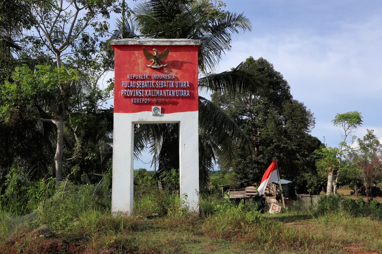
Draw a line through the jungle heart of Borneo, from the rocky headland of Tanjung Datu in the northwest to the mangrove-fringed Gulf of Sebatik in the east, and you have traced 1,881 kilometers of one of Southeast Asia's most complex international boundaries. The Indonesia-Malaysia border divides the world's third-largest island between three Indonesian provinces -- West Kalimantan, East Kalimantan, and North Kalimantan -- and two Malaysian states, Sabah and Sarawak. But the land border is only the beginning. Maritime boundaries extend through the Straits of Malacca, the South China Sea, and the Celebes Sea, and several of those lines remain unfinished, contested, or drawn only on one side's maps.
Lines Drawn by Empires
The border's origins lie in agreements between the British and the Dutch, the two European powers that carved Borneo into colonial possessions. The Convention of 1891 established the key reference point that still echoes in modern disputes: the parallel of 4 degrees 10 minutes North latitude, drawn eastward across Sebatik Island, splitting that small landmass between British North Borneo to the north and the Dutch East Indies to the south. A 1915 agreement refined the boundary further, tracing it through channels and watersheds with the precision of surveyors who had never imagined the oil and gas reserves lying beneath the seabed they were dividing. When Indonesia and Malaysia inherited these colonial boundaries at independence, they inherited the ambiguities as well. The 1969 continental shelf agreement and 1970 territorial sea agreement between the two nations resolved much of the Strait of Malacca boundary, but left the eastern maritime border largely undefined.
The Map That Changed Everything
In 1979, Malaysia published a map showing its territorial waters and continental shelf claims -- and the reaction from its neighbors was immediate. The map drew Malaysia's maritime boundary running southeast through the Celebes Sea in a way that enclosed the Ambalat oil blocks, vast stretches of the South China Sea, and waters that Indonesia, Vietnam, Thailand, China, and the Philippines all considered their own. Indonesia objected formally. ASEAN rejected the map's claims. But Malaysia's position was established on paper, and paper has a way of becoming precedent in international law. The 1979 map remains the single most contentious document in the bilateral relationship, cited in every subsequent maritime dispute and rejected by every neighboring country it affects.
Sipadan, Ligitan, and the Court's Verdict
Two tiny islands off Borneo's east coast became the border's most famous battleground. Sipadan and Ligitan -- specks of coral and sand -- were claimed by both Indonesia and Malaysia, and when bilateral negotiations failed, the dispute went to the International Court of Justice in The Hague. Indonesia argued from historical treaties: the 1891 Convention's eastward line, they contended, placed the islands on their side. Malaysia argued from effective occupation -- lighthouses built, bird sanctuaries declared, turtle conservation programs established. In December 2002, the ICJ sided with Malaysia, awarding both islands on the basis of effectivites rather than treaty interpretation. The ruling settled the island question but left the surrounding maritime boundary entirely unresolved, setting the stage for the ongoing Ambalat dispute over oil-rich seabed blocks in the Celebes Sea.
Crossing Points and Contested Waters
On the ground, the border functions through four official land crossings between Sarawak and West Kalimantan, the busiest connecting Tebedu to Entikong along the main route between Kuching and Pontianak. Numerous informal crossings also exist, used by indigenous communities whose territories predate the border by centuries. At sea, the picture is messier. Continental shelf boundaries have been agreed in the Strait of Malacca and parts of the South China Sea, but territorial sea boundaries in the eastern waters remain unsettled. Both countries have awarded petroleum exploration concessions in the disputed Ambalat blocks to major oil companies -- Shell on both sides, ENI for Indonesia, Petronas for Malaysia -- creating the surreal situation where competing nations have licensed overlapping claims to the same seabed. The border between Indonesia and Malaysia is, in many places, less a line than a negotiation still in progress.
From the Air
The Indonesia-Malaysia border spans the island of Borneo at approximately 3.18N, 119.47E. The land border runs through highland jungle terrain from Tanjung Datu in the northwest (near Kuching, Sarawak) to Sebatik Island in the east. From altitude, Sebatik Island -- split between the two countries -- is clearly visible in the Celebes Sea. Nearest major airports include Tarakan (WAON) on the Indonesian side and Tawau (WBKW) on the Malaysian side. The maritime boundary extends through the Straits of Malacca, South China Sea, and Celebes Sea.
Nearby Stories
- Ambalat 64 km away
- 2000 Sipadan Kidnappings 70 km away
- Sipadan 98 km away
- Kakaban 99 km away
- Tawi-Tawi 189 km away
- Borneo's River of Names 200 km away
- Japanese Destroyer Tanikaze 286 km away
- Cutting the Orchid in Half: The Proposed Sulawesi Canal 350 km away