Borneo's River of Names
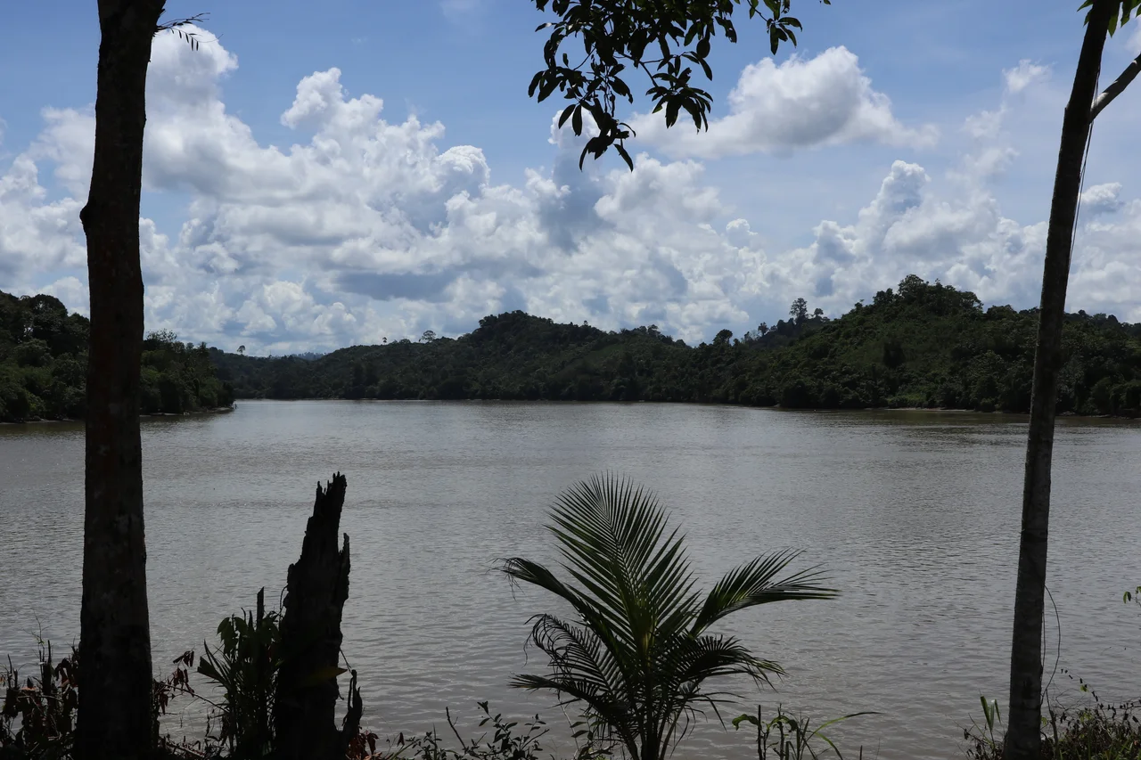
Long before roads reached the interior of North Kalimantan, there was the river. For the Dayak communities of Indonesian Borneo, the Kayan has always been more than a waterway. It is the road, the market, the rice paddy's lifeblood, and the reason anyone settled here at all. Named for the Kayan Dayak tribe, this major Bornean river rises in the Ukeng Mountains and carves a winding path through some of the most biodiverse terrain on Earth before spreading into a tidal delta that covers 3,000 square kilometers. Villages along its banks still depend on it for everything from drinking water to transportation, even as palm oil plantations and hydroelectric projects reshape the watershed around them.
From the Mountains to the Sea
The Kayan begins high in the Ukeng Mountains, in the central spine of Borneo, and descends through a landscape that shifts dramatically as it drops. In its upper reaches, the river runs fast through high-gradient rapids, cutting between steep mountain walls where the only way to travel is by small boat, and even then only for the skilled. The current pushes southeast, then east, then bends northeast, following the path of least resistance through rock and forest. About 70 kilometers before reaching the provincial capital of Tanjung Selor, the river passes through coral and limestone hills, its banks lined with nipa palms and scattered coconut trees. Below Tanjung Selor, the Kayan relaxes and broadens, finally emptying into the Sulawesi Sea through a wide, sediment-rich delta. Larger boats can navigate upriver as far as Tanjung Selor, roughly 60 kilometers from the coast. Beyond that, the river belongs to smaller craft and the people who know its moods.
Where Rivers Merge
The Kayan does not enter the sea alone. Its tidal delta merges with those of the Sekatak, Sesayap, and Sembakung rivers to form a continuous delta complex, a vast coastal wetland stretching along North Kalimantan's shore. Opposite this complex sits Tarakan Island, home to the province's largest city and a place with its own layered history of oil extraction and wartime occupation. The delta itself is a biological crossroads. At least six native mangrove species anchor its seaward edges, including Rhizophora apiculata and Sonneratia, while the interior is dominated by nipah palms. Mixed freshwater and saltwater ecosystems create habitat for species adapted to the brackish threshold where river meets ocean. The catchment area above receives between 3,500 and 4,000 millimeters of rainfall per year, classified as tropical rainforest climate, ensuring the Kayan maintains its flow even as dry seasons test other rivers in the region.
Life Along the Banks
The villages strung along the Kayan tell the story of a river-dependent civilization. At Antutan, one of many settlements perched on the banks, the population draws from several Dayak sub-tribes: the Kenyah, the Kayan, the Tidung, and the Bulungan. Paddy rice cultivation remains the economic anchor, with vast fields that have been worked for generations stretching back from the waterline. Fishing, farming, and craft-selling round out the economy, though some villagers work as teachers, nurses, soldiers, or police. For the communities of Malinau and Bulungan Regency, the Kayan has historically been the main transportation artery. Traditional boats carry people upriver into the interior of Malinau Regency, while speed boats connect downstream settlements to the broader world. River ports at Kayan and Pesawan handle passengers and goods, the commercial heartbeat of a region where the river still matters more than any road.
The Watershed Under Pressure
The Bulungan district surrounding the Kayan River harbors remarkable biodiversity: lowland tropical rainforest, montane forest, peat swamps, mangroves, and karst formations. It is the kind of ecosystem inventory that conservationists describe with equal parts wonder and alarm, because the pressures on it are intensifying. Large areas of the Kayan watershed have been converted to palm oil and timber plantations, mining concessions, fish ponds, and agricultural land. Roughly 30,000 hectares of the Kayan Delta have been designated as a Food Estate area, carved up for fish ponds and farmland. The Indonesian government has also focused on the river's hydroelectric potential, with a planned dam at Desa Long Peso in Bulungan Regency capable of generating around 900 megawatts. A smaller diesel-powered plant already operates at the village of Long Nawang in the remote Kayan Hulu subdistrict. Whether the river can sustain both its traditional communities and these industrial ambitions is the defining question for its future.
The Road That Flows
Flying over the Kayan, the view resolves into something that maps struggle to convey: the sheer reach of a river system through otherwise impenetrable terrain. The forest canopy stretches unbroken to the horizon in places, interrupted only by the brown ribbon of water and the cleared patches where villages have staked their claims. There are no highways cutting through this landscape, no rail corridors. The river is the infrastructure, as it has been for centuries. The Kayan Dayak named it, lived beside it, and built a culture around its rhythms. Industrial modernity is arriving in the form of dams and plantations, but the river's older role persists. Boats still carry rice and people between settlements that no road connects. Children still learn to read the current before they learn to read. For now, the Kayan remains what it has always been in North Kalimantan: not just a geographical feature, but the organizing principle of human life in one of the most remote corners of the Indonesian archipelago.
From the Air
Centered near 2.91N, 117.55E in North Kalimantan, Indonesian Borneo. The Kayan River is a prominent visual feature from altitude, winding from the mountainous interior to the broad tidal delta on the Sulawesi Sea coast. Tanjung Selor, the provincial capital, sits along the lower river. Tarakan Island and its airport (WAQT) are visible offshore opposite the delta complex. The nearest major airport is Juwata International Airport at Tarakan. The river's upper reaches pass through dense primary forest with no significant settlements visible from cruising altitude.
Nearby Stories
- Battle of Tarakan (1942) 21 km away
- Kakaban 71 km away
- Martin B-10 87 km away
- Ambalat 107 km away
- Sipadan 146 km away
- Sangkulirang-Mangkalihat Karst 171 km away
- The Unmapped Heart of Borneo 174 km away
- The Secret War in Borneo's Jungle 194 km away