The Unmapped Heart of Borneo
In 2003, a camera trap in the mountains of North Kalimantan captured something no scientist could identify: a dark red, cat-sized carnivore with a long bushy tail, moving through the forest at night. WWF announced the images in 2005, and the animal made headlines worldwide as possibly the first new Bornean carnivore discovered in over a century. The photographs came from deep inside Kayan Mentarang National Park, a wilderness so vast and so little explored that an entirely unknown predator had been living there undetected. At 1.36 million hectares, Kayan Mentarang is the largest stretch of protected rainforest remaining on Borneo. Straddling the border between Indonesian Kalimantan and Malaysian Sarawak, the park blankets a highland plateau where the Mentarang mountain trails wind from the Datadian region in the south through Apau Ping and up to Long Bawan in the north. It is a place defined by what has not happened to it: the logging roads, the palm oil plantations, the highways that have transformed so much of the island have never reached here.
A Catalog of the Rare and the Secretive
The species list reads like a field guide to Borneo's most elusive inhabitants. Clouded leopards patrol territories that can stretch across dozens of square kilometers, their cloud-patterned coats dissolving into the dappled light of the understory. Proboscis monkeys, with their absurd pendulous noses, crash through riverside canopy in troops. Bornean gibbons call across the valleys at dawn, their whooping songs carrying for kilometers through the mist. Sun bears, the smallest of the world's bears, claw open termite mounds and tear apart rotten logs with claws disproportionately large for their compact bodies. The park shelters creatures whose very existence depends on unbroken forest: the flat-headed cat, one of the rarest felines on earth, hunts fish along forest streams. Western tarsiers, with eyes each as large as their brains, grip branches with padded fingertips and hunt insects in total darkness. Overhead, rhinoceros hornbills and helmeted hornbills beat through the canopy on wings that produce a sound like a rushing locomotive.
The Dayak Heartland
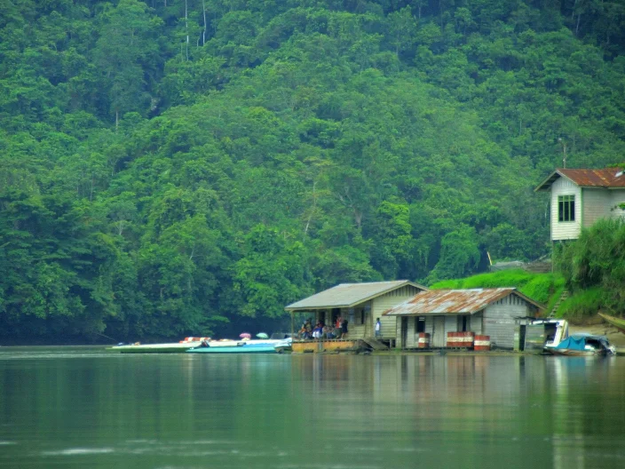
Between 20,000 and 25,000 Dayak people live in and around the park, members of the Kenyah, Murut, Punan, Lundayeh, and Lun Bawang communities. Archaeological remains, including stone tools and graves scattered through the highlands, confirm that people have inhabited this landscape for more than 350 years. These are not visitors to the forest but part of its ecology, communities whose rice cultivation, hunting practices, and land management have shaped the ecosystem for generations. The park's name itself reflects this human presence: the Kayan and Mentarang rivers, both named by the people who have lived along their banks, thread through the park's interior like the root system of a living thing. When the Indonesian government formally designated the area as a national park in 1996, upgrading it from its earlier status as a nature reserve, the decision recognized what the Dayak communities had long understood: that this forest required protection not from the people within it, but from the forces pressing in from outside.
Borneo's Transboundary Lifeline
Kayan Mentarang sits at the center of the Heart of Borneo initiative, a conservation effort led by WWF that spans the borders of Indonesia, Malaysia, and Brunei. The logic is geographic: the highland forests that the park protects do not stop at national boundaries. Watersheds feed rivers flowing into three countries. Animal populations, from orangutans to clouded leopards, range across borders that mean nothing to them. Until recently, reaching the park meant navigating a notoriously difficult rural border checkpoint between Indonesia and Malaysia. As the Heart of Borneo initiative has progressed, agreements now allow tourists to enter from Ba'kelalan in Sarawak, Malaysian Borneo, opening a corridor that reflects the park's transboundary nature. The forest canopy here is so continuous and so thick that from the air, the border is invisible. What you see instead is an unbroken expanse of green stretching to every horizon, one of the last places on Borneo where the forest looks the way all of Borneo once looked.
Where the Canopy Holds
Borneo has lost more than half its forest cover since the 1970s. Oil palm plantations, industrial logging, and road construction have fragmented the island's wilderness into shrinking patches. Against this backdrop, Kayan Mentarang's scale is staggering. The park contains both lowland and montane rainforest, from steaming river valleys choked with dipterocarp trees to cloud forests where moss drapes every branch and orchids bloom in the perpetual mist. The altitude shifts create distinct ecological zones, each harboring species found nowhere else. Bulwer's pheasants skulk through the montane undergrowth. Hose's palm civets, endemic to Borneo, forage in the canopy at night. The Malayan pangolin, covered in keratin scales and curling into an armored ball when threatened, digs through the leaf litter for ants. In a region where conservation often feels like a rearguard action, Kayan Mentarang is something rarer: a place where the forest is not being saved from destruction but has simply never been destroyed.
From the Air
Located at 3.20N, 115.50E in the highlands of North Kalimantan, Indonesian Borneo. The park straddles the Indonesia-Malaysia border. Nearest airstrip is Long Bawan (LBW/WRLB) to the north. The terrain is mountainous with dense forest canopy extending in all directions. From cruising altitude, the unbroken green expanse contrasts sharply with logged areas visible to the south and east. Cloud cover is common over the highlands, especially in the afternoon. The Ba'kelalan airstrip (on the Malaysian side) provides an alternative approach from the northwest.
Nearby Stories
- Our Forests, Our Name 20 km away
- Baram Dam 46 km away
- Sarawak Chamber 63 km away
- Martin B-10 156 km away
- Crown Colony of Sarawak 163 km away
- Battle of Tarakan (1942) 173 km away
- Maliau Basin 176 km away
- Borneo's River of Names 230 km away