Morotai Island
In December 1974, an Indonesian Air Force search party found a man living alone in the jungle of Morotai Island. His name was Teruo Nakamura -- or, in his native Amis language, Attun Palalin -- a Taiwanese indigenous soldier conscripted into the Imperial Japanese Army who had been hiding in the forest since the end of World War II. He had survived alone for nearly thirty years, unaware the war was over. His story captured the world's attention, but it was only the latest chapter in Morotai's long history of being swept up in conflicts far larger than itself.
The Spice Islands' Northern Sentinel
Morotai lies at the northern edge of Indonesia's Maluku Islands, a rugged, forested landmass stretching 80 kilometers north to south and no more than 42 kilometers wide. Almost all of its villages cling to the coastline; the interior is dense, mountainous jungle that has resisted settlement for centuries. Between Morotai and neighboring Halmahera runs the Morotai Strait, a passage that has funneled traders, missionaries, and invaders through these waters since the age of the spice trade. During the fifteenth and sixteenth centuries, the powerful Sultanate of Ternate held sway over the island, calling it the heart of a larger region known as Moro. Portuguese Jesuits established a mission here in the mid-1500s, but the Muslim states of Ternate and Halmahera drove them out by 1571. In the seventeenth century, Sultan Hamzah of Ternate forcibly relocated much of Morotai's Christian population to the island of Ternate, where they could be more easily controlled. By the end of that century, the Ternate Sultanate itself had become a vassal of the Dutch East India Company.
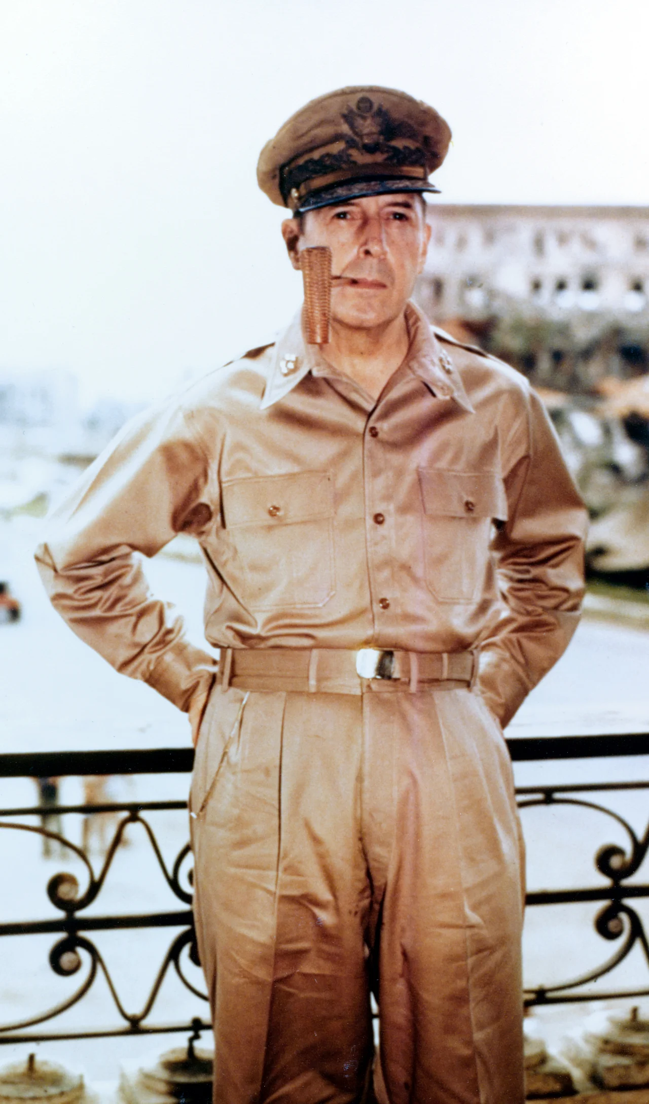
MacArthur's Stepping Stone
When American forces landed on Morotai's southern plain in September 1944, during the Battle of Morotai, they transformed a quiet tropical island into one of the largest Allied bases in the Pacific. Some 61,000 U.S. Army personnel poured ashore -- two-thirds of them engineers who rapidly built harbors, two airstrips, and extensive fuel depots. On tiny Sumsum Island, just three miles offshore from the port town of Daruba, General Douglas MacArthur established his headquarters as he prepared the invasion of the Philippines. The U.S. Thirteenth Air Force and the Australian First Tactical Air Force flew missions from Morotai against Japanese positions across the Dutch East Indies and the southern Philippines. In early 1945, Australian engineers expanded the base to support landings in Borneo. On September 9, 1945, the Japanese 2nd Army formally surrendered on Morotai. The base fell silent -- except for the handful of Japanese soldiers who refused to believe the war was over, hiding in the jungle for decades to come.
Rebellion and Recapture
Morotai's wartime airstrips refused to fade into irrelevance. After Indonesian independence, the new Indonesian Air Force kept one runway operational. When the CIA-backed Permesta rebellion erupted in 1958, the rebels saw Morotai's strategic value immediately. On April 26, rebel aircraft -- supplied with American pilots and munitions -- bombed the island, followed by an amphibious landing force that captured it within hours. A Douglas C-47 transport soon landed carrying a senior Permesta representative and two Americans, one of them a USAF officer who inspected the runway and declared it fit for B-29 heavy bombers. The rebels held the island for less than a month. In May 1958, Indonesian forces gathered an assault fleet in Ambon harbor, and on May 20 their troops landed while elite paratroopers dropped from the sky. The Permesta garrison surrendered almost as quickly as it had arrived.
From Runways to Rockets
Today, Morotai's population of roughly 80,000 lives a quieter life. The economy runs on timber, resin, and subsistence fishing. Leo Wattimena Airport -- the old wartime field once called Pitu, meaning "seven" for its seven World War II runways -- now serves as a commercial airport with ambitions of becoming an international aerodrome. But the island's most improbable future may lie in space. In 2012, Indonesia's national space agency LAPAN selected Morotai as a future spaceport site, drawn by its near-equatorial location, which makes orbital launches more fuel-efficient, and by the open Pacific Ocean to the east, which reduces the risk to populated areas downrange. The island's sparse population and those old wartime runways -- one stretching 2,400 meters, easily extendable to 3,000 -- sealed the deal. Whether rockets will ever actually fly from Morotai remains to be seen, but the idea captures something essential about this island: it keeps finding itself at the center of plans far grander than its quiet shores would suggest.
From the Air
Located at 2.30N, 128.40E in the northern Maluku Islands. Leo Wattimena Airport (WAMR) serves the island at Daruba on the south coast. The island is visible from cruising altitude as a rugged, heavily forested landmass north of the much larger Halmahera. Look for the Morotai Strait separating the two islands. Recommended viewing altitude: 10,000-15,000 ft for the full island profile. Tropical rainforest climate with heavy rainfall most of the year.
Nearby Stories
- Japanese Minelayer Tsugaru 6.6 km away
- Battle of Morotai 24 km away
- Japanese Submarine Ro-41 28 km away
- Mount Ibu 79 km away
- Hatohobei 237 km away
- Sangihe Islands 277 km away
- The Diver's Mecca at the Edge of the Map 309 km away
- Karangetang 343 km away