
Okstindan
Ask which mountain is the highest in North Norway and the guesses tend to run to the famous places — the sea-cliff spires of Lofoten, the Lyngen Alps above their fjord. Both guesses are wrong by a wide margin. The answer is Oksskolten, 1,916 metres, and it stands well inland in Hemnes Municipality, in the Helgeland district, close enough to Sweden that the border runs just east of the massif it belongs to. The range is called Okstindan, and it does not advertise. There is no road to its base, no cable car, no viewpoint café. To stand on the top of North Norway you have to cross a glacier to get there.
Nine Summits Above Fifteen Hundred
Okstindan is not one peak with attendants but a genuine alpine cluster, with nine named summits rising above 1,500 metres. Oksskolten leads at 1,916 metres, with Okshornet only fifteen metres behind at 1,901. Then the list steps down: Tvillingtindan at 1,824, Okstinden at 1,804, the southern Svartfjell at 1,749, Vesttinden at 1,711, Okskalvan at 1,646, Bessedørtinden at 1,562, Hekkelfjellet at 1,560.
What gives Oksskolten its authority is not the raw altitude so much as the drop beneath it. Its prominence — the vertical distance to the lowest saddle connecting it to anything higher — is 1,380 metres. In practical terms, the mountain rises out of its own landscape rather than perching on a plateau. From the Swedish fells to the east it reads as a single pale wall on the horizon, and the whiteness is not snow cover but ice: the glacier Okstindbreen fills the ground between these summits, and its arms reach into every valley the range provides.
1883, and a Frenchman's Name on the Door
Peder Stordal reached the summit of Oksskolten in 1883, the first person known to have done it — a local ascent in a decade when European mountaineering was busy with the Alps and had barely begun to look this far north.
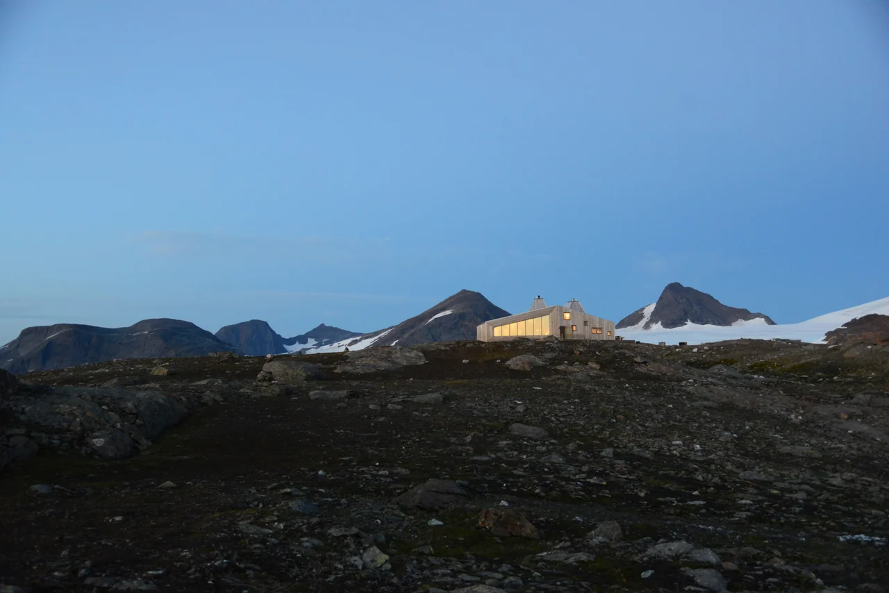
That same era brought Charles Rabot to these glaciers. A French geographer, glaciologist, journalist and traveller who lived from 1856 to 1944, Rabot spent his working life in the Arctic: Spitsbergen, the Svartisen ice cap, the northern fells on both sides of the Scandinavian divide. In 1883 he made the first ascent of Kebnekaise, the highest mountain in Sweden. He kept coming back to Okstindan, and the region kept his name. In 2014 the Hemnes tourist association opened Rabothytta — a mountain hut at 1,200 metres, the highest in North Norway, designed by the Oslo firm Jarmund/Vigsnæs with 30 beds across six rooms and a sleeping loft. It opened to the public on 16 August 2014 as the Norwegian Trekking Association's five hundredth hut, a sharply modern building of angled timber sitting on bare rock above the north side of the ice.
Getting In
There are two ordinary ways to start. One is the Leirskardalen valley; the other is the lake Kjennsvatnet. From the end of the Leirskardalen summer road at 650 metres, Rabothytta is 5.5 kilometres away and 520 metres up — an hour and a half to two hours for anyone reasonably fit, which is a modest price for a bed on the edge of a glacier.
Beyond the hut the terrain stops being forgiving. The route to Oksskolten crosses Okstindbreen, and glacier travel means rope, crevasse awareness, and a willingness to turn back. Whiteout is the ordinary hazard rather than the exceptional one: a flat overcast on an ice field removes the horizon, the shadows and any sense of slope at the same moment. Weather here changes on the timescale of an afternoon, and the massif makes its own.
The Country Around It
Hemnes Municipality holds all of this with about 4,485 people spread across roughly 1,590 square kilometres. The administrative centre is Korgen, west of the mountains; Hemnesberget sits on the fjord. In Ume Sámi the municipality is Heäjmmanássja — a reminder that the reindeer-herding presence in this border country long predates the boundary that now cuts through it.
South of the range lies Røssvatnet, the second-largest lake in Norway at 219 square kilometres, a vast pale sheet that serves as the most reliable orientation feature for anyone flying or walking the region. From the Swedish side, the Okstindan skyline is visible across the border — one of those views that belongs to a country you are not standing in. Some of the best photographs of the range have always been taken from Sweden.
From the Air
Okstindan is centred near 66.01°N, 14.34°E in Hemnes Municipality, Nordland. The massif tops out at Oksskolten, 1,916 m (6,286 ft), so a minimum safe altitude of 8,500–9,500 ft is appropriate, with 10,000–12,000 ft giving the best overview of the ice field. Visual references: the white expanse of Okstindbreen filling the interior of the range, Røssvatnet's 219 km² of water to the south, the Leirskardalen valley cutting in from the west, and the Swedish border running just east of the peaks. Nearest airports are Mo i Rana Røssvoll (ENRA) about 40 km northwest and Hemavan Tärnaby (ESUT) roughly 60 km southeast across the border. Expect strong orographic lift and severe lee turbulence in westerly flow off the Atlantic, rapid cap-cloud formation over the summits, and icing conditions year-round above 6,000 ft.
Nearby Stories
- Lukttinden 7.7 km away
- Ume River 13 km away
- Joesjö 18 km away
- Dunderland Valley Bus Crash 19 km away
- Grane Church 23 km away
- Nasa Silver Mine 57 km away
- Kittelfjäll 65 km away
- Træna Lighthouse 80 km away