.JPG)
The Sixpence in the Soil
Archaeologists working at Olompali unearthed an Elizabethan English silver sixpence, minted in 1567, from the soil of a Coast Miwok village that had been occupied since roughly 500 CE. The coin's presence, more than seven hundred years after the village's founding and two centuries before California became a state, suggests contact with Sir Francis Drake's expedition or with indigenous trade networks that reached the English explorer during his 1579 landing somewhere along the Northern California coast. A single small coin, and it rewrites the timeline. That capacity for surprise runs through everything at Olompali, a 700-acre park along Highway 101 just north of Novato in Marin County where fifteen centuries of continuous human presence have left layers that no single story can contain.
The Village That Endured
The Coast Miwok people established their village of Olompali around 500 CE, and by 1200 it had become one of the largest native settlements in what is now Marin County. The chief of the Olompolli band built an adobe house on the site in 1776, making it the oldest surviving house north of the San Francisco Bay. His son, baptized with the Spanish mission name Camilo Ynitia, accomplished something no other Native American in Northern California managed: he secured a Mexican-era land grant, Rancho Olompali, and held onto it after the United States took control of California in 1848. In an era when indigenous land claims were systematically erased, Ynitia received the only patented grant from the U.S. government to a Northern California Native American. He kept the ranch until economic pressures forced its sale, but the land itself remembers its longest tenants. Bedrock mortars, shell middens, and the adobe walls Ynitia's father raised still mark the ground.
A Skirmish and a Flag
In June 1846, a group of American settlers in Sonoma raised a homemade flag bearing a grizzly bear and declared California an independent republic. The Mexican government did not take this well. The brief conflict that followed, known as the Bear Flag Revolt, produced one notable engagement at Olompali. On June 24, a party of Californios clashed with American forces near the ranch. The encounter was small, more skirmish than battle, but it entered California history as the Battle of Olompali, the only armed confrontation of the revolt in which casualties were inflicted. The Americans suffered no deaths; the Californios lost one or two men, depending on the source. Within weeks, the United States Navy arrived and the Bear Flag Republic dissolved into American annexation. The battle's military significance was minor. Its symbolic weight, however, endures: it was the moment when California's future as an American state became a matter of gunfire rather than diplomacy.
The Dead, the Chosen, and the Fire
Olompali's strangest chapter began in the mid-1960s, after the Burdell family sold the estate and it passed through several hands to the University of San Francisco, which used it as a Jesuit retreat. In 1966, the Grateful Dead leased the property for the spring and returned frequently. The band played impromptu concerts on a concrete slab, and photographs taken among the oak trees in 1969 were used for the back cover of their album Aoxomoxoa. In 1967, Donald McCoy Jr. leased the property and established a commune called the Chosen Family, envisioning a utopian community. What followed was anything but utopian. By February 1969, the Burdell Mansion had been destroyed in an electrical fire. A fatal car accident was caused by one of the commune's loose animals. Authorities conducted narcotics raids. McCoy was committed to a mental institution. Then two small children drowned on the property, and the Jesuit landlords evicted the remaining residents. The arc from utopian dream to tragedy took less than two years.
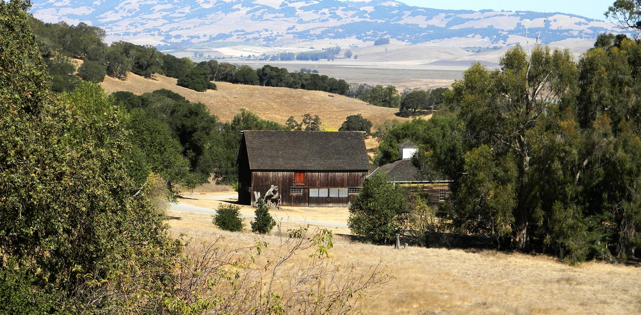
What the Park Holds Now
California purchased the property in 1977 and designated it a state historic park. Today the 700 acres encompass hiking trails through grasslands and oak woodlands, the reconstructed foundations of the Burdell mansion, and the remnants of Ynitia's adobe house, registered as California Historical Landmark number 210. The property is also listed on the National Register of Historic Places as Rancho Olompali. Visitors walking the park's trails move through layers of history compressed into a small space: Miwok grinding rocks a few hundred yards from the mansion's charred footprint, the Jesuit-era gardens giving way to grassland, the old ranch road that Bear Flag combatants once traveled. The park sits at 8901 Redwood Highway, three and a half miles north of Novato, visible from Highway 101 as a stretch of grassy hillside above the freeway. Most drivers pass it without knowing that beneath that grass lies a record of human presence stretching back fifteen hundred years, marked by a sixpence that should not be there.
From the Air
Located at 38.15N, 122.57W along the Highway 101 corridor, 3.5 miles north of Novato in Marin County. The park's 700 acres of grassland and oak woodland are visible from the air as open green hillside east of the freeway. Nearby airports include Gnoss Field (KDVO) approximately 4nm northwest in Novato, and San Rafael Airport (not towered) to the south. Best viewed at 1,500-2,500 feet AGL. The contrast between the park's open hills and the suburban development of Novato to the south makes it easy to identify. Mount Burdell rises to the west, providing an additional landmark.
Nearby Stories
- Remillard Brothers 3 km away
- David Grant USAF Medical Center 4.8 km away
- Where the Valley Came to Grind 5.1 km away
- Austin Creek State Recreation Area 7.9 km away
- The Hole in the Head 8.2 km away
- Black Diamond Mines Regional Preserve 12 km away
- From Radio Towers to Tribal College: D-Q University 12 km away
- ʻAkaka Falls State Park 3689 km away