
Oster
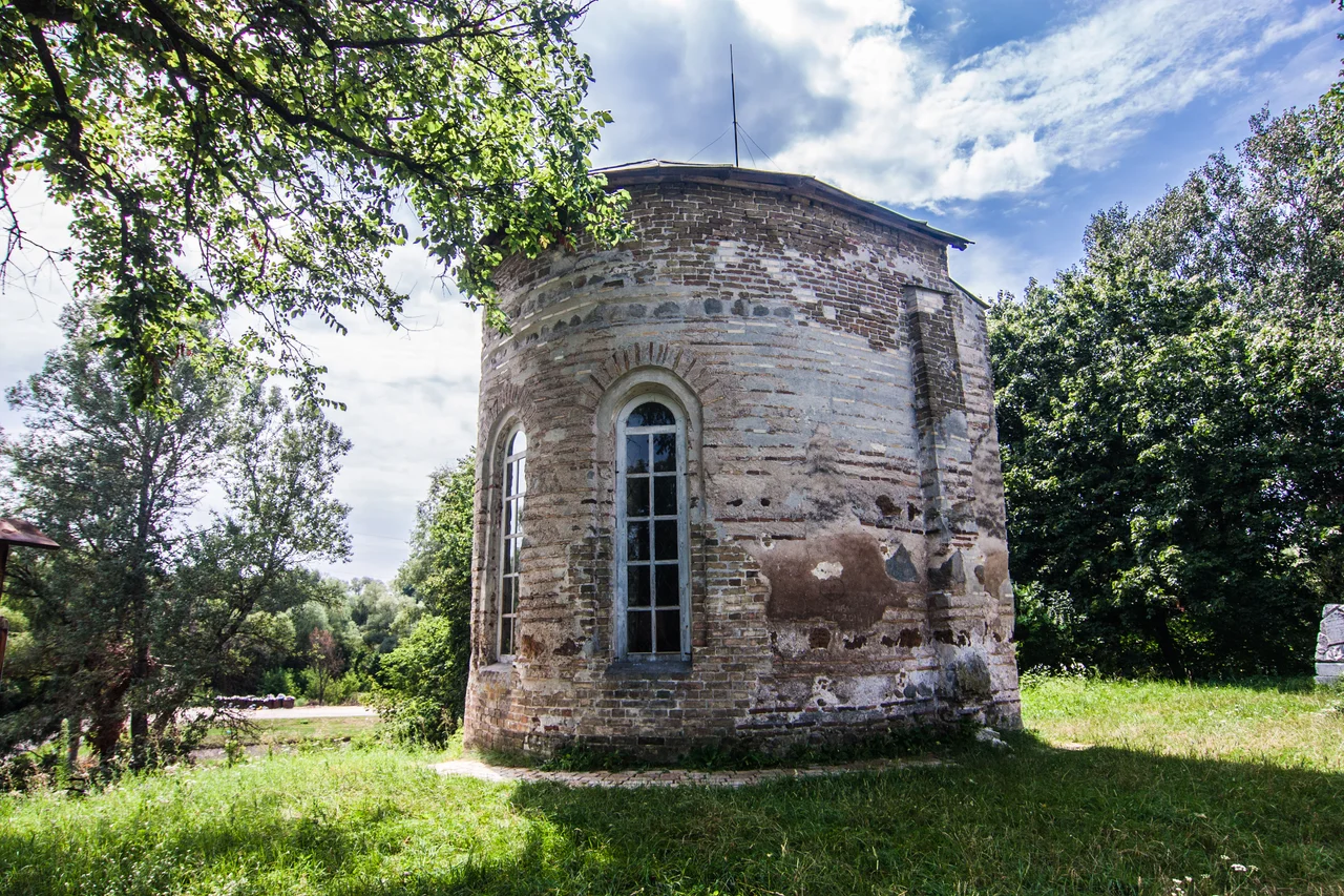
In the town of Oster stands a fragment of a church that has outlived the very country it was built for. Saint Michael's Church, raised in 1098, is the only surviving church of the medieval principality of Pereiaslav - a Rus realm that faded from the map long ago. Inside its preserved remains, a fresco painted at the turn of the 12th century still looks out from the wall, one of the oldest such images anywhere in Ukraine. Around it, where the Oster River empties into the broad Desna, sits a quiet river port that was born as a frontier fortress, erased by the Mongols, and rebuilt in a new spot by survivors who refused to let the place die.
Monomakh's Fortress
Oster began not as a town but as a stronghold. In 1098, the Kyivan prince Vladimir II Monomakh founded it under the name Gorodets, a fortress meant to guard the Pereiaslav principality along its river frontier. It later passed to his son Yuri Dolgorukiy - the same prince remembered in tradition as a founder of Moscow - linking this small Desna outpost to some of the most consequential names in early Rus history. For a century and a half, Gorodets did its work as a defensive point in a contested land. But the frontier fortresses of Rus stood in the path of a force that would sweep almost all of them away, and Gorodets was no exception when that force arrived from the east.
Destroyed and Reborn
In 1240, the Mongol invasion crashed across Kievan Rus, and Gorodets was destroyed. The fortress lay in ruins for a full century afterward, its walls broken and abandoned. Yet the location refused to be forgotten. A village grew up among the old ruins, taking the name Stary Oster, the 'old Oster.' Then, in the early 14th century, people founded a fresh settlement a little distance away, closer to the Desna itself - and this new town took the name Oster that the city still carries today. It is a pattern common along these rivers: destruction, a pause, then stubborn renewal on nearby ground. The medieval church that survived became the thread connecting the vanished fortress to the living town.
Kingdoms and Cossacks
Like so much of the land between Kyiv and the Polish frontier, Oster changed rulers many times. From 1356 it fell under the Grand Duchy of Lithuania, and after the Union of Lublin in 1569 it became part of the Polish-Lithuanian Commonwealth. In 1662 King Jan II Casimir granted the town Magdeburg rights and a coat of arms, the marks of a self-governing community. Then came the upheaval of the Khmelnytsky Uprising, whose harsh battles tore through the region. Polish rule was reimposed, but not for long: in February 1664, with the support of the local population, Cossacks and Russian forces drove the Poles back out of Oster. By 1803 the town had become an administrative center within the Chernigov Governorate, a modest but enduring seat on the Desna.
The River Port Today
Modern Oster wears its long history lightly. It is a working river port on the Desna, home to a cotton-textile factory and food industry, a town where ordinary life goes on around extraordinary old stones. Parts of the ancient fortress have been preserved alongside the remains of Saint Michael's Church - locally also known as Yurii's Temple, a nod to Yuri Dolgorukiy. To stand before that 900-year-old fresco is to look at a painting made when the principality of Pereiaslav still lived, when Gorodets still stood whole, when the Mongols had not yet come. Everything around it has changed or vanished; the image remains. In a town founded, destroyed, and reborn, that quiet survival is Oster's deepest treasure.
From the Air
Oster lies at about 50.949 N, 30.881 E in Chernihiv Oblast, at the confluence of the Oster River and the larger Desna, northeast of Kyiv. From the air, look for the junction of the two rivers and the compact town on the Desna's bank; the surviving Saint Michael's Church and fortress remnants sit within the old town. A viewing altitude of 2,500-3,500 feet AGL suits the river landscape. The nearest major airports are Kyiv Boryspil (UKBB) to the south and Kyiv Zhuliany (UKKK) to the southwest.
Nearby Stories
- Chernobyl 13 km away
- Mezhyhirya Residence 20 km away
- 1995 Borodianka Mid-Air Collision 27 km away
- Yeletskyi Dormition Monastery 37 km away
- Battle of Chornobyl 40 km away
- Nizhyn 45 km away
- Pereiaslav 63 km away
- Radomysl Castle 74 km away