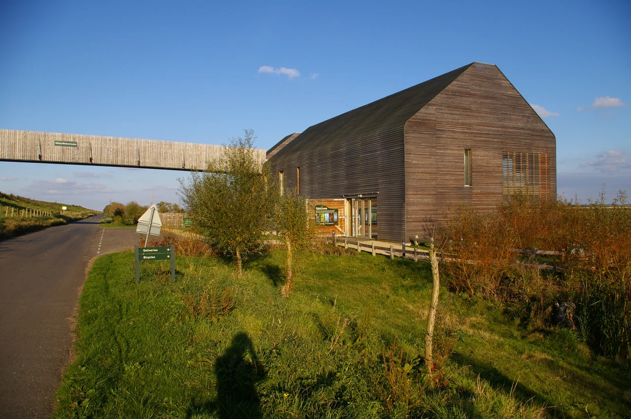

Ouse Washes
In the winter of 1649, Oliver Cromwell's engineers returned to a drainage project that the English Civil War had interrupted nineteen years earlier. The Dutch engineer Cornelius Vermuyden cut the New Bedford River parallel to the Old, creating a corridor between them — 32 kilometers long and roughly a kilometer wide — that could deliberately flood when the Great Ouse ran high. Nobody called it a wildlife reserve. It was an overflow valve for a river system serving drained farmland. But the animals arrived anyway, and they have not stopped arriving since.
An Engineered Landscape
Before the 17th century, the Fens of eastern England were tidal marshland, unsuitable for much beyond summer grazing. In 1630, King Charles I granted a drainage charter to the 4th Earl of Bedford and his Adventurers, who set Vermuyden to work on the Old Bedford River between Earith in Cambridgeshire and Downham Market in Norfolk. The Civil War interrupted the work; Cromwell restarted it in 1649, and the New Bedford River was completed in 1656. The washes between the two rivers — now known as the Ouse Washes — were designed not to be farmed but to absorb excess water, flooding seasonally and draining again when levels dropped. As the underlying peat has shrunk and compressed over centuries of drainage, that flooding has become more frequent. What was planned as a safety valve has become a permanent feature of the landscape.
Winter Wings
The flooding that frustrated farmers delighted birds. Today the Ouse Washes carry the highest international conservation designations available: Ramsar internationally important wetland, Special Protection Area, Special Area of Conservation, and a Grade I Nature Conservation Review site. The site is internationally significant for wintering and breeding wildfowl — teal, pintail, Eurasian wigeon, shoveler, and pochard gather here in numbers that matter at the scale of their entire species. Bewick's swans have traditionally wintered on the washes, though their numbers have declined in recent decades as milder European winters allow them to stay on the continent. Whooper swans still arrive in force: in the winter of 2021, more than 12,500 whooper swans were recorded here, representing approximately 5% of the world population concentrated in one strip of Fenland.
Three Guardians
The Ouse Washes' 2,513.6 hectares are split among three conservation bodies, each with distinct management approaches. The RSPB manages its reserve at Welches Dam, south of the A1101, with eight bird hides scattered along the riverbank including a wheelchair-accessible hide 300 meters from the visitor center. The Wildfowl and Wetlands Trust runs the Welney Wetland Centre to the north — 1,000 hectares with an observatory, wing hides, and an annual display of wintering swans that has made Welney one of Britain's most celebrated wildlife spectacles. The Wildlife Trust for Bedfordshire, Cambridgeshire and Northamptonshire manages a 186-hectare section between March and Ely. All three bodies, plus local wildfowling clubs that have long coexisted with conservation here, work together to protect breeding birds through the summer months.
Ditches and Diversity
The Ouse Washes are more than the open water visible from the riverbanks. The surrounding ditch network, surveyed as part of a Heritage Lottery Fund partnership that ran from 2014 to 2017, turned out to harbor astonishing invertebrate life. More than 100 water beetle species were recorded, including five for which the Fens represent their national stronghold. Dragonflies, damselflies, water voles, and amphibians shelter in the drainage channels that grid the surrounding farmland. Among 175 plant species recorded in the ditches, eight were of specific conservation concern. The ditches are, in other words, not just irrigation infrastructure — they are corridors through which the wider Fenland ecosystem breathes.
A Landscape Under Pressure
The same peat shrinkage that makes flooding more common also raises harder questions. As the land surface drops relative to the river and sea levels around it, the calculations that made the washes viable as a flood storage system require constant revision. The conservation bodies have responded by extending their management beyond the original SSSI boundaries, converting adjacent farmland into wet grassland to give breeding waders more space. The WWT acquired Lady Fen adjacent to Welney between 2007 and 2013; by 2022, the total additional meadow area stood at 350 hectares, with an eventual target of 1,000 hectares. The Ouse Washes began as an engineering solution. They have become an ecological one — and the work of maintaining them, like the flooding itself, is never finished.
From the Air
The Ouse Washes are highly visible from the air — a distinctive linear floodplain running roughly northwest to southeast between the parallel lines of the Old and New Bedford Rivers. Centered at approximately 52.53°N, 0.27°E. The flat Fenland terrain means the ribbon of water and wetland stands out clearly against surrounding agricultural land. Nearest airports: Cambridge (CBG) approximately 20 miles south, and Peterborough/Conington (KNS) approximately 18 miles west. Best viewed in winter when the washes flood and bird concentrations are highest.
Nearby Stories
- Bed Burial 2.5 km away
- Thetford Priory 6.6 km away
- Oundle School 8.1 km away
- RAF Lavenham 9 km away
- John Bunyan Museum 11 km away
- King's Lynn Minster 15 km away
- Woolsthorpe-by-Colsterworth 21 km away
- Walsingham Priory 21 km away