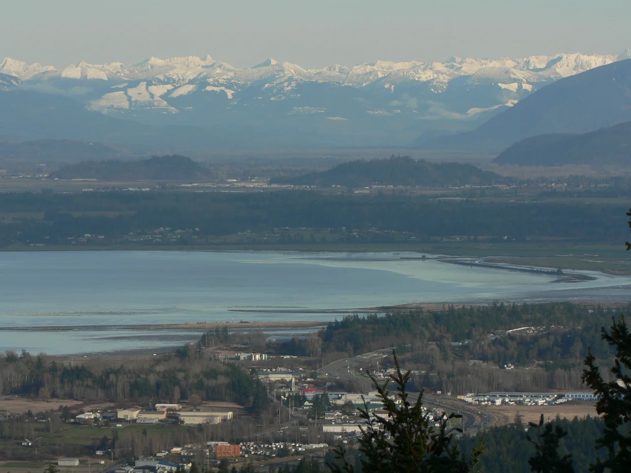

Padilla Bay
Juan Vicente de Guemes Padilla Horcasitas never came anywhere near Washington state. He was the viceroy of New Spain, governing from Mexico City, and in 1791 the naval officer Jose Maria Narvaez was exploring these waters in his name. Narvaez did what explorers did: he flattered his superior onto the chart. The bay became Seno Padillo. The island and the channel just west of it took the other half of the same man's name and became Guemes. Two centuries on, the bay, the island, and the channel are still carrying pieces of one absent bureaucrat, and almost nobody using them has any idea they are related.
A Bay That Leaves Twice a Day
Padilla Bay lies between the mainland and the San Juan Islands, with Fidalgo and Guemes islands shielding it to the west, Samish Island to the north, and Guemes Channel connecting it out to Rosario Strait. Calling it a bay slightly overstates the case. At high tide it is water; at low tide it is mud -- an enormous expanse of exposed flats stretching to the horizon, glistening and quietly alive. Even at its deepest the bay barely qualifies as deep: near Hat Island there is only about twelve feet under a hull. This is what a river delta looks like after the river leaves. The Skagit once emptied into Padilla Bay, dumping mountain sediment into it for millennia, and although the river has since shifted its outlet south, everything it deposited is still here, and the shape of the bay is still the river's work.
The Farmed Edge
Where a delta makes flat, fertile, extremely wet ground, people build dikes. Part of Padilla Bay's tidal flats were walled off and drained into farmland, which is how the Skagit Valley became one of the most productive agricultural districts on the Pacific coast -- tulip fields, seed crops, potatoes, all of it growing on ground the sea used to cover. The Swinomish Channel, a saltwater passage running from Skagit Bay in the south up to Padilla Bay in the north, separates Fidalgo Island from the mainland and gives boats a sheltered route behind the whole system. The result is a landscape of hard lines drawn on soft ground: dead-straight dike tops, right-angled fields, and beyond them a tideflat that does whatever the moon says.
A Reserve Instead of a Port
In 1980 Padilla Bay was incorporated into the National Estuarine Research Reserve system, which set aside roughly 8,000 acres of estuary -- more than 11,000 including the upland habitat behind it -- as a place to be studied rather than developed. The Washington Department of Ecology manages it. That decision looks more consequential every decade: estuaries are among the most biologically productive systems on earth and among the most thoroughly destroyed, and this one sits between an oil refinery district and a major agricultural valley. The mudflats that look like nothing from a car window are habitat for a great many birds and animals, and the reserve exists to keep them that way while people find out how they work.
Learning the Mud
The Breazeale Interpretive Center is the public face of all this, about six miles from Anacortes in the Skagit Valley. It is the rare science facility built for children as much as researchers: exhibits on estuary ecology, fish tanks, a hands-on room, a video theatre, classrooms, and beach access. Behind it are working research facilities, and graduate students from Western Washington University and the University of Washington use the reserve heavily. Outside, the trails do exactly what the landscape suggests -- a wheelchair-accessible path runs out to an observation deck, and a shore trail 2.25 miles long follows the top of the dikes with farmland on one side and tideflat on the other. Walk it at low tide, in the wind, with a few thousand birds working the mud a hundred yards out, and the case for protecting the place makes itself.
From the Air
Padilla Bay sits at 48.516N, 122.533W, between Fidalgo Island and the mainland Skagit Valley in northwestern Washington. From the air it is one of the most legible landscapes on the coast: a broad shallow bay that turns from blue to tan as the tide falls, exposing mudflats across most of its area, bounded on the east by the ruler-straight lines of diked farmland and on the west by Fidalgo and Guemes islands. Hat Island sits in the middle of the bay, the Swinomish Channel cuts south behind Fidalgo, and the refinery complexes at March Point are immediately southwest -- unmistakable at any altitude. Mount Baker dominates the eastern horizon. Best viewed at 2,000-4,000 feet at low tide, when the flats and the dike lines read clearly. Nearby airports: Skagit Regional Airport (KBVS) about 6nm southeast, Anacortes Airport (74S) about 5nm west, Bellingham International (KBLI) about 15nm north, and NAS Whidbey Island (KNUW) about 12nm southwest, with associated military airspace.
Nearby Stories
- San Juan Islands National Wildlife Refuge 5.5 km away
- Salish Sea 7.8 km away
- Utsalady, Washington 10 km away
- Nooksack, Washington 16 km away
- Mount Baker 23 km away
- Race Rocks Ecological Reserve 36 km away
- Snoqualmie Valley 74 km away
- Manning Provincial Park 91 km away