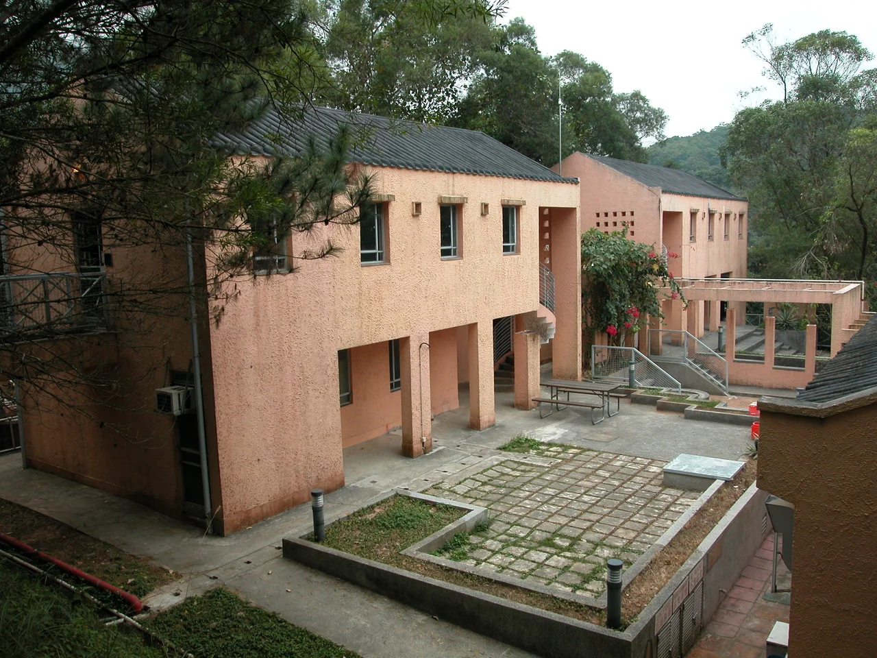

Pak Sha O
In 1799, a Hakka family named Yung arrived from mainland China and settled in Sai Kung's Hoi Ha. They stayed for more than a century. Then, in 1918, Yung Shi-chiu — unsatisfied with cramped conditions — moved his family a short distance to a quieter valley and built a mansion large enough to name. He called it King Siu Sai Kui. Across the lane, his friend Ho Yi-ko built the Ho Clan House. The two families, both Hakka, both recent enough to remember arrival, put down roots they expected would last. Fifty years later, the government built the High Island Reservoir, diverted the Pak Sha O River, and made the farmland uncultivable. The village that had survived three centuries emptied within a generation.
White Sands, Old Valleys
Pak Sha O sits in a valley south of Pak Hoi Ha in the Sai Kung North area of Tai Po District — far enough into the hills to feel genuinely remote, close enough to Sai Kung town to have maintained connections for centuries. The name means White Sands Inlet, and the area encompasses the main village and a smaller settlement called Pak Sha O Ha Yeung. Both are recognised villages under the New Territories Small House Policy. At the 1911 census, 117 people lived in Pak Sha O, 52 of them male — a population that reflected the patterns common to Hakka hill villages, where male emigration for work was already depleting communities. The villages of Sham Chung, Lai Chi Chong, and Pak Sha O had historically close social ties, sharing kinship networks and market access across a landscape that was difficult to cross but rich in community nonetheless.
The Chapel That Changed Everything
The reason Pak Sha O became a Catholic village involves tax collectors. The villagers of an earlier era faced persistent harassment from the tax-lords of Sheung Shui — authority figures who extracted payments and could make rural life miserable. Conversion to Catholicism offered a different kind of affiliation, one that the missionaries of the region — primarily Italian — provided. The first chapel was built in Pak Sha O in 1880 on a different site. The Immaculate Heart of Mary Chapel that stands today was constructed between 1915 and 1923, a modest structure with enough presence to anchor the village's identity for the century since. The site is now used as a training campsite by the Catholic Scout Guild. Italian missionaries had established Hakka congregations throughout the Sai Kung peninsula during this period, and Pak Sha O's chapel is part of that larger story of faith, community, and the particular circumstances that make people willing to change the religion of their ancestors.
The Mansions on the Lane
King Siu Sai Kui — the mansion Yung Shi-chiu built in 1918 — survives, along with its gatehouse Hau Fuk Mun, as a Grade I historic building in nearby Pak Sha O Ha Yeung. Grade I is the highest heritage designation available in Hong Kong below declared monument status. Across in the main village, several buildings of the former Ho Residence and the Ho Ancestral Hall have also been graded. These structures represent a particular moment: early twentieth-century Hakka domestic architecture at its most ambitious, built by families who had arrived with nothing and accumulated enough in two or three generations to commission permanent, substantial homes. The buildings retain their original spatial organisation — entrance halls, reception rooms, ancestral shrines, watchtowers — telling visitors exactly how these families understood hierarchy, hospitality, and memory. A youth hostel now operates in the valley, making Pak Sha O accessible to hikers who follow the trails through Sai Kung North.
What the Reservoir Took
The High Island Reservoir, completed in the 1970s, was one of the largest civil engineering projects in Hong Kong's history — created to address the territory's chronic water shortages by damming the sea inlet at Sai Kung's High Island. The dam at Hoi Ha, constructed as part of that project, diverted the Pak Sha O River significantly enough to drain the farmland the villagers depended on. The phenomenon has a term: water diversion. Farmland became uncultivable. Families who had returned generation after generation to tend the same terraced fields found there was no longer any point. Many left. Some emigrated. The village did not die — the heritage buildings remained, the chapel continued, the hostel brought new visitors — but the community that had made it a living place was dispersed. Walking through Pak Sha O today, the Grade I mansions stand solid and the chapel holds its ground, while the terraced hillsides above them slowly return to secondary forest. The families who built those buildings knew how to read a landscape. They simply ran out of water.
From the Air
Pak Sha O sits at 22.449°N, 114.320°E in a valley in Sai Kung North, surrounded by the hills of Tai Po District. From the air, the area is strikingly green — steep forested ridges enclosing small valley settlements, with High Island Reservoir visible to the southeast and Long Harbour stretching to the south. The nearest airport is Hong Kong International (VHHH), approximately 45 km to the southwest. Sai Kung town and its distinctive peninsula coastline lie to the south. At 2,000 feet, the Hoi Ha Wan Marine Park inlet is visible to the north, and the dramatic ridgeline of Pat Sin Leng Country Park rises to the northwest. The terrain here is among the most rugged in the New Territories — low passes and narrow valleys that isolated communities like Pak Sha O for centuries.
Nearby Stories
- Sha Chau and Lung Kwu Chau Marine Park 5.9 km away
- Wanshan Archipelago 22 km away
- Hong Kong 12 25 km away
- Second Battle of Chuenpi 27 km away
- Mount Guanyin (Dongguan) 43 km away
- Battle of Penghu 474 km away
- Penghu Air Raids 482 km away
- Checheng Fu'an Temple 592 km away