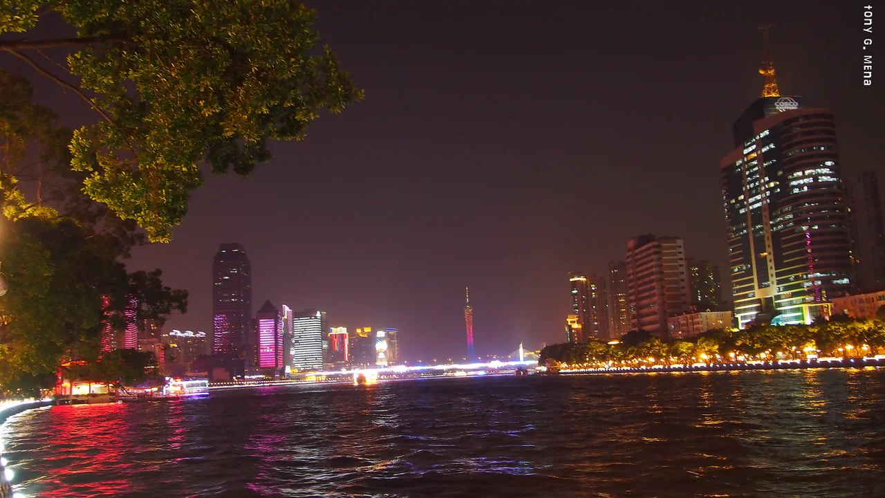

Pearl River
The name comes from the riverbed. Where the Pearl flows through Guangzhou, pearl-colored shells rest beneath the current, catching the light in a way that centuries of observation could not ignore. A river earns a name like that. Today the Pearl River is southern China's defining waterway — a sprawling system that drains parts of six provinces, crosses borders into northern Vietnam, and pours into the South China Sea through a delta so dense with cities that from the air it looks like a single continuous metropolis glowing at night.
Third-Longest, Second by Volume
Scale matters with the Pearl River, and the numbers are worth pausing on. Measured from the furthest headwaters of the Xi tributary — tracing the Nanpan, Hongshui, Qian, Xun, and Xi rivers in sequence — the full Pearl River system stretches to become China's third-longest river, behind only the Yangtze and the Yellow River. By volume of water discharged, it ranks second in the country, surpassed only by the Yangtze. These are not small footnotes for a river that most people outside China cannot name. The Pearl drains the majority of Guangdong and Guangxi provinces — together known as Liangguang — plus portions of Yunnan, Guizhou, Hunan, and Jiangxi. It even pulls water from the far northeast corner of Vietnam's Cao Bằng and Lạng Sơn provinces before routing it all toward the South China Sea.
Three Rivers, One Delta
The Pearl River is simultaneously one river and many. The name applies to the overall system and to a specific, surprisingly short distributary within the delta. Three major tributaries feed the system from different compass points: the Xi, meaning 'west'; the Bei, meaning 'north'; and the Dong, meaning 'east.' Each carries its own tributaries and sub-tributaries — the Liu, the Gui, the Yu, the Rong flowing through karst landscapes that look almost too dramatic to be real. Where the tributaries converge just north of Guangzhou, the water begins to be called the Pearl River proper. From there it fans out across the delta, separating Macau and Zhuhai on the western bank from Hong Kong and Shenzhen on the east, before reaching the sea through the estuary known as Bocca Tigris — the Tiger's Mouth.
The Tiger's Mouth and the Mouth of the World
Bocca Tigris has a history as dramatic as its name. The narrows between Shiziyang and Lingdingyang once guarded the approach to Guangzhou — one of China's primary ports of trade — and foreign ships that wanted to reach the city had to pass through. The estuary remains strategically significant today, regularly dredged to keep it open for ocean-going vessels. Three zones divide the bay from north to south: Shiziyang, Lingdingyang, and Jiuzhouyang at the southern tip, surrounded by the Wanshan Archipelago. Crossing this bay today is the Hong Kong–Zhuhai–Macau Bridge, one of the longest sea-crossing bridges in the world. High above the river near Nansha Bridge, a 500-kilovolt power line hangs from three of the tallest electricity pylons ever built. Civilization, in all its ambitious forms, keeps reaching across this water.
Cities on the River
The Pearl River is the spine around which the world's largest urban agglomeration has grown. Guangzhou, the ancient trading city, sits along its banks. Downstream are Foshan, Dongguan, Zhongshan, Zhuhai, Shenzhen, and the territories of Hong Kong and Macau. Upstream, Zhaoqing, Wuzhou, Guilin, and Nanning mark the river's reach into Guangxi. This string of cities contains hundreds of millions of people, sustained by a waterway that has carried commerce, culture, and conquerors for thousands of years. The Zhujiang Brewery in Guangzhou — one of China's three largest domestic breweries — takes its name directly from the river. So does the Pearl River Bridge food company, and dozens of other brands across the region. The Pearl River is not just geography. It is identity.
A River Still Shaping Its Land
The Pearl River Delta is young terrain, geologically speaking. The river is still building it — depositing sediment carried from the highlands of Yunnan and Guizhou, nudging its own banks outward, slowly claiming new land from the sea. The estuary's tidal pulse reaches far inland. Monsoon rains swell the system each summer, flooding low-lying areas before the dry season pulls the water back. Engineers have spent decades managing this pulse: building bridges, sinking tunnels, raising embankments, and dredging channels. Some of the largest engineering projects in human history — the bridges, the tunnels, the grid of highways — exist because the Pearl River made the delta, and then the delta demanded to be crossed.
From the Air
The Pearl River system is centered at approximately 23.24°N, 113.17°E, near Guangzhou. Flying south from Guangzhou Baiyun International Airport (ZGGG), the delta unfolds beneath you as a glittering network of channels and estuaries. At 5,000–8,000 feet, the three main tributaries — Xi from the west, Bei from the north, Dong from the northeast — are clearly visible converging south of Guangzhou. The Nansha Bridge, one of the longest cable-stayed bridges in the world, marks the lower delta. The Pearl River Estuary (Bocca Tigris) leads the eye southeast toward Hong Kong, visible on clear days. The Hong Kong–Zhuhai–Macau Bridge, crossing 55 km of open bay, is unmistakable at cruising altitude. ZGGG serves the region; VHHH (Hong Kong International) lies at the southeastern edge of the delta.
Nearby Stories
- Nanfeng Kiln 5.1 km away
- Qingyuan 15 km away
- Opium War Museum 24 km away
- South China Mall 33 km away
- Heyuan 118 km away
- Battle of Nanpeng Island 167 km away
- Temple of the Five Lords 427 km away
- Lugu Lake 1260 km away