Piumhi
In 1731, a sertanista named Batista Maciel told everyone who would listen that gold lay along the Piui River. A priest rode out from Pitangui, said the first Mass on the sandy banks, and watched hopeful prospectors pan nothing much at all. The authorities arrested Maciel as a fraud. His sons mutinied and shot the procurator in the arm. That chaotic misadventure gave birth to the town that would become Piumhi - named, eventually, not for the disappointing gold but for the rivers themselves, so abundant with fish that one early chronicler wrote they caught the eye even among the teeming tributaries of the Sao Francisco.
Fish River, Reconsidered
The name came to us sideways. The earliest records spell it Piauhy - piau for fish, i for water - the language of guides who were not from Minas Gerais but from the coastal Tupi country, brought inland by bandeirantes who spoke the lingua geral. Nineteenth-century priests began writing Piauim, nasalizing the vowel. A century of further drift produced Piumhi, the form eventually enshrined in law. The word traveled a long way from what it once meant. In the ecclesiastical archives at Mariana, the older spellings survive in a petition from 1823, where members of the Sao Roque chapel asked to be affiliated with a parish whose name their grandchildren would no longer recognize.
The River That Moved
For most of human memory the Piumhi River flowed into the Rio Grande, through the Cururu Swamp - a wetland so broad the river's channel blended into its own floodplain. Then, in the late 1950s, engineers arrived to build the Furnas Hydroelectric Dam. The new reservoir threatened to flood the town of Capitolio, so the decision was made to redirect the Piumhi entirely. The river now drains the other direction, into the Sao Francisco basin. Twenty thousand hectares of wetland were drained. What emerged was some of the most fertile farmland in the region, and immediately some of the most contested. Large landowners claimed the new ground as extensions of their properties. Sharecroppers and tenant farmers, who had lived off the swamp for generations, asserted their own right to the ground under their feet. The 1960s land conflicts that followed left a trail of oral history but few official records. The government, as elderly residents remember it, generally sided with the landowners.
Canastra Cheese, Registered Here
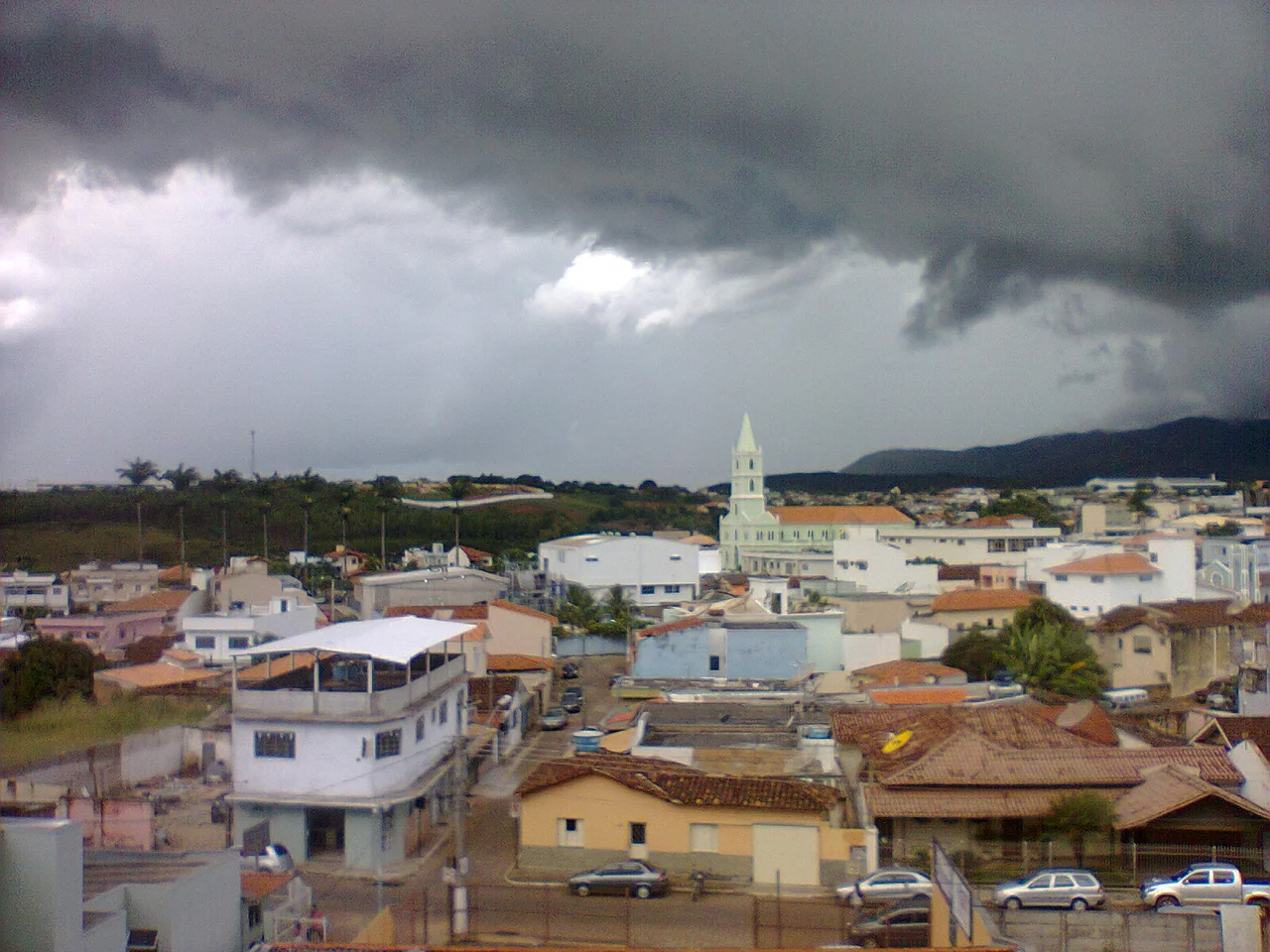
Piumhi sits at the edge of the Serra da Canastra, and the trademark "Canastra Cheese" - the raw-milk specialty that has become one of Brazil's best-known regional cheeses - is registered in Piumhi. The milk comes from dairy herds grazing the cerrado uplands. The cheese is pressed into cylinders, salted, aged in mountain caves. In 2014, Piumhi ranked first in foreign trade in the central-west region of Minas Gerais, an agricultural record built on coffee, corn, beans, and dairy. A visitor climbing the 269 steps to the Cruz do Monte viewpoint on the southern outskirts looks down at pastureland stretching to the mountain ranges - Pimenta, Andaime, Cromo - whose ridges mark the beginning of what Joao Guimaraes Rosa called the sertao, the backlands of his great novel Grande Sertao: Veredas.
A Flower Not Seen in Two Hundred Years
In March 2024, near the Cachoeira da Belinha waterfall, a team of botanists identified a sunflower-family plant that had not appeared in Brazilian scientific records for more than two centuries. The discovery came during an environmental survey commissioned by a grassroots movement called Amigos do Araras e da Belinha, which had formed the previous year in response to proposed iron-ore mining in the Piumhi mountains. Faced with the threat of bulldozers, the movement pushed the city council to create the Serras e Aguas de Piumhi environmental protection area, which covers nearly 12,000 hectares - 73.7 percent of the municipality's remaining native vegetation. The law was signed in 2024. The newly recognized sunflower, along with an endangered native fish called the pirapitinga, now has legal standing.
Nineteen Cities After Dark
Seven kilometers northeast of the town, up a narrow switchback road to the top of the Pimenta Range, there is a viewpoint where on a clear night you can see the lights of nineteen surrounding cities scattered across the Minas Gerais highlands. The climb is steep enough that most drivers think twice at the trailhead. Those who make it find a plateau at 1,256 meters, the highest point in the municipality. The wind carries the smell of cerrado vegetation - grasses, stunted trees, dry soil. Somewhere below, the Furnas reservoir glitters under whatever moon is out. The Piumhi River, the one that used to flow the other way, is down there too.
From the Air
Coordinates: 20.46 S, 45.96 W. Western Minas Gerais at 793 meters elevation, tropical highland climate. Piumhi's Dr. Vitrasiano Leonel Municipal Airport (ICAO: SNUH) has a 1,148-meter asphalt runway with night lighting. Nearest commercial airports: Belo Horizonte/Confins (SBCF) 256 km northeast, Ribeirao Preto (SBRP) 265 km southwest. Visual landmarks: the Pimenta Range peaking at 1,256 m, the Furnas reservoir 25 km north, Serra da Canastra National Park 80 km west. The MG-050 highway crosses the region.
Nearby Stories
- Southeast Brazil 30 km away
- Lagoa da Prata 41 km away
- Boa Esperança, Minas Gerais 51 km away
- Bom Despacho, Minas Gerais 54 km away
- Lavras 67 km away
- Guaxupe 70 km away
- São Gonçalo do Pará 75 km away
- José Chiachiri Municipal Historical Museum 104 km away