Boa Esperança, Minas Gerais
In 1937, the composer Lamartine Babo wrote "Serra da Boa Esperanca" - Range of Good Hope - and it became one of the anthems of Brazilian popular music. Generations of singers have recorded it. The melody evokes mountains and rivers and a kind of patriotic longing. The actual Serra da Boa Esperanca, the range the song is named for, rises above a small municipality in the southern highlands of Minas Gerais, where the Rio Grande cuts through on its way to join the Parana. The town below the mountain began in 1778 as a frontier settlement called Dores do Pantano - "Sorrows of the Marsh." It took another century to become a city, coffee to make it prosperous, and a dam built in the late 1950s to turn it into a lake town. Today it is called Boa Esperanca, and Babo's song is one of its treasures.
Dores do Pantano
The first settlement was established in 1778 during the late-colonial push into the Minas Gerais highlands that followed the gold rush. The original name, Dores do Pantano - "Sorrows of the Marsh" - captured something of the character of this corner of Brazil in its earliest days: wet, difficult, somewhat inhospitable. By 1804, it still bore that name. Work began on the parish church in 1814, and at roughly the same time the first coffee plantations appeared. Coffee changed everything. The volcanic soils and mild highland climate turned this corner of Minas Gerais into productive coffee country, and the parish attached to the little church grew into something more. In 1866, provincial law elevated the parish to the status of village. On November 15, 1868, Provincial Law No. 1611 promoted it to municipality, with its own seat of local government. By then, the name had changed too - from the sorrowful marsh to the mountain of good hope.
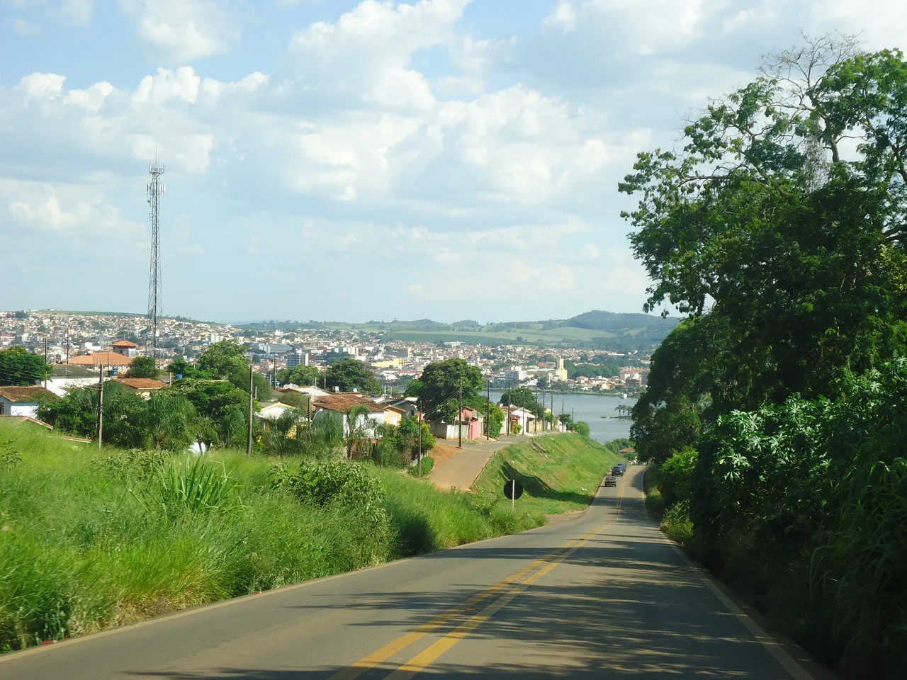
The Lake That Came
In 1957 and 1958, construction began on the Furnas Dam - one of the largest hydroelectric projects in Brazilian history, part of a national push to electrify the country and power its industrial expansion. The dam impounded the Rio Grande, creating Furnas Lake, which at its full extent covers more than 1,400 square kilometers and touches dozens of municipalities. Boa Esperanca sat on its edge. The town had been agricultural and a little sleepy, known regionally for coffee and not much else. The lake transformed it. Tourism became a pillar of the economy, drawing visitors from Belo Horizonte and beyond for fishing, water sports, lakeside hotels. The royalties paid by Furnas Centrais Eletricas to the municipalities around the lake have provided a steady fiscal base for local government ever since. A town that started in a marsh became a lake town - first by naming itself for the mountain above, then by the engineering that flooded the valley below.
Coffee, Birds, and Araucarias
Boa Esperanca sits at 775 meters elevation in a zone that is technically tropical but tempered by altitude - annual average temperature of 19 degrees Celsius, about 1,500 mm of rain a year, summers hot and winters cool. Coffee remains the primary agricultural product, consumed domestically and exported abroad. Grain, rice, garlic, potatoes, beans, maize, sugarcane, cassava, soybeans, tomatoes, and various fruits fill out the farming economy. Cattle, pigs, and poultry have been raised here since the earliest settlement. The Rio Grande and its tributaries - the Ribeirao Sao Pedro, Ribeirao das Tres Pontas, Ribeirao Marimbondo, Ribeirao da Maricota - web through the municipality. Birdlife is abundant: darters, herons, lapwings, kingfishers, jabirus. Capybaras live in the wetlands, brocket deer in the forest margins, monkeys in the remaining araucaria groves. The vegetation is a mix of cerrado, gallery forest, and the distinctive araucaria highlands that mark southern Minas.
The Song That Stayed
Lamartine Babo - the Carioca composer also known for "Carnaval no Fogo" and "Voce" - wrote "Serra da Boa Esperanca" in the mid-1930s, and it became one of the defining songs of Brazilian popular music. Dorival Caymmi sang it. So did Francisco Alves and dozens of others. The song is simple: it evokes the hills, the moonlight, the longing of distance. For a municipality of just over 40,000 people, having a national song of that caliber carry its name is a minor miracle and a persistent source of local pride. Every tourism brochure mentions it. The serra itself rises above the town, visible from the lake and from the approach highways, and it is hard to look at the range without the melody coming somewhere to mind if you have ever heard it. The song outlasted its moment. It became part of the landscape.
From the Air
Located at 21.09 S, 45.57 W in southern Minas Gerais, Brazil, at about 775 meters elevation. Nearest major airport is Varginha Airport (SBVG), about 70 km southeast, with Belo Horizonte-Confins (SBCF) about 240 km north. Furnas Lake is the most prominent visual feature - a vast reservoir with complex fingered shoreline visible from 10,000 feet. The Serra da Boa Esperanca rises above the town, one of several ranges in southern Minas. Best visibility May-October during the dry season. Avoid late-afternoon flying during the November-April rainy months.
Nearby Stories
- Três Pontas 11 km away
- Our Lady of the Rosary Church, Lavras 27 km away
- Piumhi 54 km away
- Guaxupe 68 km away
- Crucilandia 80 km away
- Southeast Brazil 98 km away
- Poços de Caldas 102 km away
- Ibitipoca State Park 124 km away