Port Moresby Airfield Complex
In 1943, the busiest airfield in the entire Southern Hemisphere was a strip of pierced steel matting laid across the coastal plain near Port Moresby. It was called Wards, or 5 Mile Drome, and it shared taxiways with another airfield called Jackson that crews could reach without taking off. Together they were two of eight airstrips built in and around the town during the Second World War. The whole complex existed because Port Moresby, improbably, held. For months in 1942 it was the only major Allied base left between Japanese forces and the Australian mainland.
Why Here, Why Then
Before the war, Port Moresby had one airstrip, built by the Australians in 1933 on a gravel bed. That was Kila Kila, 3 Mile Drome - the town's first airport. When Japanese forces overran Rabaul in January 1942 and began pushing south, the strip near Port Moresby suddenly became the frontline. The RAAF took it over, Americans arrived in April, and a building frenzy began. Kila got pierced steel planking and expanded dispersal pads. Engineers laid out Berry, Schwimmer, Durand, Rogers, and Fishermans at intervals measured from the town in miles - the drome numbers became the names. Each was named for a pilot or officer killed in the fighting: Berry for Jack W. Berry, lost in a P-39D; Schwimmer for Charles Schwimmer, killed intercepting Japanese aircraft; Durand for Edward D. Durand, missing in action in April 1942.
Jackson and Wards
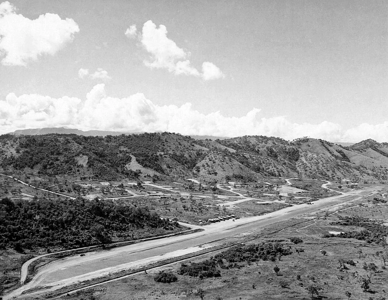
Jackson Airfield - 7 Mile Drome - took its name from Squadron Leader John Francis Jackson of 75 Squadron RAAF, killed at 34 while flying a P-40E on 28 April 1942. His squadron had flown the first defense of Port Moresby weeks earlier. By mid-war, Jackson had three parallel runways: a fighter strip, a bomber strip, and a 7,500-foot crash strip for aircraft limping home. Wards, 5 Mile, carried the cargo traffic - C-47s in and out, B-24 Liberators of the 320th and 321st Bombardment Squadrons based there, and behind everything, the 27th Air Depot, where men in coveralls assembled brand-new aircraft that had crossed the Pacific in crates. The ships came into Fairfax Harbor. The planes flew out to bases further north. The pace in 1943 was relentless.
What Was Named for Whom
Lt. Col. K. H. Ward, for whom Wards Airfield was named, helped build the runway he never saw finished - he was killed on 27 August 1942 at Isurava, during the fighting on the Kokoda Track. The Kokoda was not an aviation battle. It was Papuan terrain, jungle and ridge, where young Australian reservists fought a rearguard against veteran Japanese troops for two months. They were assisted, and often saved, by Papuan porters and medical carriers who moved supplies and wounded men along trails that Europeans could barely walk. The airfields the Allies defended were defended in part by those porters, whose names appear in no squadron rolls. Major Floyd "Buck" Rogers went down in an A-24 and got Rogers Airfield, 30 miles out. The pattern repeats: each drome a memorial, each memorial a casualty list.
What Remains
Seven of the eight airstrips are gone or unrecognizable. Kila Kila became a police barracks and a technical school. Berry, 12 Mile, lies under the Bomana Police Training College and Bomana War Cemetery - where many of those killed in the New Guinea campaign are buried, including, by coincidence of geography, pilots who flew from the strip itself. Schwimmer is obliterated. Durand's outline can be traced in vegetation. Rogers is overgrown with kunai grass. Fishermans on Daugo Island shows only a pale line in aerial imagery. Jackson survived. It became Jacksons International Airport, the only way in and out of Papua New Guinea for most travelers, and its western end still holds revetments built for B-17 and B-24 bombers - earthen horseshoes where aircraft hid from air attack, now surrounded by domestic terminals and Air Niugini flights. Wards is now Waigani, Port Moresby's government district. Its main runway is Kumuni Avenue. On a hillside above, if you know where to look, a concrete slab still bears the outline of a Fifth Air Force insignia, faded and cracked, with kunai grass growing through it.
From the Air
The complex lies between 9.43 degrees S and 9.50 degrees S, 147.15 to 147.30 degrees E. Jacksons International Airport (AYPY / POM) is the only active field; its revetments are visible at the western end of the airport. For a tour of surviving remnants: Wards site (Waigani, roughly 9.43 S 147.18 E) requires ground reference; the Fifth Air Force slab sits on a hill overlooking the Chinese Embassy off Sir John Guise Drive. Bomana War Cemetery (at the former Berry Airfield site) is visible from approach to AYPY runway 14L. Recommended altitude 2,500 to 4,000 feet AGL for field-to-field context. The Owen Stanley Range rises sharply to the north - its peaks exceed 13,000 feet and often carry afternoon cloud. Morning VFR is strongly preferred.
Nearby Stories
- First Battle of Eora Creek - Templeton's Crossing 15 km away
- Battle of Mission Ridge-Brigade Hill 28 km away
- Kapa Kapa Trail 45 km away
- Second Battle of Eora Creek - Templeton's Crossing 68 km away
- Strathallan Estate 230 km away
- Gulf of Papua 253 km away
- Milne Bay Province 265 km away
- HMS Pandora (1779) 343 km away